Recent Acquisitions
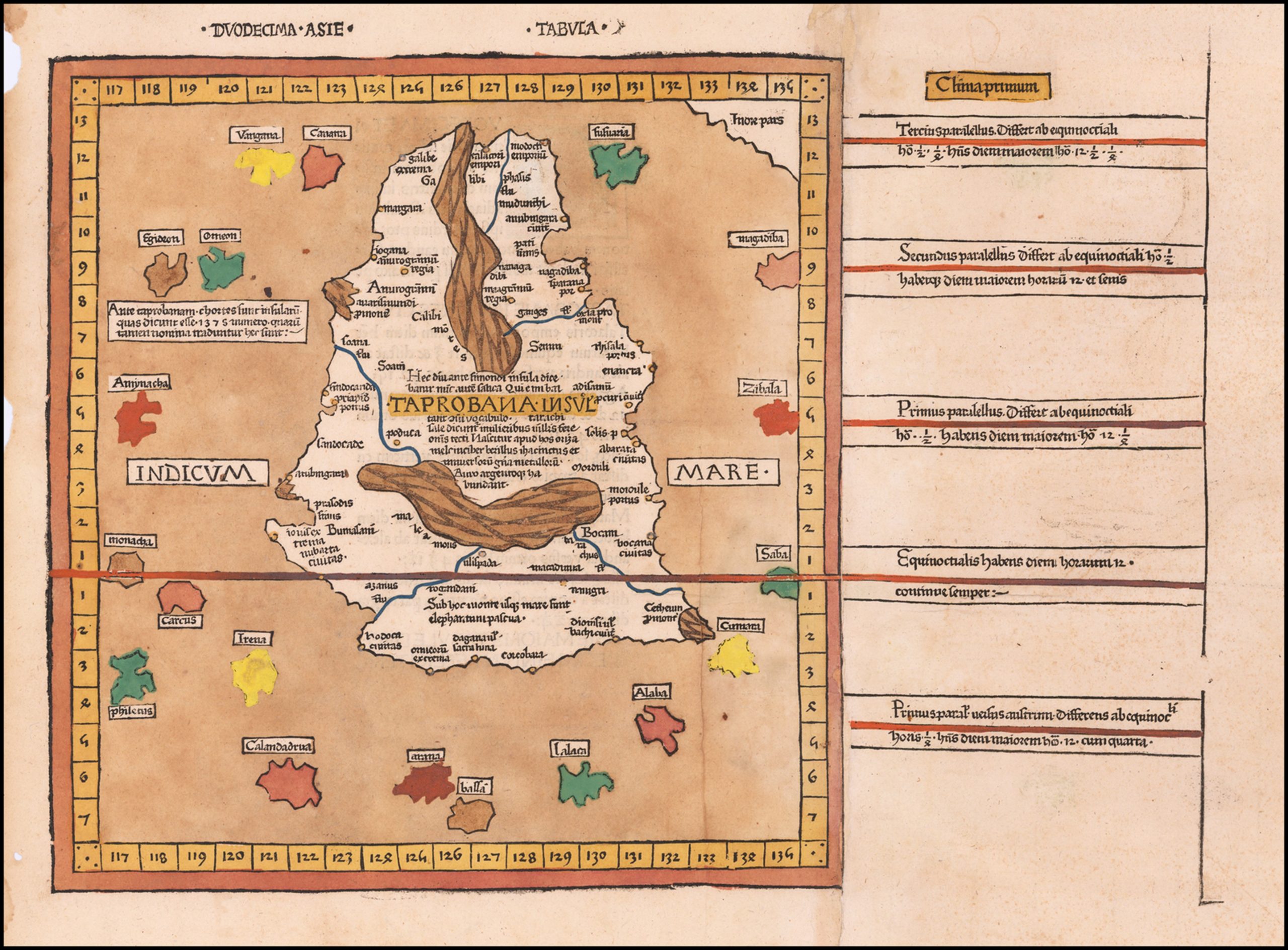
[Taprobana] Duodecima Asie Tabula
Sri Lanka, As Known To The Greeks
Fine old color example of this remarkable early map of Taprobana (Sri Lanka), from the 1486 Ulm edition of Ptolemy’s Geographia.
The map is drawn from the work of Nicolas Germanicus, whose manuscript maps were created to illustrate pre-1470 editions of Ptolemy’s Geographia.
The present map is from the second edition of this work, which was first published in 1482.
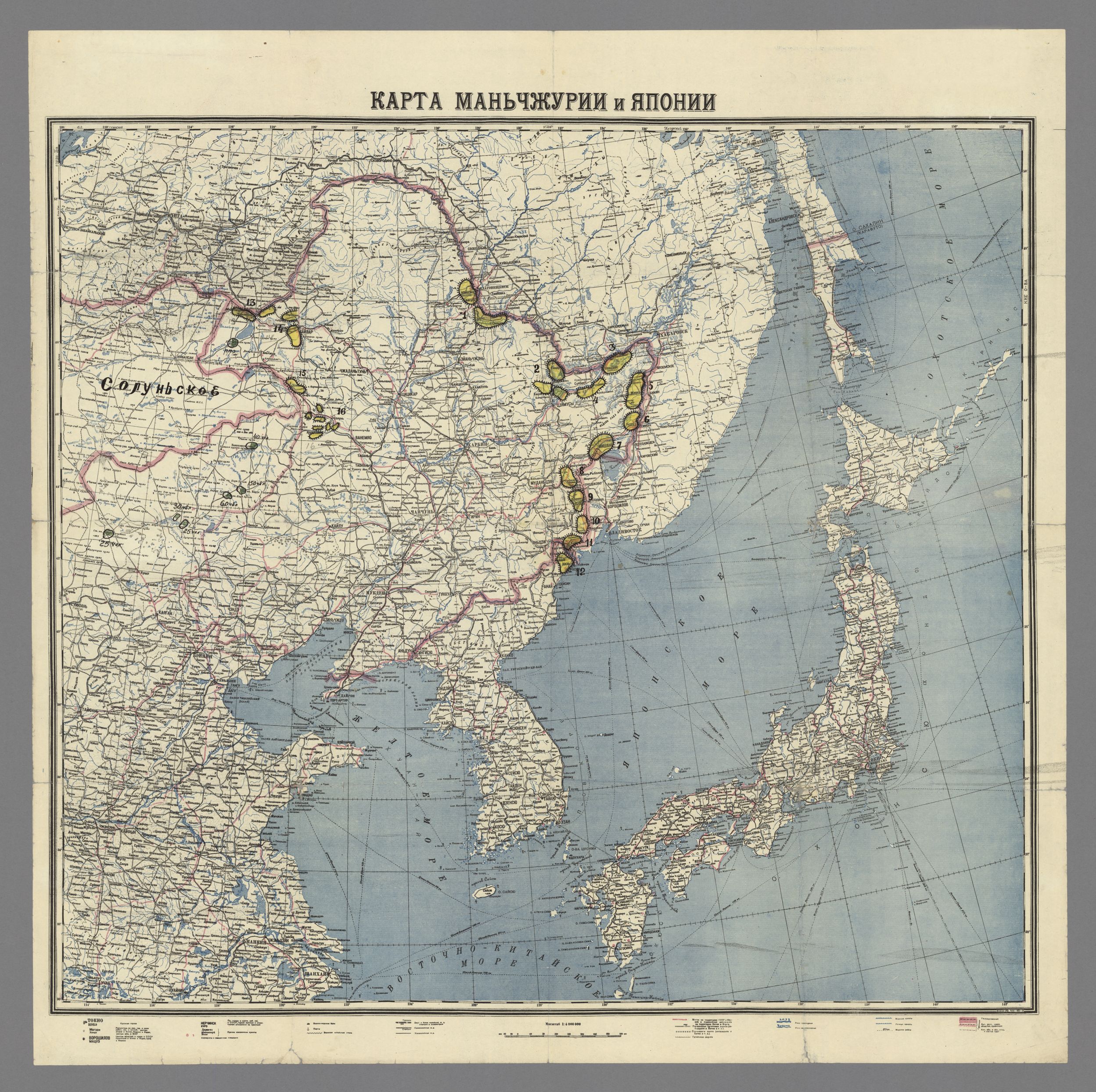
Карта Маньчжурии и Японии (Karta Man’chzhurii i Iaponii)
[Map of Manchuria and Japan]
Soviet invasion military map of Manchuria from WWII with a two-layer handwritten key attached in the upper right corner of the map. The map was printed in August 1945 at the Leningrad factory. There are printed details on cities, airports and areas usable for airplane landings, rivers, and different types of roads suitable for army needs. There are hand-drawn ink and pencil additions showing sixteen Kwantung Army fortified areas and information on the numbers of Mengjiang forces.
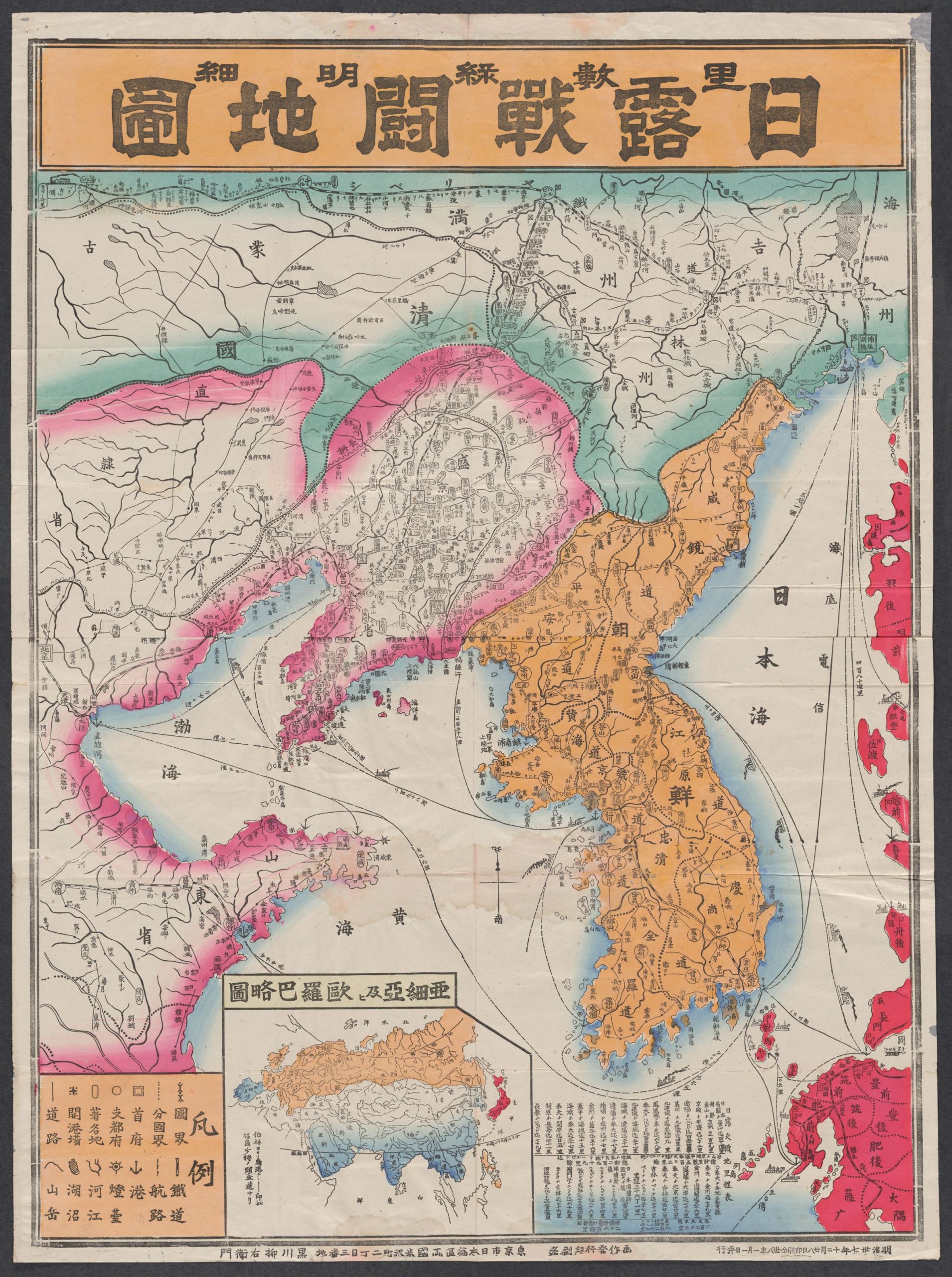
里數綠明細日露戰關地圖
[Map of the Russo-Japanese War]
First edition, October 1904. A poster map published in Tokyo by the boutique mapmaker Ryūemon Kurokawa to showcase the theatre of the Russo-Japanese War. Inset: map of Eurasia that contextualizes the battle theatre. Shows railways and main roads, stations and towns labeled in lozenges, shipping routes with some accompanied by pictographic representations of Japanese vessels, anchorages, forts, and ancient walls. Japanese territories and zones of control are outlined in red (Japan proper), Korea in orange, Russian in green, and Chinese in pink.
RUSSO-JAPANESE WAR – BATTLE OF LIAOYANG – ORIGINAL JAPANESE ‘HEADQUARTERS MAP’:[IMPERIAL JAPANESE ARMY HEADQUARTERS, SOUTHERN MANCHURIA].
Untitled [遼陽会戦/ Ryōyō-kaisen].
[Liaoyang vicinity, August-September 1904].
A Map formed from a joined composite of lithographed map sheets and manuscript extensions, with extensive manuscript battle information in colored paint, marker and crayon, mounted upon original scroll backing with rollers in traditional Japanese style.

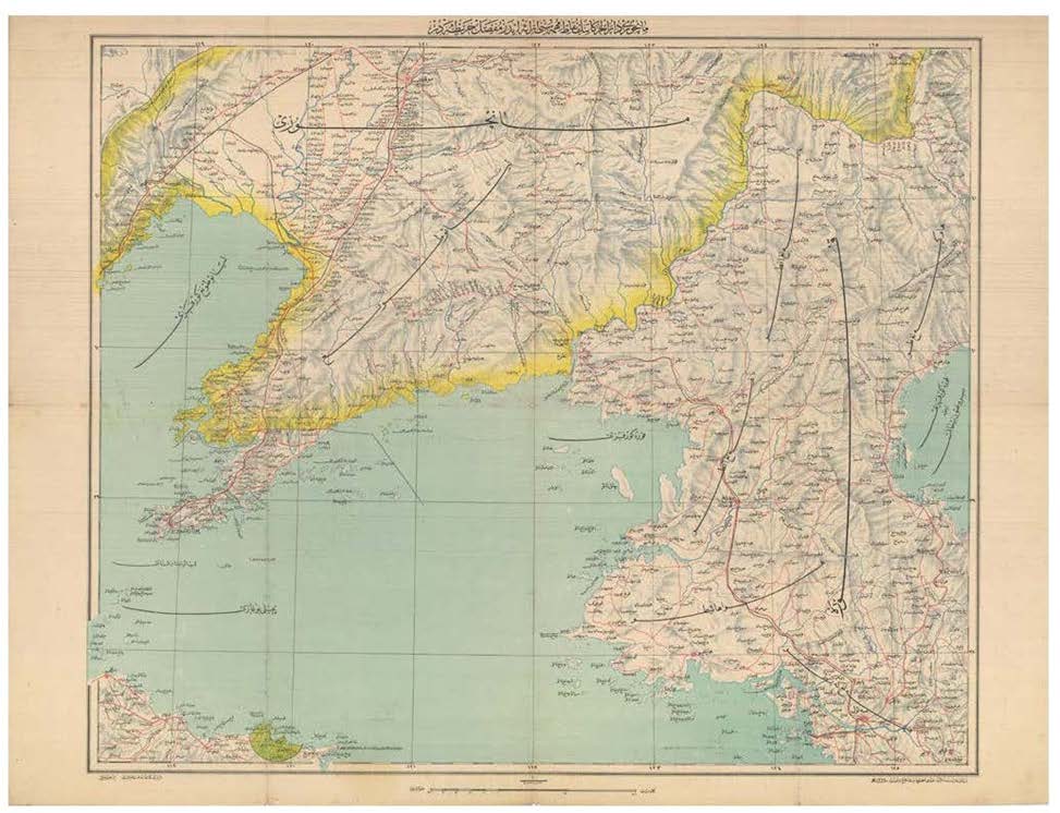
OTTOMAN EMPIRE MAP OF THE RUSSO-JAPANESE WAR
This extremely rare broadside map was issued in Istanbul by the leading Ottoman publisher İbrahim Hilmi to depict the main terrestrial theatre of the Russo-Japanese War (1904-5) and to capitalize on the “Japanomania” among the Turkish public.
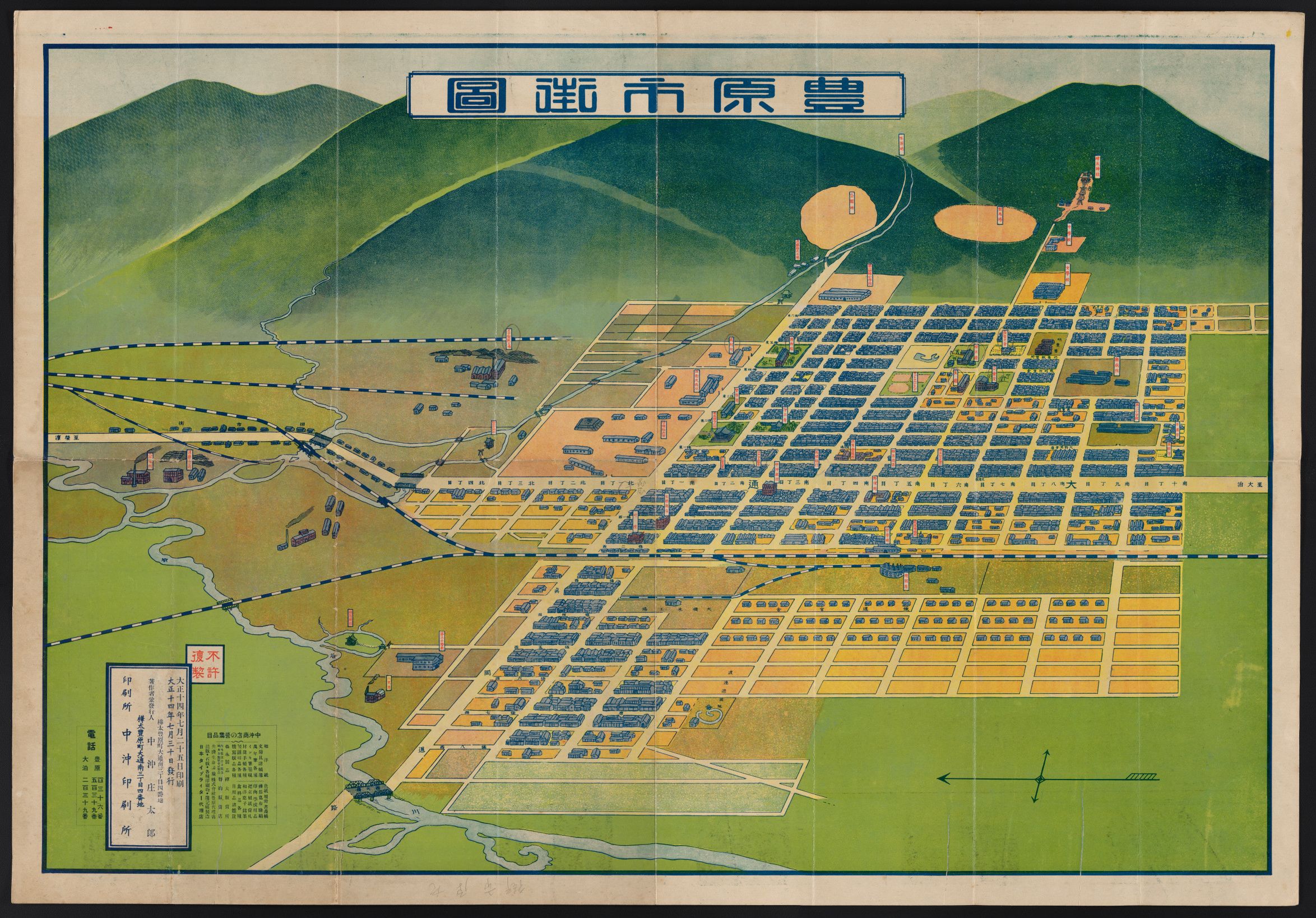
豐原商業會議所
[Toyohara Chamber of Commerce; present-day Iuzhno-Sakhalinsk]
This bird’s eye view of Toyohara City was published by the Chamber of Commerce and is one of the finest records of any Japanese ‘new’ or ‘colonial’ city. Beautifully designed and chromolithographed in rich layers of bright hues. The scene captures Toyohara from a point above looking east.
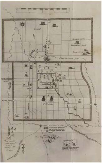
Lange, Lorenz. Dnevnye Zapiski Karavannomu Puti cherez Naunskuyu Dorogu ot Tsurukhaitu do Pekina, 1736
godu
[i.e. DailyNotes on the Caravan Travel along the Nenjiang River Route from Tsurukhaitu to Beijing in
1736]
An important first publication of a Russian traveling to China, with the first plan of Beijing published in a Russian book.
This account describes the travel of a Russian diplomat and trade caravan to Beijing in July 1736 – May 1737, under the command of Siberian merchant Yerofey Firsov and an important Russian diplomat of Swedish origin Lorenz Lange (ca. 1690s- 1752).
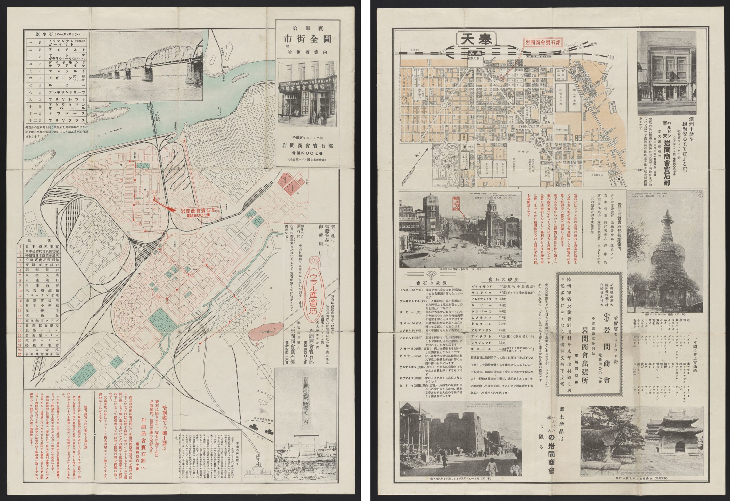
哈爾濱市街全圖: 附哈爾賓案内; 奉天. Harubin shigai zenzu : fu Harubin annai ; Hōten.
[Complete city street map of Harbin: with Harbin guide; map of Mukden]
Date: Between 1932 and 1945
2 maps on 1 sheet both sides in color (55 x 39 cm).
The maps of Harbin and Mukden are on opposite sides of a folded sheet. Both sides contain illustrations, information about local attractions, and miscellaneous facts about gemstones. Also includes a glossary of Japanese 8 terms and phrases with their Chinese-language (Mandarin) equivalents phoneticized in katakana. Issued by Iwama Shōkai Hōsekibu, the jewelry retailing division of a Harbin-based Japanese raw materials dealer and military contractor Iwama Shōkai; cartographer unknown.
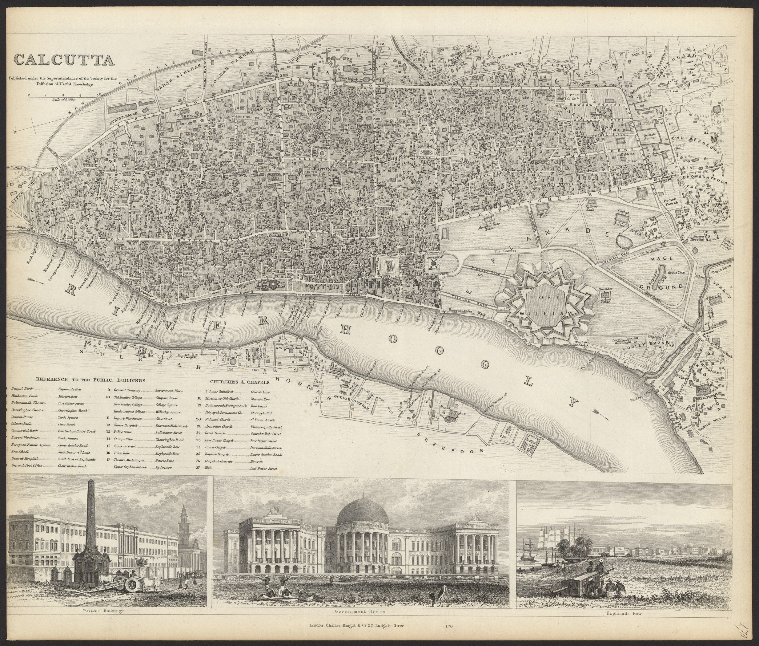
Calcutta/Kolkata
The Calcutta map is small, with a highly detailed town plan of Calcutta, including a legend listing 27 public buildings, churches and chapels. Large vignettes of the Writer’s Building, Government House and Esplanade Row. This map is considered one of the best published in a commercial atlas in the 19th Century.
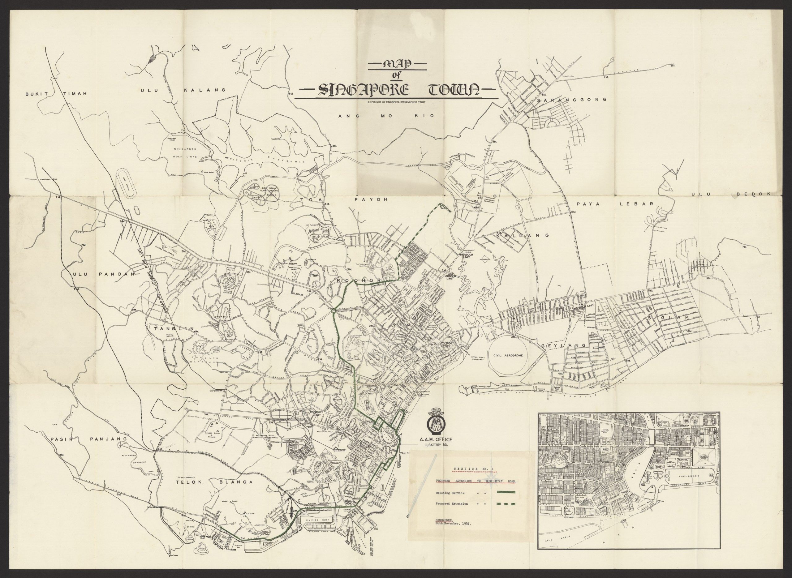
Singapore
The map of Singapore (1954) is a lithographed plan of Singapore (79 x 107.5 cm) with partial hand-color along the Kim Kiat road and an inset plan detailing the coastline near the Esplanade and mouth of the Singapore River. Lower right: a typewritten note detailing a “Proposed Extension to Kim Kiat Road” dated 26th November 1954.
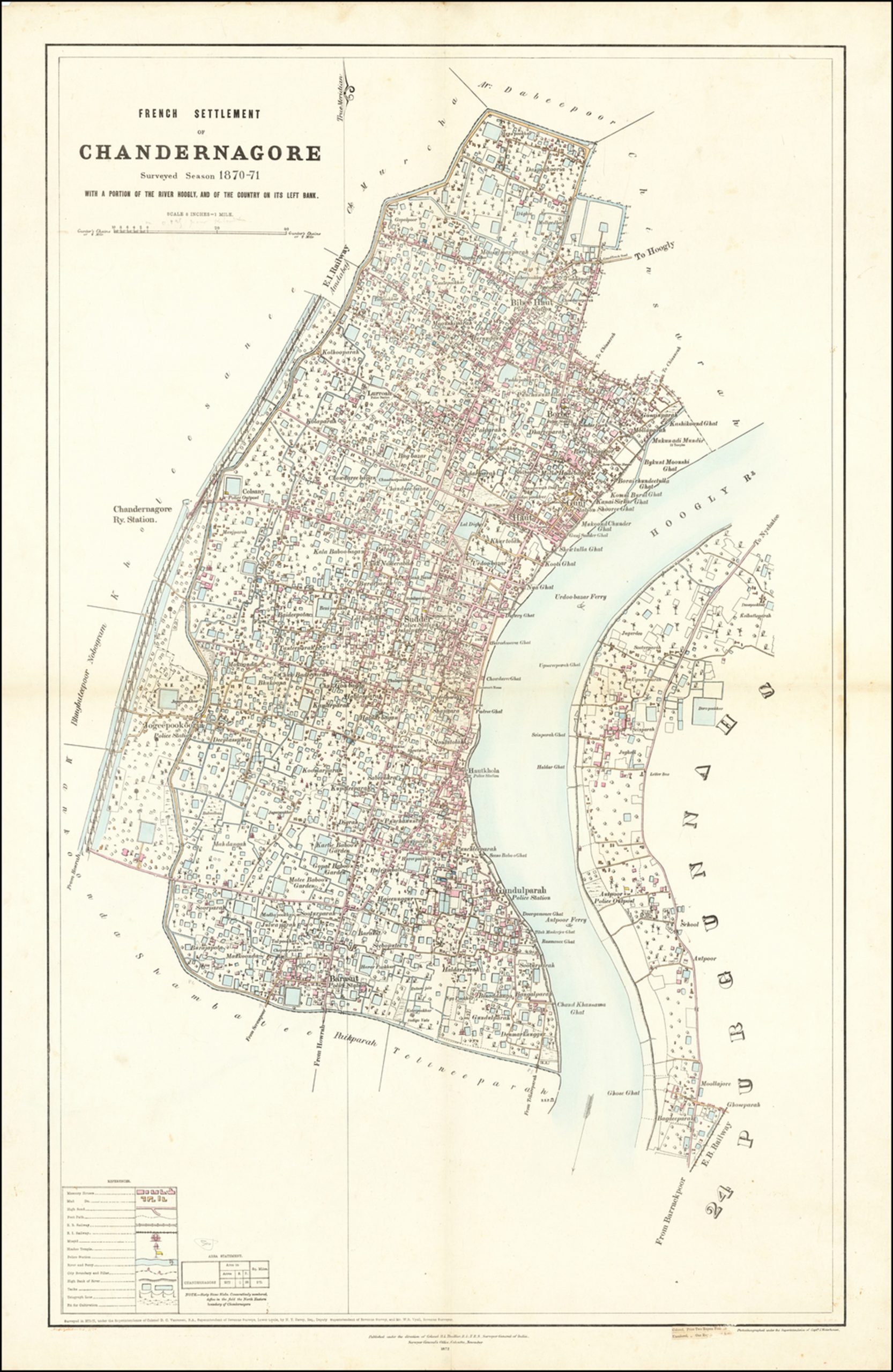
[Chandannagar] French Settlement of Chandernagore Surveyed Season 1870-71 with a portion of the River Hoogly, and of the Country on its Left Bank
Rare map of the city of Chandannagar in West Bengal, published by the Surveyor General of India in 1872.
The map provides an exceptionally detailed look at the city, which at the time was one of three remaining French colonies in India.
Chandannagar was founded by the French, as a combination of several local villages, including Gondolpara to the South, Boro in the North and Khalisani to the West. The name “Chandernagore” can be first found in the letter dated 1696, intended for the officials of French East India
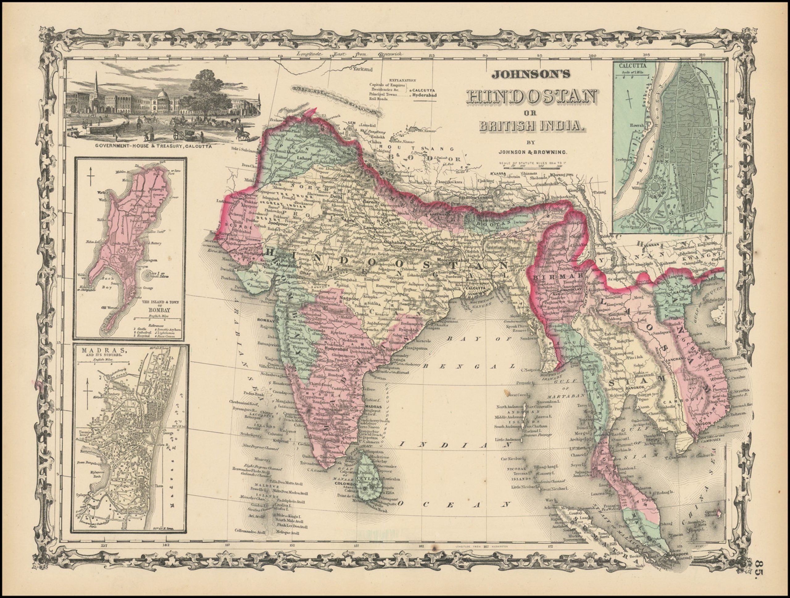
Johnson’s Hindostan or British India
Scarce first edition of Johnson & Browning’s map of India, Ceylon, Birma, Laos, Vietnam, Cambodia, Thailand and part of Malaysia and Sumatra. Insets of Bombay, Madras and Calcutta. Vignette of Government House and Treasury in Calcutta. Colored by province. Shows towns, islands, rivers, lakes, mountains, etc. Decorative border.
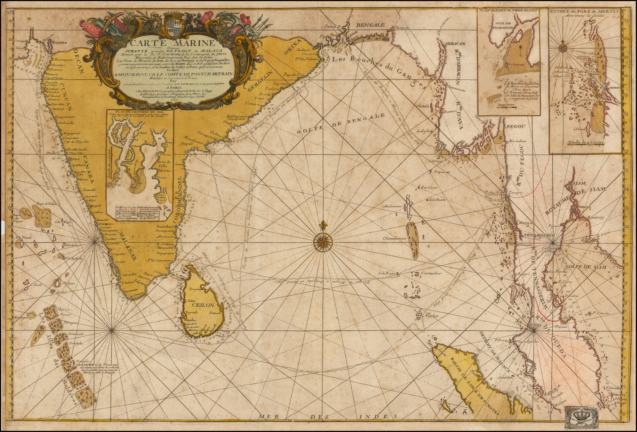
Carte Marine depuis Suratte jusqu’au Detroit de Malaca Dressee par le R.P. Tachard de la Compagnie de Jesus Missionaire et Mathematicien du Roy dans les Indes . . . 1701
Fine example of this important chart of the Indian Ocean, illustrating the route of the Jesuit priest Guy Tachard at the end of the seventeenth century.
The present example bears the bookplate (bottom right) of the Prussian Royal Academy of Sciences (Königlich-Preußische Academie der Wissenschaften), which was formed on July 11, 1700.
The map shows the Maldives, Ceylon (Sri Lanka), much of India, the flood plains of the Ganges River, Burma (Myanmar), continuing around to Malacca on the Malaysian Peninsula. It includes most of Sumatra and names the Aceh region. Three insets detail the vicinity of Goa, the Port of Negrailles, and the Port of Mergui.
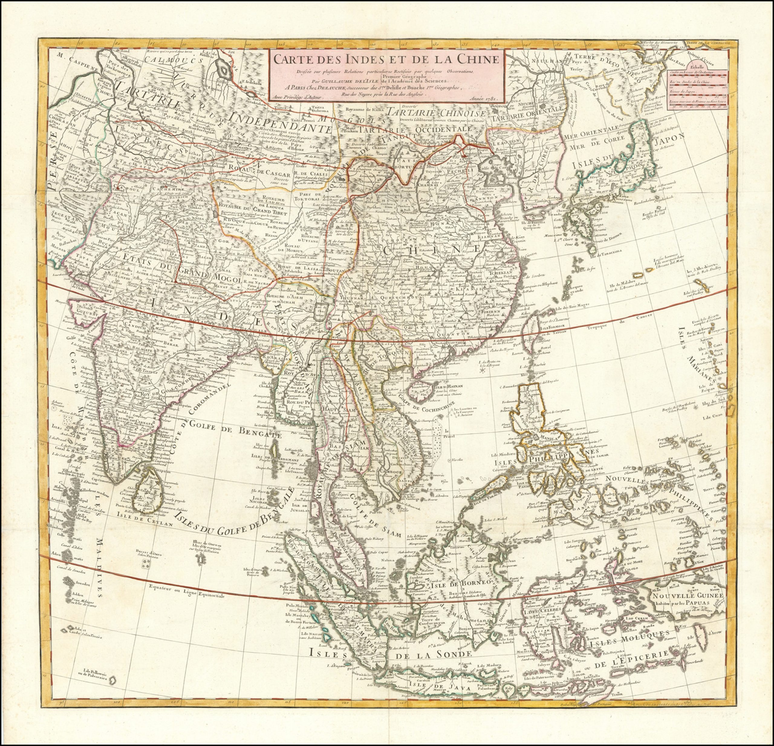
Carte Des Indes et de la Chine Dressee sur plusieurs Relations particulieres Rectifees par quelques Observations Par Guillaume De L’Isle de l’Academie Royale des Sciences . . . 1781
Notable example of this meticulously-drawn map of East Asia and the Indian subcontinent published in Paris. The map is based upon the earlier work of the famed geographer Guillaume De L’Isle and was re-issued by his son-in-law, Philippe Buache, and later by their heir, J.A. Dezauche.
The map covers much of Asia, from China and Japan, south to New Guinea and the Moluccas, west through Malaysia and Indonesia to what is today Vietnam and Thailand, and India.
Dotted lines mark political boundaries. The map is thickly detailed with settlements, geographic features, and ethnographic notes. There is a simple title cartouche in the top center, with a quadruple scale bar in the upper right corner.
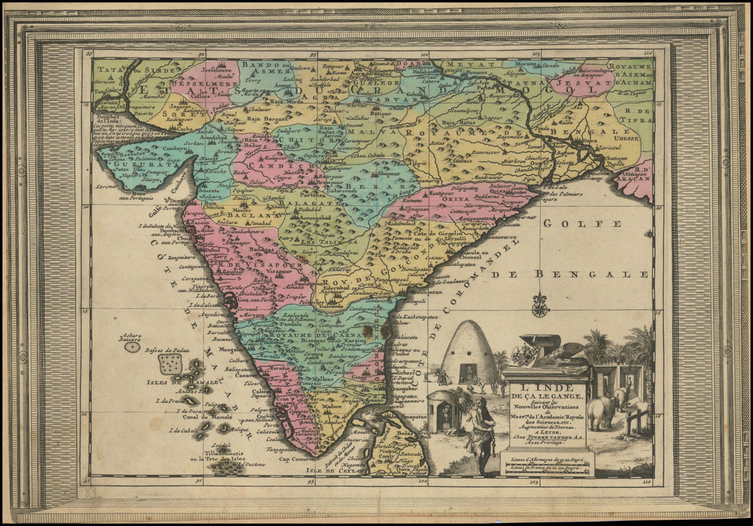
L’ Inde de ca Le Gange Suivant les Nouvelles Observations de Mess’rs de l’ Academie Royale des Sciences, etc.
This fine map, surrounded by an elegant frame border, encompasses most of India. While the various traditional princely states of the subcontinent are distinguished by color, much of these states had by this time fallen under the rule of the Mughal Empire of Emperor Aurangzeb (reigned 1656-1707). During Aurangzeb’s reign, the Mughals expanded their presence deep into southern India, although they never managed to conquer the entire area. Most notably the great Kingdom of Mysore was able to check their advance. At the same time, much of the coastal areas were under the auspices of various European powers, including the English, Dutch, Portuguese, French and Danes. Their numerous forts and trading posts are detailed on the map. An elegant cartouche with elephants and beehive-dwellings completes the composition.
India. Published under the Supervision of the Society for the Diffusion of Useful Knowledge
The details mark British possessions, French and Portuguese settlements and the blue line indicates finished railways across the country. The latter help dating the map in the late 1860s.
The map was made under the supervision of Society for the Diffusion of Useful Knowledge, founded in London in 1826, to educate non-elite adults, and is preserved in a handsome original wrappers with advertisements by Edward Stanford Ltd., the world leading commercial cartographic enterprise.

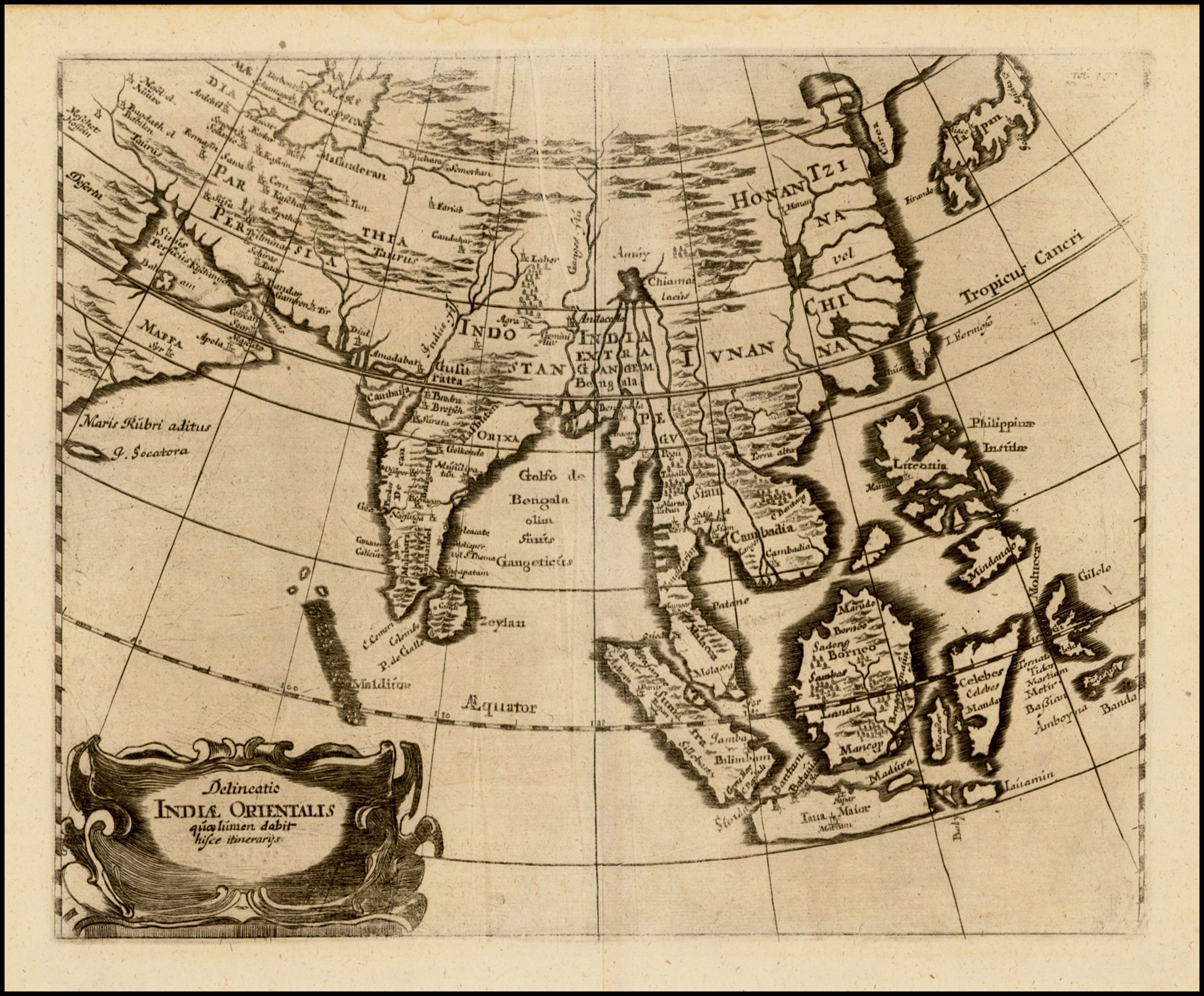
Delineatio Indiae Orientalis quaelumen dabit hisce itinerarijs
In 1660, before contact with the Dutch, a rare map that is centered on the Indian Ocean and extends from Japan, China and Korea to the Caspian Sea and the Persian Gulf, including South and great details of Southeast Asia.
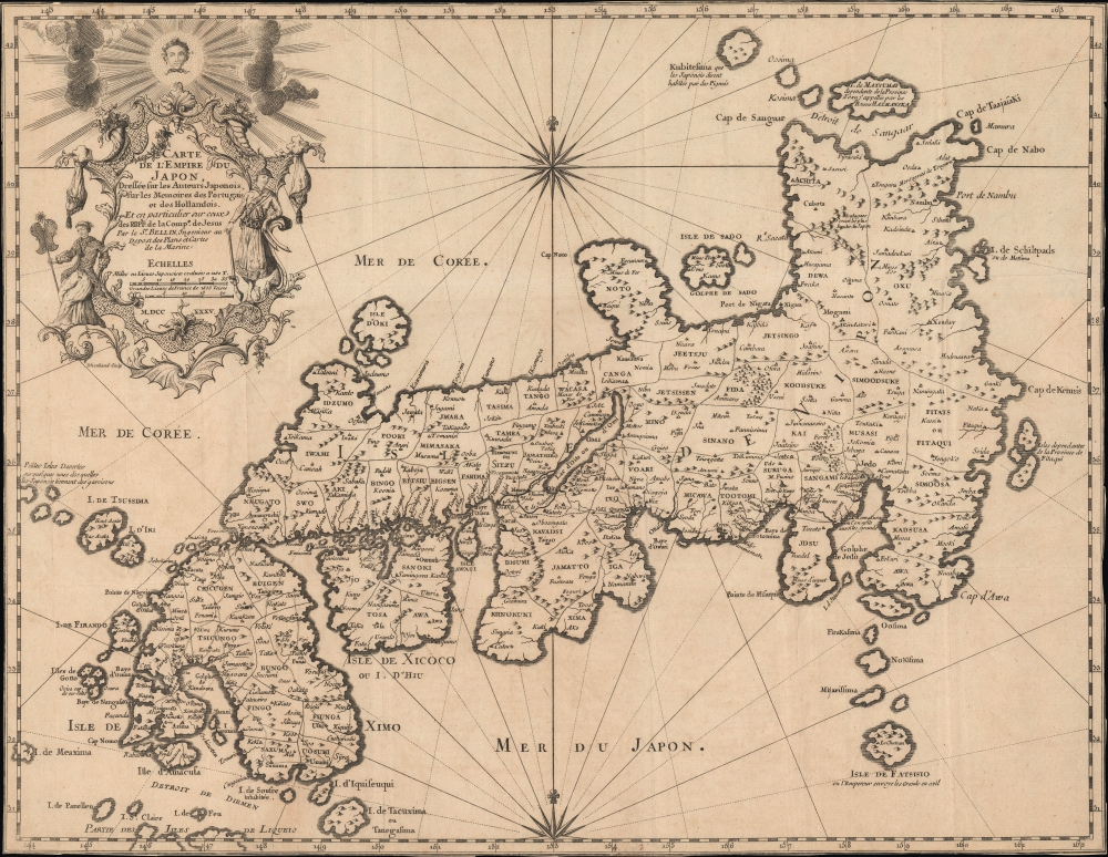
Japan: Perceived by Early Europeans
Carte de l’Empire du Japon, dressée sur les auteurs japonais, sur les mémoires des Portugais et des Hollandais et en particulier sur ceux des RRPP. de la Comp. de Jésus
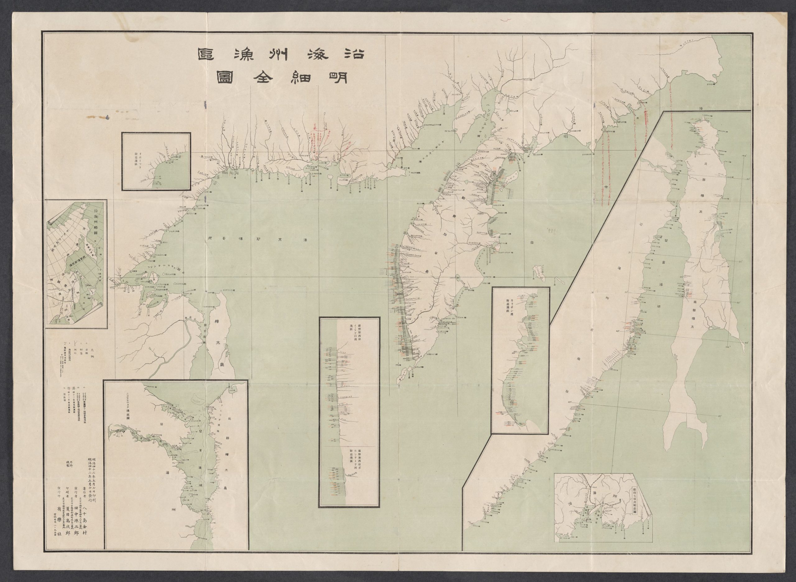
沿海州漁區明細全圖
[Complete Map for the Primorye Fishing Areas]
(Tokyo : Arakusha, 1909) Kanemura, Yasojima ; 八十島金村
Extremely rare – the map that was the ‘masterplan’ for the operations of theJapanese fishing industry along the coasts of the Russian Far East (PrimorskyKrai, Kamchatka and North Sakhalin), which existed in the wake of Japan being given extensive fishing rights under the Treaty of Portsmouth (1905) that ended the Russo-Japanese War.
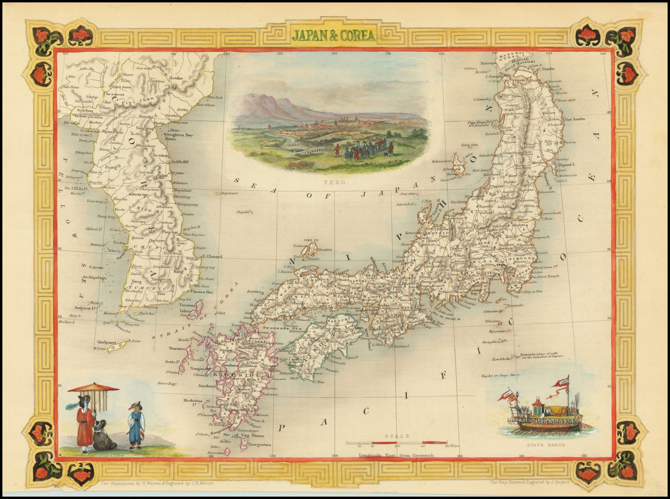
Japan & Corea
Striking full-color example of Tallis’s decorative map of Japan and Korea, decorated in Tallis’s classical style. The map includes a wealth of detail, with the traditional provinces of Japan outlined and major geographical features shown.
The map is particularly notable for its decorative style, typical of Tallis. Three vignettes are shown, with vignettes of Yedo (Edo, or Tokyo), a state barge and a depiction of Koreans.

Saikin no Toa Keisei Zukai
Rare 1937 Osaka Mainichi Shimbun Japanese anti-Soviet propaganda map centered on China – it depicts the area from Central Asia and India to Japan, and from Siberia to Vietnam
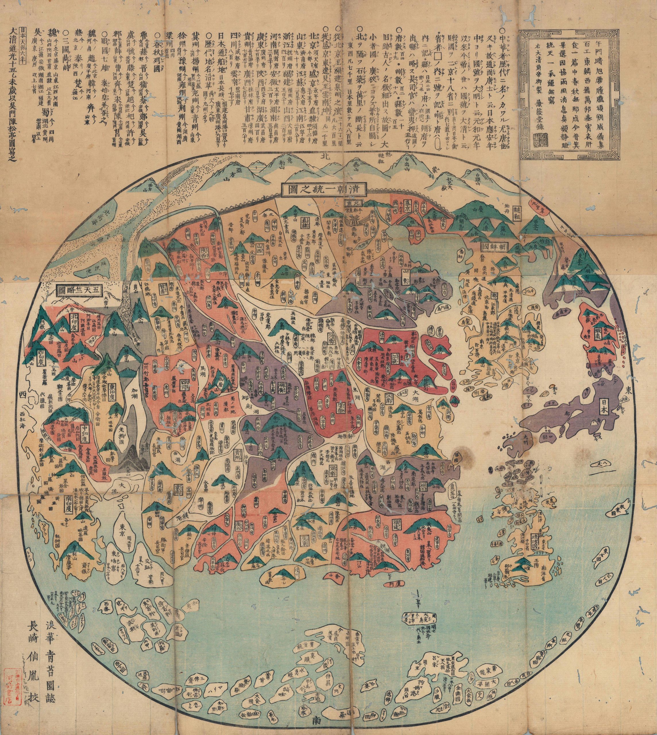
清朝一統之圖 / [Map of the Unified Qing Dynasty]
This is an 1835 Japanese xylographic map of the Qing Empire and much of Asia – a curiosity issued in Japan despite the isolationist Tokugawa policies. It is further notable for recognizing and praising the Manchu-led Qing Dynasty, whereas many Japanese maps of the era ignored or even denigrated the Manchus. Yet it retains common elements of Tokugawa-era maps of China, such as historical and religious (Buddhist) references as well as cartographic anachronisms, rooted in Japan’s admiration for and fascination with ancient Chinese culture.