Rare and Historic Maps at UHM Library
Google maps was launched for desktops in 2005 and now the app is on our mobile devices bringing the wayfinding tool to our palms and in our cars – it works at home or abroad. There have been other wayfinding tools over the years, but the one constant that carries over are maps – the kind we saw in atlases, folded out when traveling, and essential to shipping and all forms of travel. In 2018 librarians for Japan, China, Korea and Russia in Asia jointly purchased a map of Manchuria printed in 1926. It was framed and is on permanent display in the Asia reading room.
Since then librarians in the Asia Collection have been acquiring rare and unusual maps from antiquarian dealers with funds made available through the generosity of library donors and supported by Clem Guthro, University Librarian. Professor Reece Jones in the Geography Department says, “By acquiring these important maps, the library is building a foundation of knowledge for research across Asia. The collection of rare maps will be vital resources for students and faculty for generations to come.” Numerous maps have been acquired for Northeast Asia that are in Russian, Japanese, and Chinese, which portray themes of interest to many countries – of note, is a recently purchased rare map of a Japanese castaway who lived in Russia Oranda Chikyuzu.
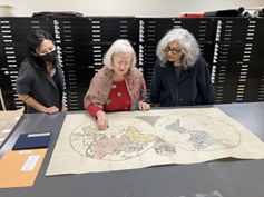
L-R Karen Kadohiro Lauer, Patricia Polansky & Monica Ghosh view the castaway map
![[Taprobana] Duodecima Asie Tabula – Sri Lanka as known to the Greeks dated 1482 – Over 500 years old it is the oldest map in the Map Collection.](https://manoa.hawaii.edu/library/wp-content/uploads/2023/12/map2.png)
[Taprobana] Duodecima Asie Tabula – Sri Lanka as known to the Greeks dated 1482 – Over 500 years old it is the oldest map in the Map Collection.
The purpose of maps can vary widely – some of them had wartime applications with strategic and propagandist intentions and agendas, such as Saikin no Toa Keisei Zukai, a remarkable and rare 1937 Osaka Mainichi Shimbun Japanese anti-Soviet propaganda map centered on China – it depicts the area from Central Asia and India to Japan, and from Siberia to Vietnam; some were intended to define and fix borders that had political impact, especially by colonizers; some were navigational and center on the ocean over land masses; some on economic activities of fishing and mining, such as a Complete Map for the Primorye Fishing Areas; and others zero in on city limits, such as the Harbin & Mukden, and Pekin maps.
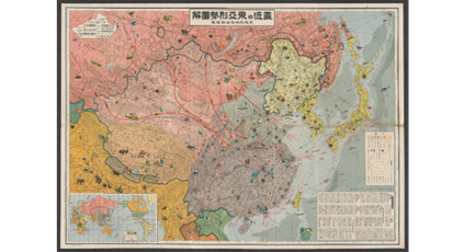
Saikin no Toa Keisei Zukai
Using text, color coding, and cartoon imagery to describe the complex political, military, and economic environment of East Asia, highlighting the threat of Soviet expansion and advocating a Japanese military buildup to counter it.
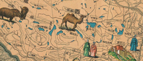
Detail from Saikin no Toa Keisei Zukai
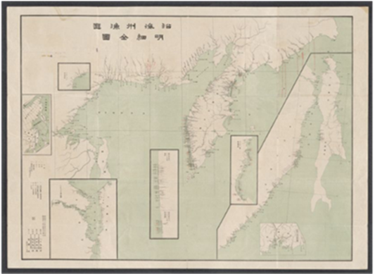
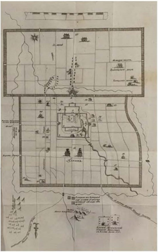
Complete Map for the Primorye Fishing Areas
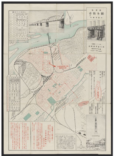
Harbin City Guide
Pekin – Plan of Peking
published in Russia
As Prof. Ned Bertz, South Asia and Indian Ocean historian, elaborates on the significance of “maps in teaching and research are far more than detailed renderings of geography: maps are also cosmological expressions, perspectival spatial conceptualizations, and projections of power.” Furthermore, “they can foreground terrestrial or aquatic perspectives, such as the intriguing Dutch map (1660) that centers on the Indian Ocean, revealing early modern European understandings of (and desires to master) a dynamic regional world. It could be compared with maps drawn by premodern Indian Ocean cartographers and sailors (such as the vibrant 1482 map of Sri Lanka, drawn from original Greek maritime knowledge), whose intent could be to navigate or locate oneself in the cosmos. Similarly, these maps can be contrasted with the fascinatingly detailed 1840 British map of Calcutta, then the East India Company’s administrative capital in the subcontinent. It shows more than the buildings and byways of the town, but also demonstrates how colonialism uses urban and riverine space to dominate and profit.” There is an uncanny connection with a map of Singapore from 1954 that serves as evidence of how mapping finds echoes across the genre and over time.
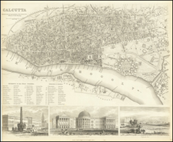
Calcutta City Map (1840)
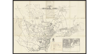
Singapore Map (1954)
Librarians in the Asia Collection have worked closely with Map Librarian, Ted Kwok, who notes that the dozens of rare historical maps acquired over the last several years provide primary source materials for research – they have become cultural heritage objects that are not only cartographically beautiful, but also include a wide range of data, in many languages, place names, exploration/trade/economic routes, battlegrounds, etc., that may be used to visualize content for a wide range of subjects across the humanities and social sciences. The library is gradually digitizing the maps and other treasures in its state-of-the-art Digitization Lab that can be viewed in our repository of Early and Historical Maps.