The Luciano Minerbi Collection: 50 Years of Collaborative Community Activism Through Urban and Regional Planning

May 5, 2020-June 30, 2020
Location: Online
This online exhibit embodies the work of Dr. Luciano Minerbi, Professor of Urban and Regional Planning at the University of Hawai'i at Mānoa. This faculty collection housed at the University Archives is a collaborative effort of years of work done by Dr. Minerbi, his colleagues, as well as his students on issues of sustainable island development, watershed and land management, cultural impact assessments, heritage landscape analysis, community planning, and place-based management for local Hawaiian and global communities outside of Hawaiʻi.
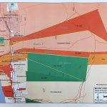
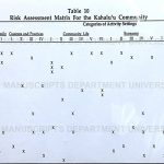
The collection presents practicum, photographs, research, maps, PLAN (Urban and Regional Planning) methodology, and community identity. Some of his published work include topics on tourism, coastal zones, indigenous people and land use planning. His work incorporates aspects of oral histories, indigenous populations, community and indigenous knowledge, and protocols.
View the Online Exhibit at: https://

