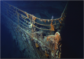
SF Fig. 1.13. This photograph of the bow of the Titanic was taken in 2004 by the ROV (Remotely Operated Vehicle) Hercules.
Compare-Contrast-Connect: Converting Decimal Degrees to Degrees, Minutes, and Seconds
Latitude and longitude coordinates can be written using degrees, minutes, and seconds or using decimal degrees. Location is given as decimal degrees in most GPS (Global Positioning System) units and on Google Maps. Both methods of writing location are correct.
| 1. To convert seconds to minutes, divide by 60 | 57 / 60 = 0.95 |
| 2. Add your minutes together | 0.95 + 43 = 43.95 |
| 3. Divide your minutes by 60 | 43.95 / 60 = 0.7325 |
| 4. Add to your degrees | 0.7325 + 43 = 43.7325 decimal degrees N |
| 1. Subtract the whole number (this is the degrees) | = 49В° and 0.947 as the decimal |
| 2. Multiply the decimal by 60 0.947 x 60 | = 56.82 |
| 3. Subtract the whole number (this is the minutes) | = 49В° 56вҖҷ and 0.82 as the decimal |
| 4. Multiply the decimal by 60 0.82 x 60 | = 49.2 |
| 5. Subtract the whole number (this is the seconds) | = 49В° 56вҖҷ49вҖқ W |
- LЕҚК»ihi seamount is the newest volcano in the Hawaiian chain (SF Fig. 1.14). The position of LЕҚК»ihiвҖҷs northern cone is 18В° 56вҖІ 1вҖІвҖІ N, 155В° 15вҖІ 5вҖІвҖІ W. Convert this position into decimal degrees.
-
Image captionSF Fig. 1.14. (A) The location of the newest volcano in the main Hawaiian island chain is the LЕҚК»ihi seamount.
Image copyright and sourceImage adapted from Google Maps
Image captionSF Fig. 1.14. (B) The LЕҚК»ihi seamount is located off the southeast coast of the Island of HawaiвҖҳI.
Image copyright and sourceImage adapted from Google Maps
-
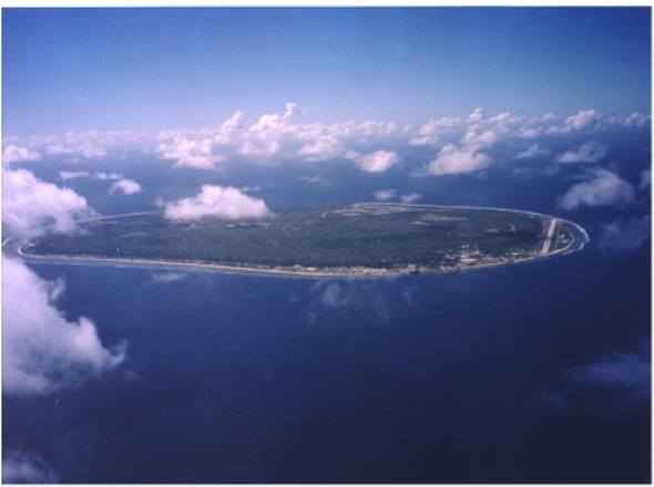
Nauru is the smallest island nation on earth, covering just 21 sq. km (SF Fig. 1.15). It is located at 0.527 decimal degrees south and 166.937 decimal degrees east. Convert this position into degrees minutes and seconds.
Image captionSF Fig. 1.15. Nauru
Image copyright and sourceImage courtesy of Atmospheric Radiation Measurement (ARM) Climate Research Facility


