Continents and the Ocean
There is one world ocean. The ocean is composed of salt water; it covers 70 percent of the earth’s surface and contains 97 percent of the earth's water. The ocean is the most prominent feature on our planet. You can see this by tracing through the ocean on a map with your finger. On a globe, you can trace the ocean by moving your finger in a complete circle around the world without having to cross any land.
The world ocean can best be visualized by viewing a globe from the South Pole (Fig. 1.2 A). From this perspective, Antarctica is at the center of the world ocean. Three ocean extensions reach northward from Antarctica and extend toward the South Pacific, South Atlantic, and Indian ocean basins between the continents.
The North Pacific and Atlantic ocean basins meet in the Arctic ocean basin at the North Pole (Fig. 1.2 B). In Fig. 1.2 C, the sea ice at the North Pole has been removed to show how the world ocean is connected, which is hard to see in most illustrations because of the North Pole ice (shown in Fig. 1.2 B). In contrast, if the ice were removed from the South Pole (e.g. from Fig. 1.2 A), rather than an ocean basin, the land of Antarctica would be visible.
Fig. 1.2 (A) Map of the world from the South Pole, including sea ice (1997)
Image courtesy of National Oceanic and Atmospheric Administration (NOAA) Pacific Services Center
Fig. 1.2 (B) Map of the world from the North Pole, including sea ice (1997)
Image courtesy of National Oceanic and Atmospheric Administration (NOAA) Pacific Services Center
Fig. 1.2 (C) Map of the world from the North Pole, not including sea ice
Image courtesy of National Oceanic and Atmospheric Administration (NOAA) Pacific Services Center
Maps
Maps are one of the most important tools we have for understanding Earth’s features, including the ocean. Maps are a universal method of conveying information, regardless of language or culture. Information about coastlines, shipping routes, or storm paths—extremely important for people throughout the world—can be read by anyone when it is represented graphically on a map.
Maps are a convenient and portable way to represent the surface of the earth. There are many different types of maps and ways to depict locations on a map. Figure 1.3 shows several examples of maps of Pearl Harbor, O'ahu, Hawai'i. Each type of map provides a unique perspective, and it is important to understand that perspective in order to correctly use the map. We will begin the exploration of the earth’s oceans by studying maps.
Fig. 1.3 (A) A street view of Pearl Harbor.
Fig. 1.3 (B) A satellite view of Pearl Harbor.
Fig. 1.3 (C) A nautical chart of a portion of Pearl Harbor. This portion is the area outlined in red on maps A and B.
Image courtesy of the National Oceanic and Atmospheric Administration (NOAA)
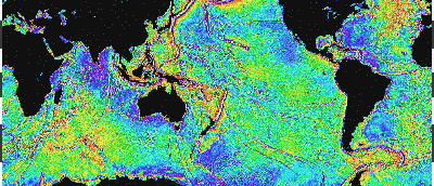
Because the earth is spherical, its surface features can only be represented accurately on a globe. Two-dimensional maps are flat representations of the three-dimensional earth, and therefore they distort some of the information they display. This is especially true of maps that show large areas. Maps of the whole earth, for example, flatten the curved surface of the earth’s sphere onto a two-dimensional surface and, in doing this, change the way the earth looks.
Image caption
Fig. 1.4. Pseudocylindrical map projection of the earth. On this map land is green even if it is covered by ice. This map does not show sea ice.
Image copyright and source
However, two-dimensional maps are more convenient to use than globes because they can be easily transported and stored, they allow ease of measurement, they can be viewed on flat-paneled electronics, and they are cheap to produce. Figure 1.4 shows one example of a two-dimensional map showing the entire surface of the earth. This maps is called a pseudocylindrical map. Other types of two-dimensional maps will be discussed in greater detail later in this unit.
Ocean Basins and Continents
Even though there is one world ocean, it has traditionally been divided into four major ocean basins: the Arctic, the Atlantic, the Indian, and the Pacific. For Exploring Our Fluid Earth’s purposes, continents are defined as large landmasses separated by natural barriers, mainly water, and islands are defined as smaller landmasses. The six continents are Africa, Antarctica, Australia, Eurasia, North America, and South America. When dividing the world into large geographical areas, islands are usually grouped with the continent closest to them.
Activity
Check your knowledge of ocean basins and continents by locating and labeling them on a world map.
 Pacific Services Center</p>")
 Pacific Services Center</p>")
 Pacific Services Center</p>")


</p>")

")


")


