Geography: The Federated States of Micronesia (FSM) are a group of 607 islands (FSM Government, 2014a) in the North Pacific Ocean about three-quarters of the way from Hawaiʻi to Indonesia. The islands have a total land area of 271 square miles (Central Intelligence Agency, 2014d). Unique attributes of each of the FSM’s four states will be discussed separately below.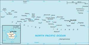
FSM History European ships visited the islands beginning the 17th century. In 1686 Spanish navigator Francisco Lazcano named the chain (together with Palau) “the Caroline Islands” after Carlos II of Spain (Room, 1988). In the 18th century the islands were visited by whaling ships. Spain formalized their claim to the islands in 1886 and held them as a colonial possession until the end of the Spanish-American War, when they were sold to Germany (Hezel, 2003). At the outbreak of World War I Japan moved to seize Germany’s colonial possessions in Micronesia, seeking to incorporate the islands into its empire. Under a mandate from the League of Nations, Japan administered the Caroline Islands until the end of World War II, when control passed to the United Nations (U.N.). In 1947, the U.N. created a strategic-area trusteeship encompassing more than 2,000 islands situated between 1° and 22° N latitude and 130° and 172° E longitude (an area of about 3 million square miles). Administered by the U.S., the Trust Territory of the Pacific Islands (TTPI) comprised the Marshall Islands, Palau, Yap, Chuuk, Pohnpei, Kosrae, and the Marianas Islands (excluding Guam) (Encyclopaedia Britannica, 2014k). Beginning in 1969 representatives from what would become the FSM entered into self-government negotiations, culminating in their unification under the constitution drafted in 1975 and put into effect in 1979. In 1991 the UN recognized the FSM as an independent nation, although they continue to rely heavily on foreign financial aid which they receive as part of the Compact of Free Association (COFA) signed with the United States in 1986 and renewed in 2004 (Central Intelligence Agency, 2014d). The FSM has no official language. There are 8 distinct local languages and many dialects; English is widely spoken, especially for trade and government functions (Encyclopaedia Britannica, 2014g).
 State of Yap: The volcanic islands of Gagil-Tamil, Maap, Rumung, and Yap, are located within a coral reef and collectively comprise the Yap islands (Encyclopaedia Britannica, 2014l). Located 280 miles east of Palau and 500 miles southwest of Guam, The Yap islands, together with one other volcanically raised island and eight major atolls, comprise the state of Yap. The state covers 78,000 square miles of ocean in the Western Pacific and has a total land area of 46 square miles (Yap State Government, 2011). The earliest inhabitants of Yap most likely came from Eastern Indonesia or the Philippines around 1500 B.CE or earlier (Yap Visitors Bureau, 2014). Yap is famous for its stone money, which was quarried in Palau and brought to the state in oceangoing canoes. The stones are large and round with a hole in the middle, made to be placed on poles. There are about 12,000 pieces remaining in Yap, and it is illegal to remove them (Ridgell, 1995). In 1525 Dioga Da Rocha from Portugal was the first European to visit Yap; various other European navigators would pass through the islands of Yap over the next 2 centuries. In 1731 the first Catholic missionaries came to Yap from Guam (Yap Visitors Bureau, 2014). Over the next century or so Yap was nominally controlled by Spain. From 1800-1860 the Yapese traded sea cucumbers with British traders and other Europeans. In 1869 the Germans established their first permanent trading station in Yap (Yap Visitors Bureau, 2014). In the late 19th century an Irish-American named David O’Keefe made a small fortune by quarrying stone money in Palau and bringing it to Yap in a Chinese sailboat (Ridgell, 1995). The people of the Yap islands have a culture and language (Yapese) which are more closely related to the Melanesian language and culture than other Micronesian peoples (Encyclopaedia Britannica, 2014l). People on the outer islands of Yap state speak Nuclear Micronesian languages similar to outer-island Chuuk and Saipan Carolinian (Ridgell, 1995). Approximately one-tenth of the FSM population (about 11,200) people lives in Yap State (FSM Government, 2014b); ethnically Yapese comprise 5.7% and Yap outer islanders 5.1% of the total FSM population (Central Intelligence Agency, 2014d).
State of Chuuk: Similar to the state of Yap, the state of Chuuk comprises the Chuuk Islands and several outlying atolls. The Chuuk Islands are a group of 16 highly-eroded volcanic islands in a lagoon surrounded by a barrier reef (Encyclopaedia Britannica, 2014b); Chuuk State also includes 24 inhabited outer-island atolls. The total land area of the state is 49 square miles (Ridgell, 1995). The earliest inhabitants of Chuuk, Pohnpei, and Kosrae most likely came from the Marshall Islands in the east, having originated in Vanuatu and Fiji. Archaeological evidence of settlements dating back to the 1st century C.E. has been found on Chuuk (Encyclopaedia Britannica, 2014g). Historically Chuuk had a fierce reputation characterized by fighting among the islands of the lagoon. For this reason whites tended to avoid these islands, and when missionaries did come to Chuuk State they established missions on the outer islands first (Ridgell, 1995). During Japanese rule rice and sugarcane were planted extensively on the lagoon islands, and in preparation for World War II the Chuuk islands were heavily fortified by the Japanese. Over 60 ships were sunk in the lagoon during the war; today it draws scuba divers from around the world. (Ridgell, 1995). Approximately one half of the FSM population (about 53,500 people) lives in Chuuk State; it is the most populous state in the FSM (FSM Government, 2014b). Weno, the capital, is developed and has paved roads, electricity, and other modern amenities; many people from the outer islands go there for work (Ridgell, 1995). In addition to the Chuuk Islands in the lagoon, there are four main areas of the state. Atolls to the west of the Chuuk Islands are more traditional, identifying with the culture of the outlying Yapese atolls and sailing traditional oceangoing canoes over hundreds of miles. Their dialect is different from the Chuukese spoken by the people living in the Chuuk island lagoon. The atolls to the southeast, called the Mortlock atolls, speak a dialect closer to the lagoon Chuukese, but think of themselves as a different people. Lastly, located to the north of the lagoon are the Hall islands (Ridgell, 1995). Ethnic Chuukese/Mortlockese people comprise 49% of the FSM population (Central Intelligence Agency, 2014d).
State of Pohnpei: Pohnpei is made up of one large volcanic island and six outlying atolls, all of which are inhabited. Located 450 miles east of Chuuk, Pohnpei has a total land area of 133 square miles—mostly on Pohnpei Island (Ridgell, 1995). Thanks to ample rainfall and fertile volcanic soils the island of Pohnpei has lush, tropical foliage (Encyclopaedia Britannica, 2014j). The island is fertile and well-suited for agriculture, producing much food for local consumption (Ridgell, 1995). The low-lying coral atolls surrounding Pohnpei are wooded, supporting coconut palm trees (Encyclopaedia Britannica, 2014j). The earliest inhabitants of Chuuk, Pohnpei, and Kosrae most likely came from the Marshall Islands in the east, having originated in Vanuatu and Fiji (Encyclopaedia Britannica, 2014g). Pohnpei is famous for the ruins of an ancient city called Nan Madol, constructed of huge basalt rock crystals piled on one another like logs. Pohnpei was the only state in the FSM to vote against the COFA with the United States (defeating it by a narrow margin of 51% to 49%); however since the other three states voted for the Compact it is still binding on Pohnpei. Palakir, the capital of the FSM, is located on Pohnpei (Ridgell, 1995). There are numerous ethnic groups and languages spoken in the state of Pohnpei. In Pohnpei proper, the Pohnpeian language is spoken (Central Intelligence Agency, 2014d). People from the island of Pingelap speak Pingalapese, which is close to Pohnpeian but different (Ridgell, 1995). Polynesian languages are spoken on the atolls of Kapingamarangi and Nukuoro to the southwest of Pohnpei (Encyclopaedia Britannica, 2014g). Additionally, there is a sizable community of Mortlockese on Pohnpei as they were allowed to settle there after a typhoon hit the Mortlock atolls during the time of German rule (Ridgell, 1995). Approximately one third of the FSM population (about 34,500 people) lives in Pohnpei (FSM Government, 2014b). Ethnically, Pohnpeian people comprise 30% of the FSM population, and Polynesian people make up 1.6% (Central Intelligence Agency, 2014d).
State of Kosrae: Kosrae is the only state in the FSM which is made up of a single island. Kosrae is a hilly, volcanic island with an area of 42 square miles (Encyclopaedia Britannica, 2014e). The easternmost island in the FSM, Kosrae is located 350 miles east-southeast of Pohnpei. There are many rivers and waterfalls on Kosrae (Ridgell, 1995). The fertile soils of Kosrae make it ideal for growing oranges, taro, breadfruit, and bananas; it also has valuable timber resources (Encyclopaedia Britannica, 2014e). Although imports continue to increase, Kosrae produces much food for local consumption (Pacific Small Business Development Center, 2012). The earliest inhabitants of Chuuk, Pohnpei, and Kosrae most likely came from the Marshall Islands in the east, having originated in Vanuatu and Fiji (Encyclopaedia Britannica, 2014g). A frequent stop for whalers, the Kosraean population was reduced by disease from several thousand to a few hundred in the 19th century (Ridgell, 1995). The main Kosraean harbor of Lelu was once a whaling port, and remnants of old stone walls and dikes can be seen there (Encyclopaedia Britannica, 2014e). These basalt rock crystal ruins are similar to those found at Nan Madol in Pohnpei (Ridgell, 1995). The arrival of Protestant missionaries after the whalers in some ways helped the population to recover, albeit at the cost of losing many of their ancient customs and traditions. The missionaries’ influence persists to this day, as many Kosraeans are very religious (Ridgell, 1995). Approximately one tenth of the FSM population (about 7,700 people) lives in Kosrae (FSM Government, 2014b). Just as it is the only one-island state in the country, Kosrae is the only culturally and linguistically unified state in the FSM (Encyclopaedia Britannica, 2014g). Ethnically, Kosraean people comprise 6% of the FSM population (Central Intelligence Agency, 2014d).
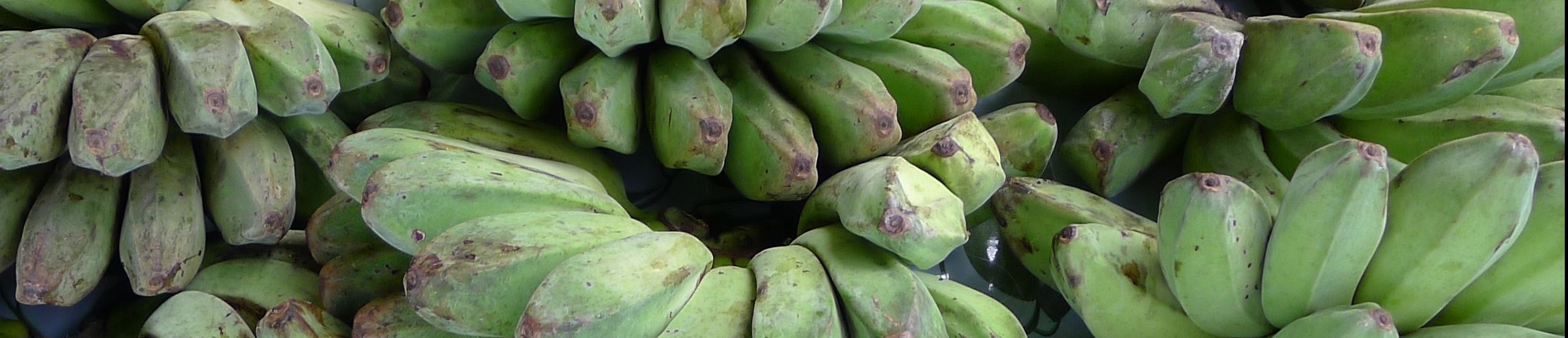
Economy: Traditionally the people on the coral atolls of FSM lived on taro, breadfruit, banana, and coconut as well as fish and seafood. Local production of these crops continues to be a major source of subsistence for people living on the outlying islands. On larger volcanic islands the above crops are supplemented with cassava and sweet potato. Pigs, dogs, and poultry are also raised for food (Encyclopaedia Britannica, 2014g). In addition to traditional subsistence crops, the population relies on imports of rice and processed foods from U.S., Japan, South Korea, China, and the Philippines. Other major imports include machinery and transport equipment. The country’s few exports, which are outnumbered 10:1 by imports, are limited to marine products and, to a lesser extent, garments, copra, and betel nut (Encyclopaedia Britannica, 2014g). Part of the impetus for the formation of the Federated States of Micronesia is that, relative to other states in the region, Yap, Chuuk, Pohnpei, and Kosrae have relatively fewer resources and no potential U.S. military bases (Ridgell, 1995). Today two thirds of the economic revenues of the country come from U.S. grant assistance, with most of the remainder coming from the sale of fishing rights to foreign vessels and the burgeoning tourism industry. The economy is concentrated in government service jobs, with some people engaged in small venture fishing operations or tourism. Presently there is a trend of migration from outlying islands to towns, as people seek schools and employment opportunities (Encyclopaedia Britannica, 2014g).
Political Affiliation: Under the Compact of Free Association, the United States provides defense and economic aid, while the FSM remains responsible for its own internal self-government (Ridgell, 1995). As an independent nation, the FSM has an ambassador to the United States but no delegate to the U.S. Congress. FSM citizens are not American citizens but they may freely migrate to the United States to live, work, and study (Wasem, 2004).