
Geography: Consisting of 29 low-lying coral atolls and five coral islands ordered in two chains (the Ralik chain to the west and the Ratak chain to the east), the Marshall Islands span several hundred miles from north to south. The easternmost country in Micronesia, the Marshalls comprise over 1,200 islands and islets with a total land area of 66 square miles (Encyclopaedia Britannica, 2014f). Only 24 of the country’s islands are inhabited (Ridgell, 1995). No part of any island in the Marshall group rises higher than 10 meters above sea level (Central Intelligence Agency, 2014c).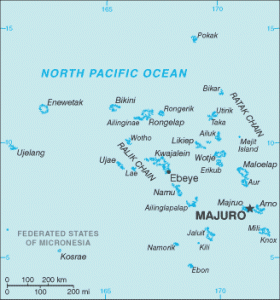
History: The Marshall Islands were first settled around 20-50 C.E. by Micronesians. The early inhabitants were skilled navigators who voyaged between the atolls in oceangoing canoes. Initial contact with Europeans came in 1529, when the islands were sighted by Spanish navigator Álvaro Saavedra (Encyclopaedia Britannica, 2014f). Due to their reputation for attacking ships, the Marshalls were largely avoided by outsiders early in their history (Ridgell, 1995). Partially explored by British naval captains John Marshall and Thomas Gilbert in 1788, the islands were frequented by American Whalers in the 1820s. In the 1850s the first Christian missionaries arrived from America. Under an agreement with Great Britain, Germany established a protectorate over the Marshalls in 1886. At the outbreak of World War I Japan moved to seize Germany’s colonial possessions in Micronesia, administering them under a mandate from the League of Nations. After occupation by U.S. forces during World War II, the Marshalls became part of the U.S. administered United Nations Trust Territory of the Pacific Islands (TTPI) in 1947 (Encyclopaedia Britannica, 2014f). A strategic-area trusteeship encompassing more than 2,000 islands situated between 1° and 22° N latitude and 130° and 172° E longitude (an area of about 3 million square miles), the (TTPI) comprised the Marshall Islands, Palau, Yap, Chuuk, Pohnpei, Kosrae, and the Marianas islands (excluding Guam) (Encyclopaedia Britannica, 2014k). From 1946 and 1958, the United States conducted 67 nuclear explosive tests in the Marshall Islands, primarily on Bikini and Enewetak atolls. In 1954, one such test caused radioactive fallout to blow over the inhabited atolls of Rongelap and Utrik, which were subsequently evacuated. In the late 1960s cleanup efforts began, followed by resettlement operations. Presently only Enewetak and Utrik are inhabited. Residents of the Bikini atoll left soon after the attempted resettlement and residents of Rongelap chose to leave the island for good in 1985 (Embassy of the United States in the Marshall Islands, 2012). In 1978, residents of the Marshall Islands voted to separate from the TTPI, forming the Republic of The Marshall Islands (RMI) and adopting a constitutional form of internal self-government in 1979. A Compact of Free Association (COFA) with the United States was signed in 1982, approved in 1983, and fully implemented in 1986 (Ridgell, 1995). Under the COFA the United States provides defense and external security in exchange for financial aid and use of Kwajalein Atoll for military purposes. Today the U.S. Army Kwajalein Atoll (U.S.A.K.A.) Reagan Missile Test Site is a key part of the U.S. strategic missile defense system (Central Intelligence Agency, 2014c).
Demographics: RMI has two official languages. Marshallese is spoken by over 98% of the population, and English is spoken by some as a second language (Central Intelligence Agency, 2014c). Almost three quarters of the Marshallese population lives on the atolls of Majuro and Kwajalein. Many people are employed at the U.S. missile test site on Kwajalein. As a result of missionary influence starting in the 1850s, the Marshallese population today is largely Christian (Encyclopaedia Britannica, 2014f).
 Economy: People living on atolls far from the two major population centers engage in subsistence fishing and farming. Major food crops include coconut, pandanus, breadfruit, and taro; people on the outer islands also raise pigs and poultry for food (Encyclopaedia Britannica, 2014f). Copra is the major export of the Marshall Islands; however the main source of economic revenue is the employment and rent generated by the U.S. base at Kwajalein. Some revenue also comes from commercial fishing in the large expanse of water comprising the Marshalls’ economic zone (Ridgell, 1995). The country relies on imports of machinery and transport equipment, fuel, and manufactured goods from the U.S., Japan, and Australia (Encyclopaedia Britannica, 2014f).
Political Affiliation: The Republic of the Marshall Islands is an independent country (Wasem, 2004). Since the dissolution of the TTPI in 1986, RMI has had internal self-governance, while under the COFA the U.S. is responsible for defense and external security. The U.S. also provides substantial financial assistance to the republic (Encyclopaedia Britannica, 2014f). The Marshallese people are citizens of the Republic of the Marshall Islands; while not U.S. citizens, they may migrate freely to the U.S. under the terms of the COFA (Wasem, 2004).