National Estuarine Research Reserve System Overview
Click here to get a virtual tour of the He'eia NERR!
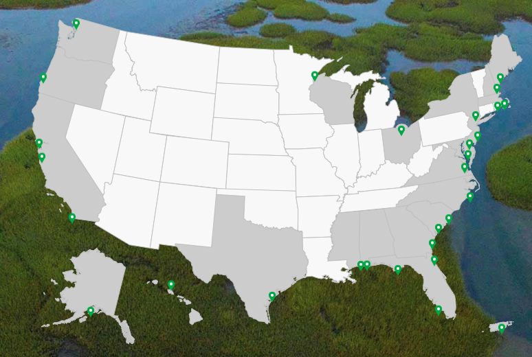
The National Estuarine Research Reserve System (NERRS) is a network of 29 coastal sites that cover 1.3 million acres of estuaries across the United States and are designated to protect and study estuarine systems (Fig. 1.). These sites were established through the Coastal Zone Management Act and represent partnerships between NOAA and the coastal states.
Image
Image caption
Fig. 1. Map of the United States showing the designated 29 sites in the National Estuary Research Reserve System. Follow the link below to learn more about each site.
Established in 2017, the He'eia National Estuarine Research Reserve is the newest member of the network. Covering 1,385 acres of He'eia estuary and KДҒne'ohe Bay, this reserve pretects reefs, sand flats, and traditional agricultural and heritage lands, such as the HeвҖҳeia Fishpond. With such an imporant area to protect, rising seas present a particular challenge.


")


")

