
| Oregon Flora Image Project | |
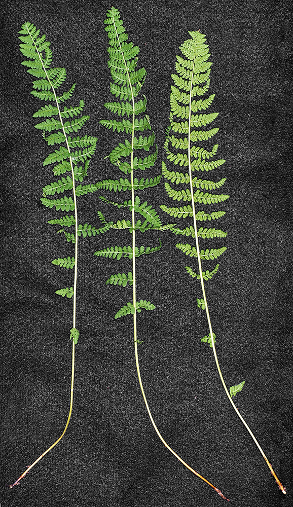
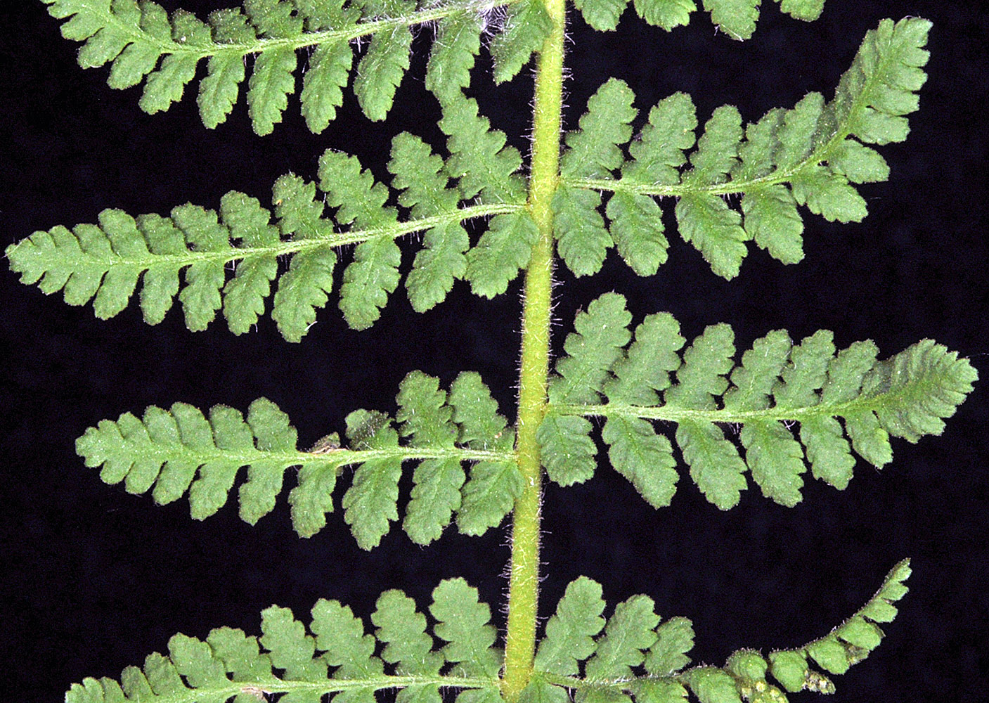
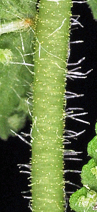
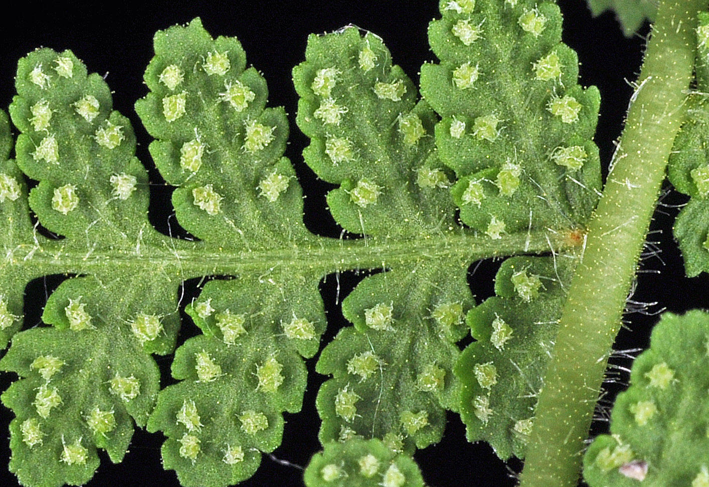
| Woodsia scopulina D. C. Eaton ssp. scopulina | Rocky Mountain woodsia - native Woodsiaceae |
Click on an image for a larger version. All images © Gerald D. Carr unless otherwise noted.
| cliffs along Sherman Creek, off Hwy 20, 9.8 mi. SW of jct. with Hwy 395, W of Kettle Falls, 2420 ft. elev., N48.57799, W118.28661, Ferry Co., WASHINGTON, 6/1/2015, © Robert L. Carr | cliffs along Sherman Creek, off Hwy 20, 9.8 mi. SW of jct. with Hwy 395, W of Kettle Falls, 2420 ft. elev., N48.57799, W118.28661, Ferry Co., WASHINGTON, 6/1/2015, © Robert L. Carr | cliffs along Sherman Creek, off Hwy 20, 9.8 mi. SW of jct. with Hwy 395, W of Kettle Falls, 2420 ft. elev., N48.57799, W118.28661, Ferry Co., WASHINGTON, 6/1/2015, © Robert L. Carr |
|
|
|
| cliffs along Sherman Creek, off Hwy 20, 9.8 mi. SW of jct. with Hwy 395, W of Kettle Falls, 2420 ft. elev., N48.57799, W118.28661, Ferry Co., WASHINGTON, 6/1/2015, © Robert L. Carr | cliffs along Sherman Creek, off Hwy 20, 9.8 mi. SW of jct. with Hwy 395, W of Kettle Falls, 2420 ft. elev., N48.57799, W118.28661, Ferry Co., WASHINGTON, 6/1/2015, © Robert L. Carr | cliffs along Sherman Creek, off Hwy 20, 9.8 mi. SW of jct. with Hwy 395, W of Kettle Falls, 2420 ft. elev., N48.57799, W118.28661, Ferry Co., WASHINGTON, 6/1/2015, © Robert L. Carr |
 |
 |
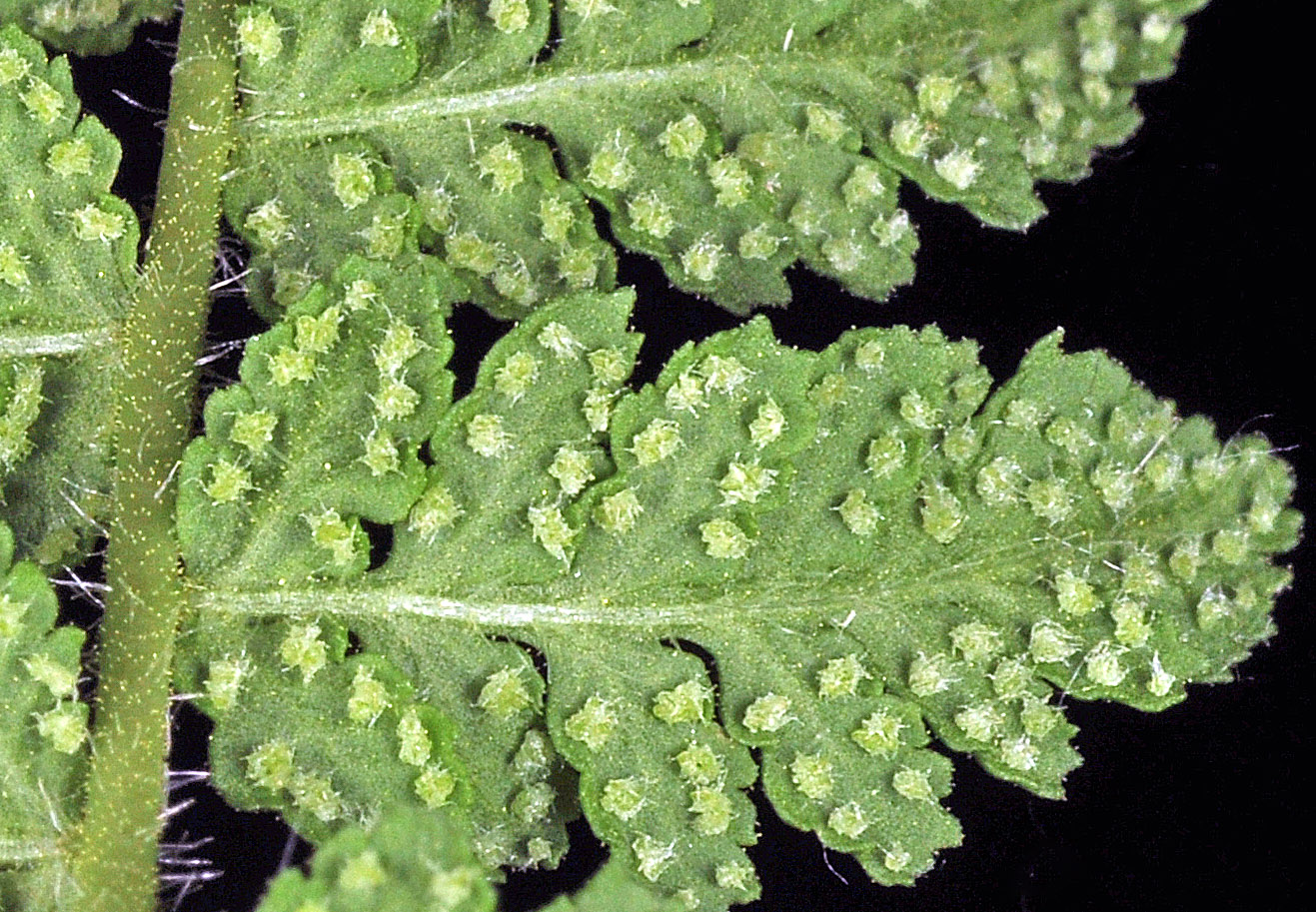 |
| cliffs along Sherman Creek, off Hwy 20, 9.8 mi. SW of jct. with Hwy 395, W of Kettle Falls, 2420 ft. elev., N48.57799, W118.28661, Ferry Co., WASHINGTON, 6/1/2015, © Robert L. Carr | cliffs along Sherman Creek, off Hwy 20, 9.8 mi. SW of jct. with Hwy 395, W of Kettle Falls, 2420 ft. elev., N48.57799, W118.28661, Ferry Co., WASHINGTON, 6/1/2015, © Robert L. Carr | ||
 |
 |