
| Oregon Flora Image Project | |
| Toxicodendron rydbergii (Small ex Rydb.) E. Greene | poison ivy - native Anacardiaceae |
Click on an image for a larger version. All images © Gerald D. Carr unless otherwise noted.
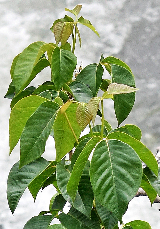
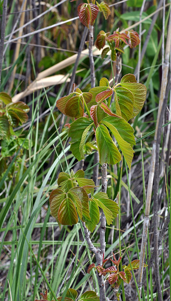
| Along Rogersburg Rd., 1.3 air mi. SSW of Rogersburg, 950 ft. elev., N46.06173, W116.99304, Asotin Co, WASHINGTON, 6/4/2018, © Robert L. Carr | Along Rogersburg Rd., 1.3 air mi. SSW of Rogersburg, 950 ft. elev., N46.06173, W116.99304, Asotin Co, WASHINGTON, 6/4/2018, © Robert L. Carr | Along Hwy 22, 6.8 mi. SE of jct. with Hwy 97 at Toppenish, 700 ft. elev., N46.30840, W120.20711, Yakima Co. WASHINGTON, 5/30/2010 (© Robert L. Carr) |
|
|
|
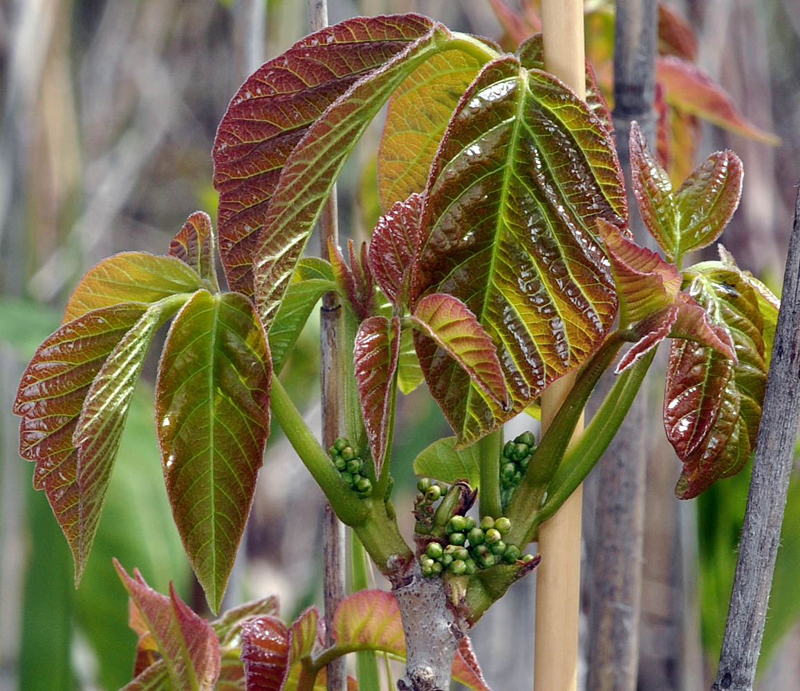
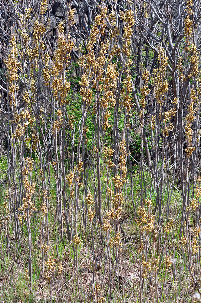
| Along Hwy 22, 6.8 mi. SE of jct. with Hwy 97 at Toppenish, 700 ft. elev., N46.30840, W120.20711, Yakima Co. WASHINGTON, 5/30/2010 (© Robert L. Carr) | Rock Creek Rd., 3 mi. SE of jct with Bickleton Hwy, near bridge across Rock Creek, ca. 18.8 mi. E of Goldendale, N45.80584, W120.50885, 850 ft. elev., Klickitat Co. WASHINGTON, 4/7/2011, © Robert L. Carr | Rock Creek Rd., 3 mi. SE of jct with Bickleton Hwy, near bridge across Rock Creek, ca. 18.8 mi. E of Goldendale, N45.80584, W120.50885, 850 ft. elev., Klickitat Co. WASHINGTON, 4/7/2011, © Robert L. Carr |
 |
 |
 |