


| Oregon Flora Image Project | |
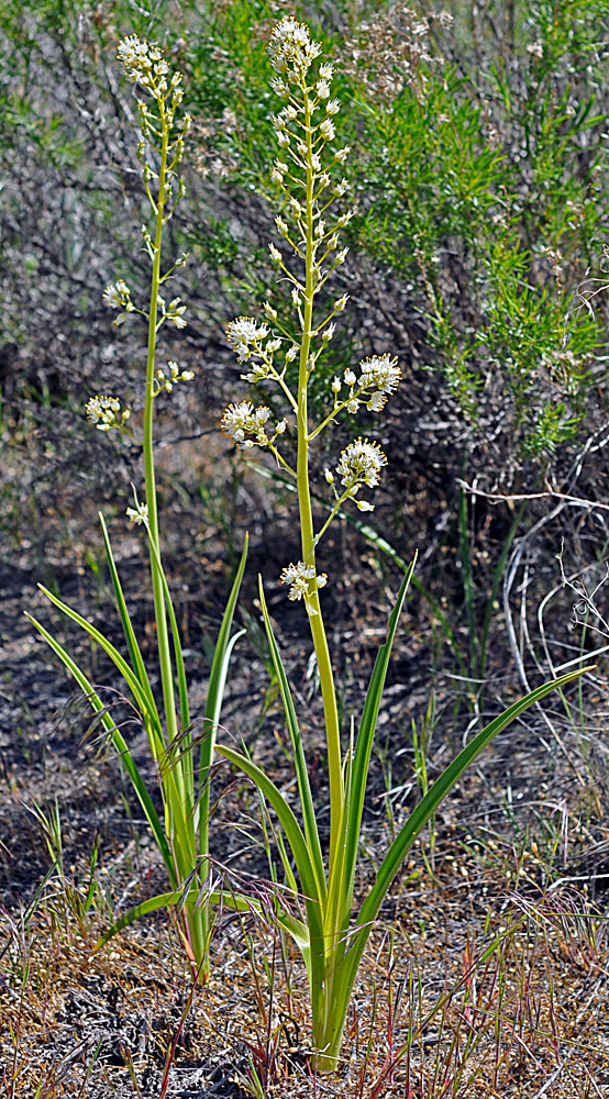
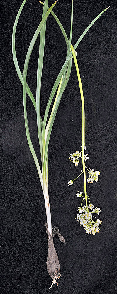
| Toxicoscordion paniculatum (Nutt.) Rydberg | panicled death camas - native Melanthiaceae |
Click on an image for a larger version. All images © Gerald D. Carr unless otherwise noted.
[The name used in the heading above is supported by recent systematic evidence; the name appearing on the images below is a synonym that may be found in many existing references.]
| N side of Squaw Butte Rd., 6.6 mi. SSE of Hwy 20, 4560 ft. elev., N43.46556, W119.68516, Harney Co., OR, 6/3/2013 | Hwy 20, 0.5 mi SW of Pine Cr. Rd., Harney Co., OR, 5/29/2006 | Hwy 20, 0.5 mi SW of Pine Cr. Rd., Harney Co., OR, 5/29/2006 | Hwy 20, 0.5 mi SW of Pine Cr. Rd., Harney Co., OR, 5/29/2006 | Hwy 20, 0.5 mi SW of Pine Cr. Rd., Harney Co., OR, 5/29/2006 |
|
|
|
|
|
| Hwy 20, 0.5 mi SW of Pine Cr. Rd., Harney Co., OR, 5/29/2006 | Steens Mt. Loop Rd., 14.4 mi. ESE of Frenchglen, 7153 ft. elev., N42.74789, W118.67812, Harney Co., OR, 7/18/2012 | Steens Mt. Loop Rd., 14.4 mi. ESE of Frenchglen, 7153 ft. elev., N42.74789, W118.67812, Harney Co., OR, 7/18/2012 | Dalles Mt. Rd., 0.15 mi. N of SR14, N45.65147, W121.13531, Klickitat Co., WASHINGTON, 3/29/2007 | Just N of Park along the path to Steamboat Rock, SW of Grand Coulee, N47.86000, W119.12608, Grant Co., WASHINGTON, 5/10/2011, © Robert L. Carr |
 |
 |
 |
 |
 |
| 0.5 mi. up Northrup Canyon Rd. from Hwy 155, S of Grand Coulee, N47.86554, W119.08389, Grant Co., WASHINGTON, 4/24/2010, © Robert L. Carr | 0.5 mi. up Northrup Canyon Rd. from Hwy 155, S of Grand Coulee, N47.86554, W119.08389, Grant Co., WASHINGTON, 4/24/2010, © Robert L. Carr | ||
 |
 |