
| Oregon Flora Image Project | |
| Torreyochloa pallida (J. Presl) G.L. Church var. pauciflora (J. Presl) J.I. Davis | weak mannagrass - Native Poaceae |
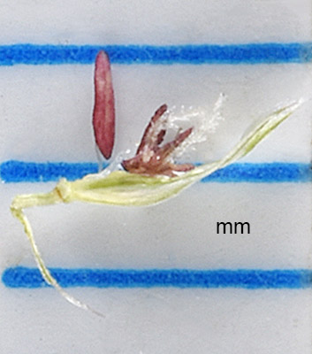
Click on an image for a larger version. All images © Gerald D. Carr unless otherwise noted.
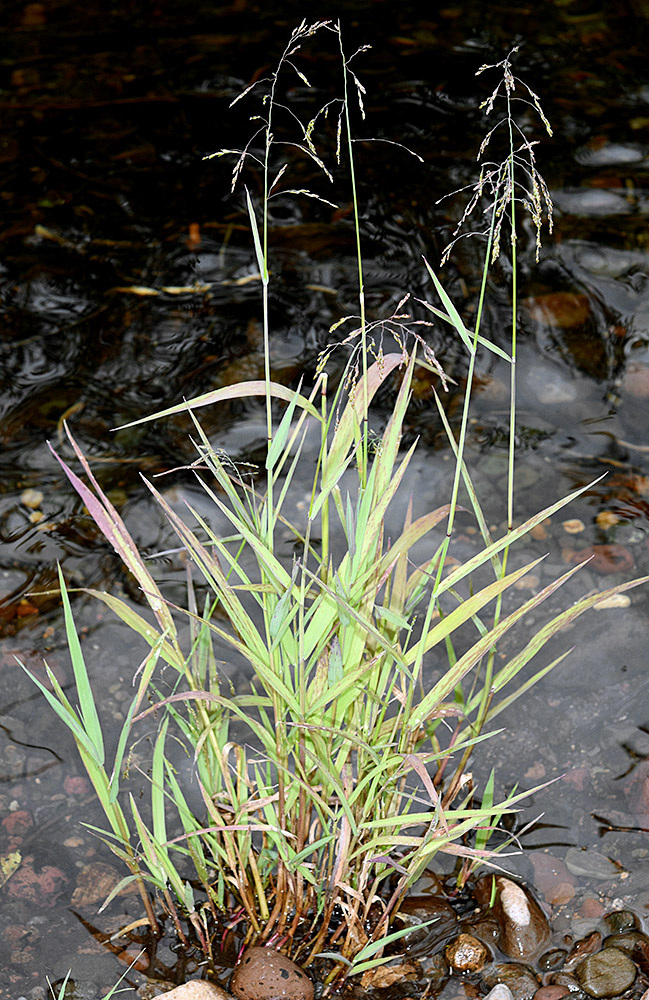
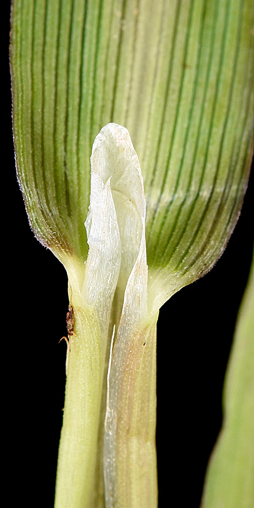
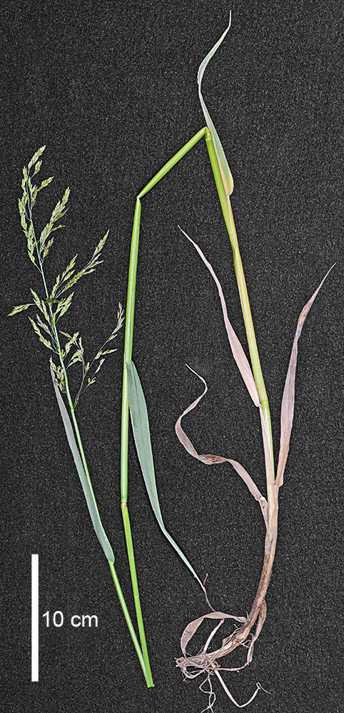
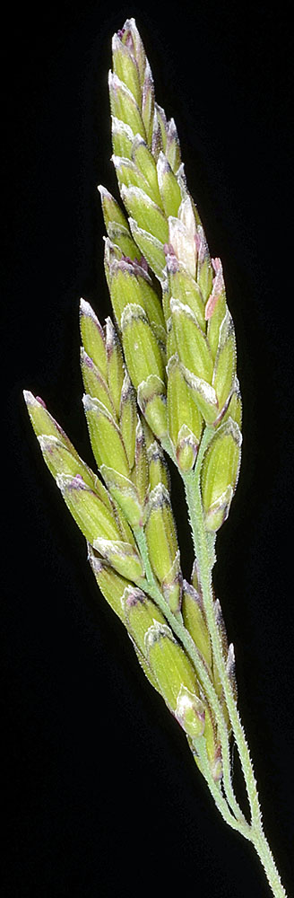
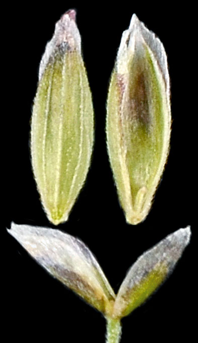
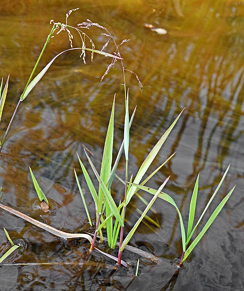
| NFD Rd. 560 at S Fork Park Creek Bridge, ca. 1.7 mi. W of jct. with NFD Rd. 2067, ca. 3.6 mi. WSW of Hwy. 22, NW of Santiam Junction, 3660 ft. elev., N44.47821, W122.05113, Linn Co., OR, 8/9/2016 | NFD Rd. 560 at S Fork Park Creek Bridge, ca. 1.7 mi. W of jct. with NFD Rd. 2067, ca. 3.6 mi. WSW of Hwy. 22, NW of Santiam Junction, 3660 ft. elev., N44.47821, W122.05113, Linn Co., OR, 8/9/2016 | NFD Rd. 560 at S Fork Park Creek Bridge, ca. 1.7 mi. W of jct. with NFD Rd. 2067, ca. 3.6 mi. WSW of Hwy. 22, NW of Santiam Junction, 3660 ft. elev., N44.47821, W122.05113, Linn Co., OR, 8/9/2016 | wet ditch by jct. of 3rd St. and old Hwy 30, 3688 ft. elev., N45.51337, W118.42354, Meacham, Umatilla Co., OR, 6/20/2015 [R. Halse 9490] |
|
|
|
|
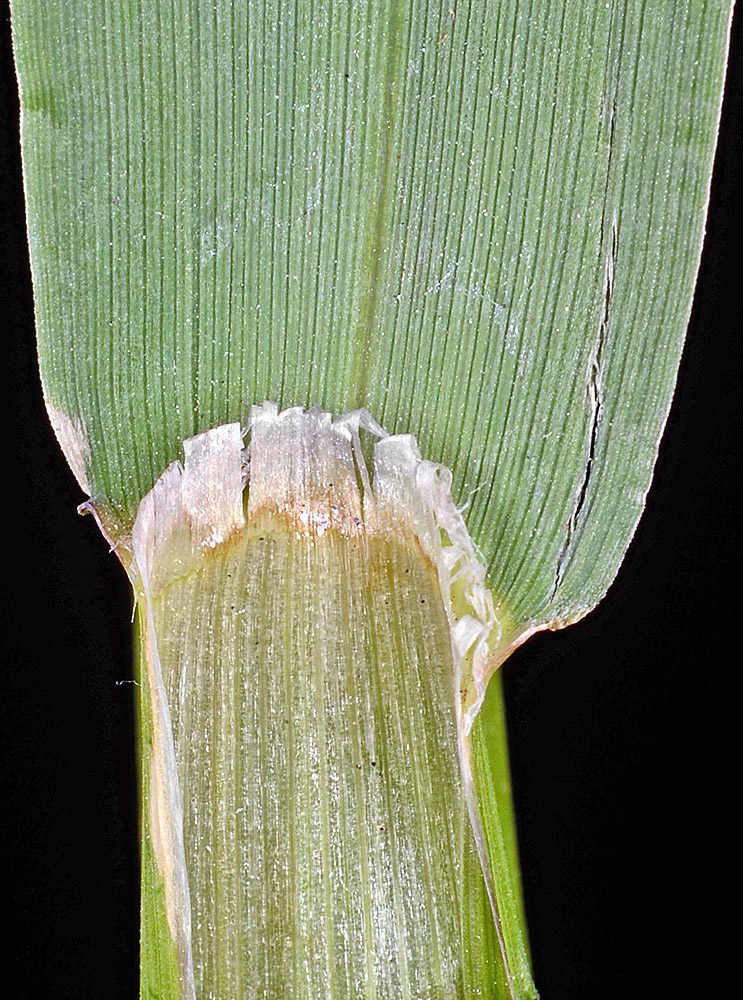
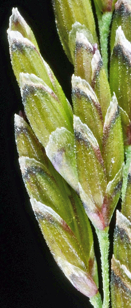
| NFD Rd. 560 at S Fork Park Creek Bridge, ca. 1.7 mi. W of jct. with NFD Rd. 2067, ca. 3.6 mi. WSW of Hwy. 22, NW of Santiam Junction, 3660 ft. elev., N44.47821, W122.05113, Linn Co., OR, 8/9/2016 | wet ditch by jct. of 3rd St. and old Hwy 30, 3688 ft. elev., N45.51337, W118.42354, Meacham, Umatilla Co., OR, 6/20/2015 [R. Halse 9490] | wet ditch by jct. of 3rd St. and old Hwy 30, 3688 ft. elev., N45.51337, W118.42354, Meacham, Umatilla Co., OR, 6/20/2015 [R. Halse 9490] | wet ditch by jct. of 3rd St. and old Hwy 30, 3688 ft. elev., N45.51337, W118.42354, Meacham, Umatilla Co., OR, 6/20/2015 [R. Halse 9490] |
 |
 |
 |
 |
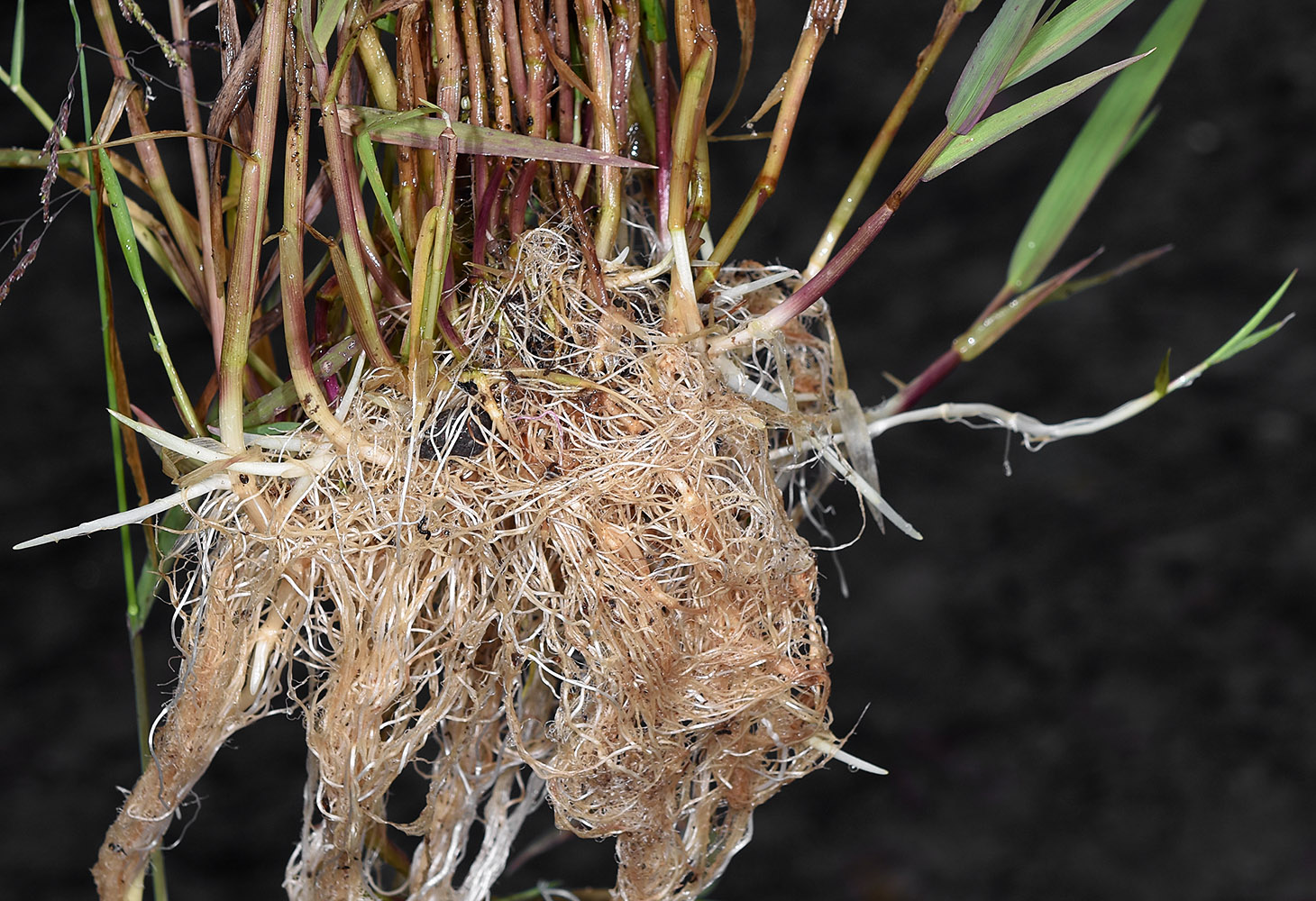
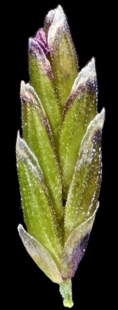
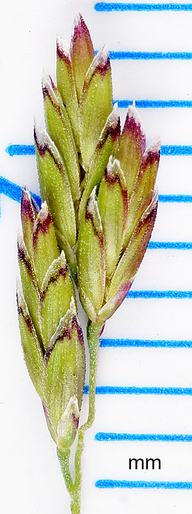
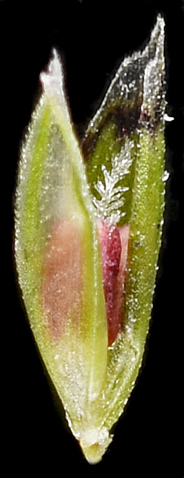
| wet ditch by jct. of 3rd St. and old Hwy 30, 3688 ft. elev., N45.51337, W118.42354, Meacham, Umatilla Co., OR, 6/20/2015 [R. Halse 9490] | wet ditch by jct. of 3rd St. and old Hwy 30, 3688 ft. elev., N45.51337, W118.42354, Meacham, Umatilla Co., OR, 6/20/2015 [R. Halse 9490] | wet ditch by jct. of 3rd St. and old Hwy 30, 3688 ft. elev., N45.51337, W118.42354, Meacham, Umatilla Co., OR, 6/20/2015 [R. Halse 9490] |
 |
 |
 |
| in Lost Creek, near jct. of Hwy 20 and CR 2630, 3.5 air mi. WSW of Tiger, 3209 ft. elev., N48.66611, W117.47579, Pend Oreille Co., WASHINGTON, 9/23/2016, © Robert L. Carr | in Lost Creek, near jct. of Hwy 20 and CR 2630, 3.5 air mi. WSW of Tiger, 3209 ft. elev., N48.66611, W117.47579, Pend Oreille Co., WASHINGTON, 9/23/2016, © Robert L. Carr | in Lost Creek, near jct. of Hwy 20 and CR 2630, 3.5 air mi. WSW of Tiger, 3209 ft. elev., N48.66611, W117.47579, Pend Oreille Co., WASHINGTON, 9/23/2016, © Robert L. Carr | in Lost Creek, near jct. of Hwy 20 and CR 2630, 3.5 air mi. WSW of Tiger, 3209 ft. elev., N48.66611, W117.47579, Pend Oreille Co., WASHINGTON, 9/23/2016, © Robert L. Carr |
 |
 |
 |
 |