

| Oregon Flora Image Project | |
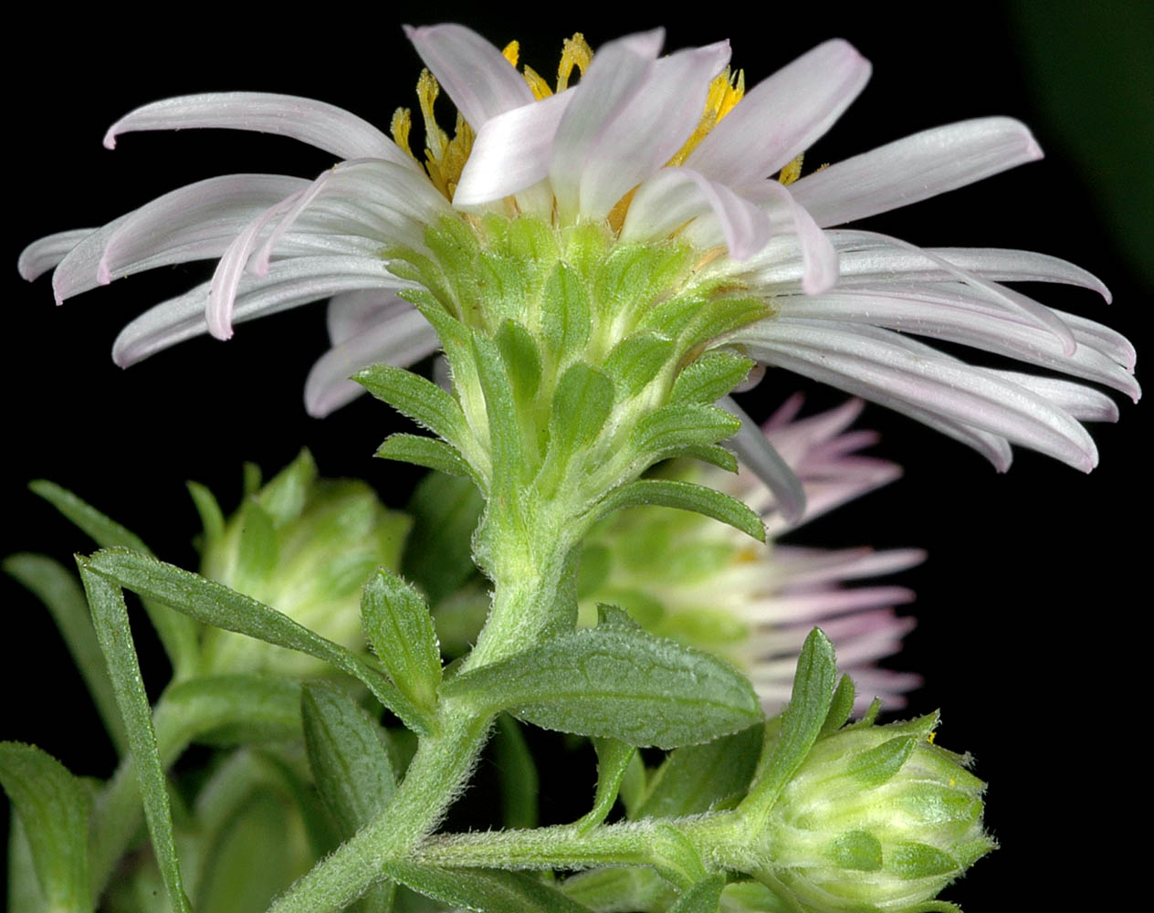
| Symphyotrichum bracteolatum (Nutt.) G. L. Nesom | Eaton's aster - native Asteraceae: Astereae |
Click on an image for a larger version. All images © Gerald D. Carr unless otherwise noted.
| West bank near mouth of Deschutes River, ca. 0.4 mi. SE of SR 206, Wasco, Co., OR, 9/21/2008 | West bank near mouth of Deschutes River, ca. 0.4 mi. SE of SR 206, Wasco, Co., OR, 9/21/2008 | ||
|
|
| West bank near mouth of Deschutes River, ca. 0.4 mi. SE of SR 206, Wasco, Co., OR, 9/21/2008 | West bank near mouth of Deschutes River, ca. 0.4 mi. SE of SR 206, Wasco, Co., OR, 9/21/2008 | West bank near mouth of Deschutes River, ca. 0.4 mi. SE of SR 206, Wasco, Co., OR, 9/21/2008 |
 |
 |
 |
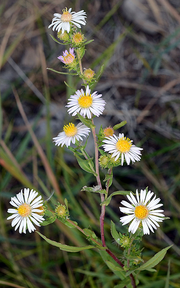
| The Dalles Riverside Park, Wasco Co., OR, 9/3/2008 | The Dalles Riverside Park, Wasco Co., OR, 9/3/2008 | ||
 |
 |
| The Dalles Riverside Park, Wasco Co., OR, 9/3/2008 | Horsethief Butte trailhead, SR 14 MP86.3, Klickitat Co., WA, 9/3/2008 | Horsethief Butte trailhead, SR 14 MP86.3, Klickitat Co., WA, 9/3/2008 |
 |
 |
 |
| Horsethief Butte trailhead, SR 14 MP86.3, Klickitat Co., WA, 9/3/2008 | Horsethief Butte trailhead, SR 14 MP86.3, Klickitat Co., WA, 9/3/2008 | ||
 |
 |
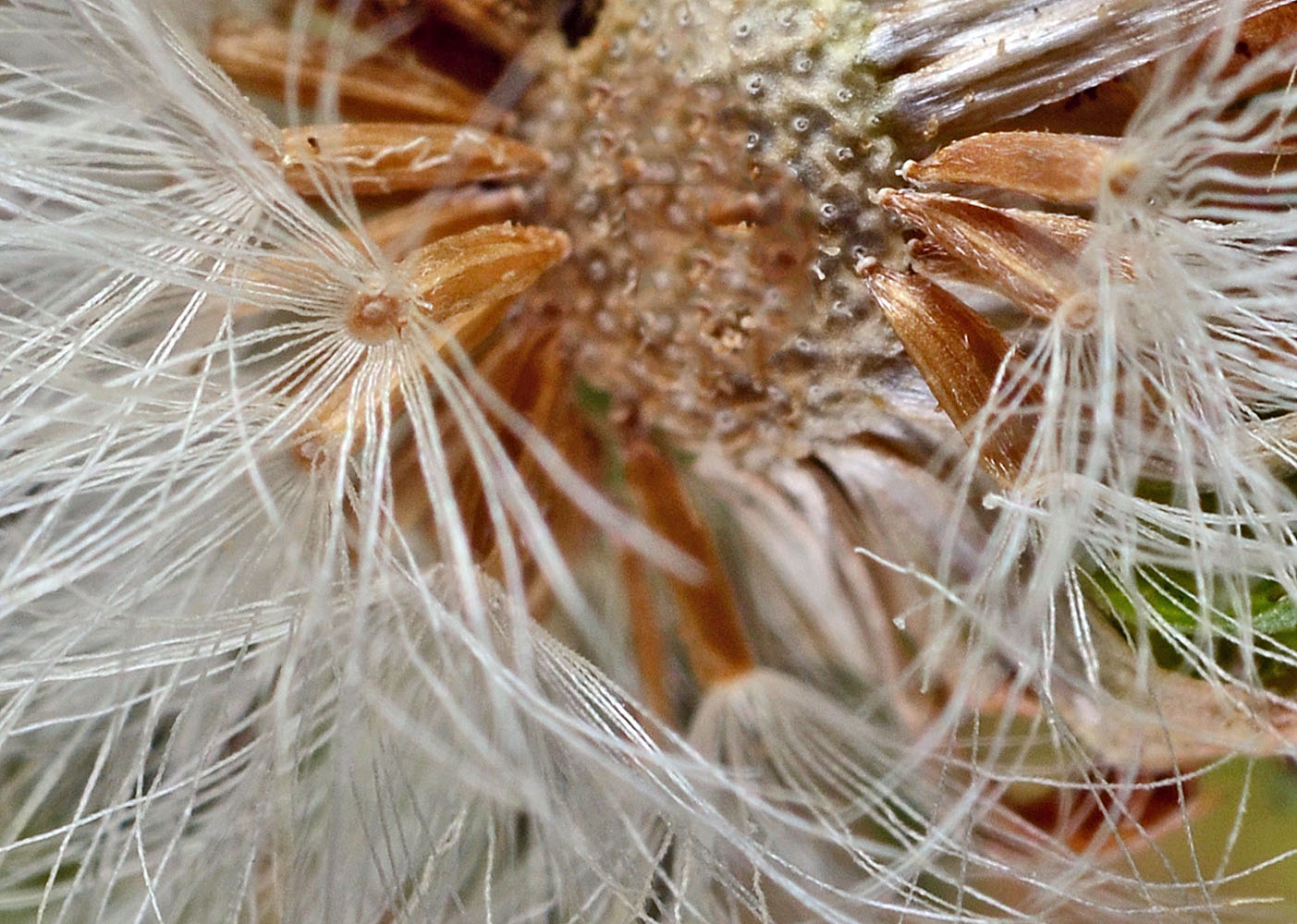
| Banks of irrigation canal on S side of SR 126, 0.8 mi. W of Powell Butte, 10.5 mi. WSW of jct. with Hwy 26 at Prineville, 3107 ft. elev., N44.24759, W121.03359, Crook Co., OR, 8/26/2015 | Banks of irrigation canal on S side of SR 126, 0.8 mi. W of Powell Butte, 10.5 mi. WSW of jct. with Hwy 26 at Prineville, 3107 ft. elev., N44.24759, W121.03359, Crook Co., OR, 8/26/2015 | Banks of irrigation canal on S side of SR 126, 0.8 mi. W of Powell Butte, 10.5 mi. WSW of jct. with Hwy 26 at Prineville, 3107 ft. elev., N44.24759, W121.03359, Crook Co., OR, 8/26/2015 | Banks of irrigation canal on S side of SR 126, 0.8 mi. W of Powell Butte, 10.5 mi. WSW of jct. with Hwy 26 at Prineville, 3107 ft. elev., N44.24759, W121.03359, Crook Co., OR, 8/26/2015 |
 |
 |
 |
 |
| Banks of irrigation canal on S side of SR 126, 0.8 mi. W of Powell Butte, 10.5 mi. WSW of jct. with Hwy 26 at Prineville, 3107 ft. elev., N44.24759, W121.03359, Crook Co., OR, 8/26/2015 | Banks of irrigation canal on S side of SR 126, 0.8 mi. W of Powell Butte, 10.5 mi. WSW of jct. with Hwy 26 at Prineville, 3107 ft. elev., N44.24759, W121.03359, Crook Co., OR, 8/26/2015 | ||
 |
 |