


| Oregon Flora Image Project | |
| Senecio hydrophiloides Rydb. | stout meadow groundsel - native Asteraceae: Senecioneae |
Click on an image for a larger version. All images © Gerald D. Carr unless otherwise noted.
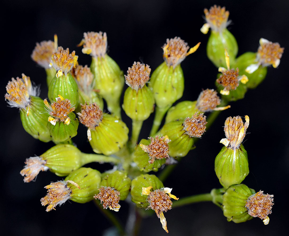
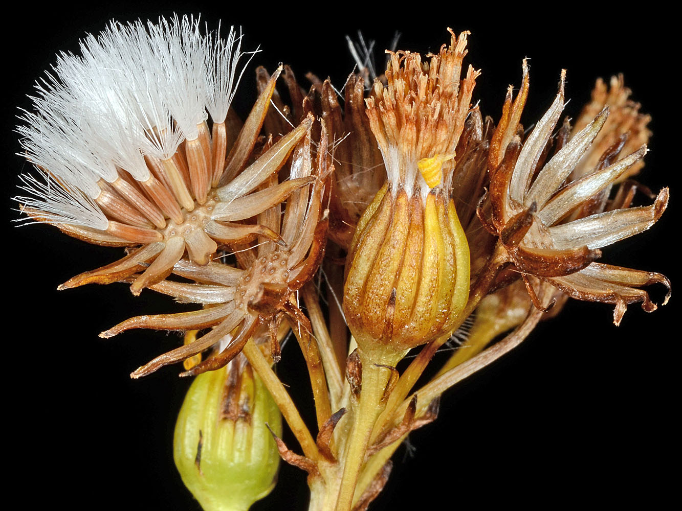
| Badger Creek Rd. spur, 0.5 mi. S of jct. with Indian Creek Rd. (NFD Rd. 22), NW corner of Big Summit Prairie, E of Prineville, 4685 ft. elev., N44.40144, W120.26024, Crook Co., OR, 7/12/2013 | Badger Creek Rd. spur, 0.5 mi. S of jct. with Indian Creek Rd. (NFD Rd. 22), NW corner of Big Summit Prairie, E of Prineville, 4685 ft. elev., N44.40144, W120.26024, Crook Co., OR, 7/12/2013 | Badger Creek Rd. spur, 0.5 mi. S of jct. with Indian Creek Rd. (NFD Rd. 22), NW corner of Big Summit Prairie, E of Prineville, 4685 ft. elev., N44.40144, W120.26024, Crook Co., OR, 7/12/2013 | Badger Creek Rd. spur, 0.5 mi. S of jct. with Indian Creek Rd. (NFD Rd. 22), NW corner of Big Summit Prairie, E of Prineville, 4685 ft. elev., N44.40144, W120.26024, Crook Co., OR, 7/12/2013 |
|
|
|
|
| Badger Creek Rd. spur, 0.5 mi. S of jct. with Indian Creek Rd. (NFD Rd. 22), NW corner of Big Summit Prairie, E of Prineville, 4685 ft. elev., N44.40144, W120.26024, Crook Co., OR, 7/12/2013 | Badger Creek Rd. spur, 0.5 mi. S of jct. with Indian Creek Rd. (NFD Rd. 22), NW corner of Big Summit Prairie, E of Prineville, 4685 ft. elev., N44.40144, W120.26024, Crook Co., OR, 7/12/2013 | ||
 |
 |
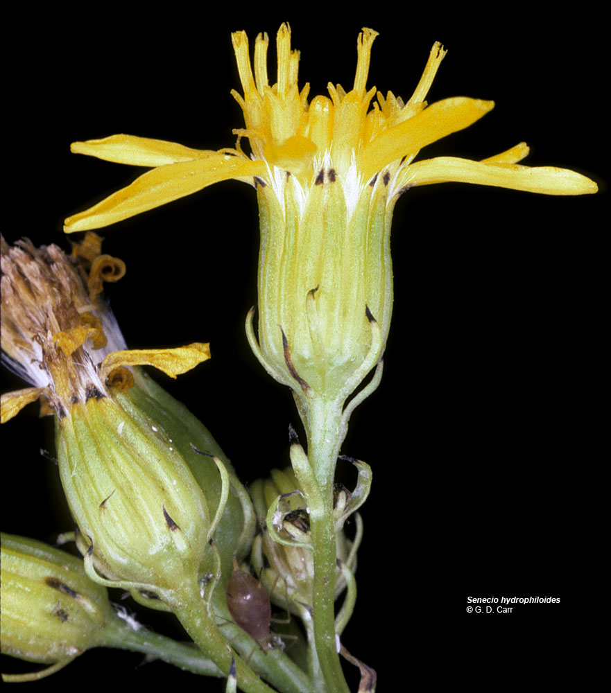
| Badger Creek Rd. spur, 0.5 mi. S of jct. with Indian Creek Rd. (NFD Rd. 22), NW corner of Big Summit Prairie, E of Prineville, 4685 ft. elev., N44.40144, W120.26024, Crook Co., OR, 7/12/2013 | vic. Cheney, Spokane Co., WASHINGTON, 8/15/1986 | ||
 |
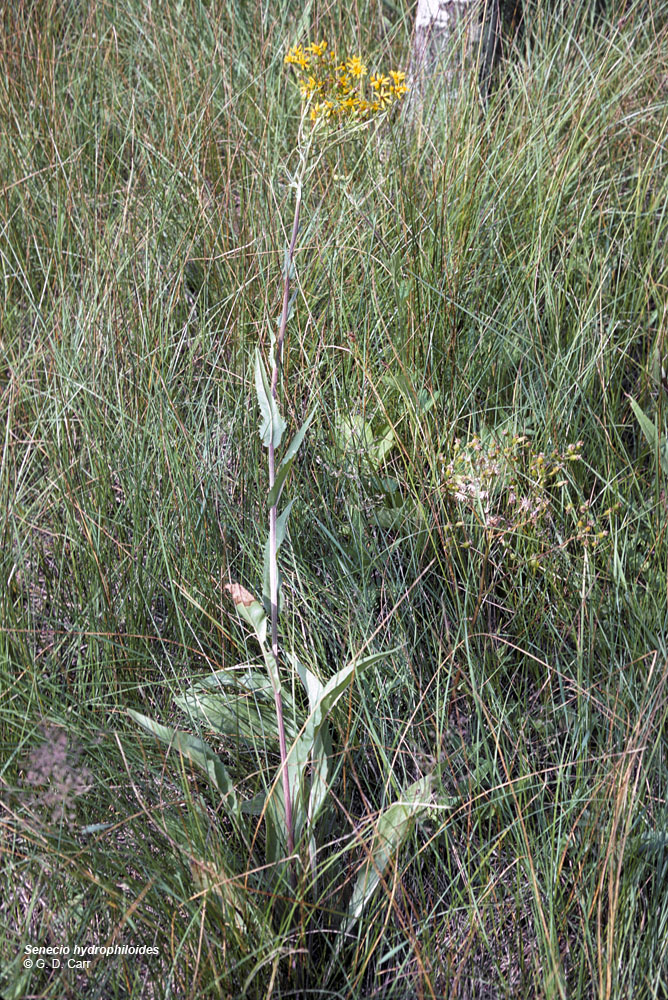 |
| vic. Cheney, Spokane Co., WASHINGTON, 8/15/1986 | vic. Cheney, Spokane Co., WASHINGTON, 8/15/1986 | vic. Cheney, Spokane Co., WASHINGTON, 8/15/1986 |
 |
 |
 |