

| Oregon Flora Image Project | |
| Securigera varia (L.) Lassen | crown vetch - exotic, naturalized Fabaceae: Faboideae |
Click on an image for a larger version. All images © Gerald D. Carr unless otherwise noted.
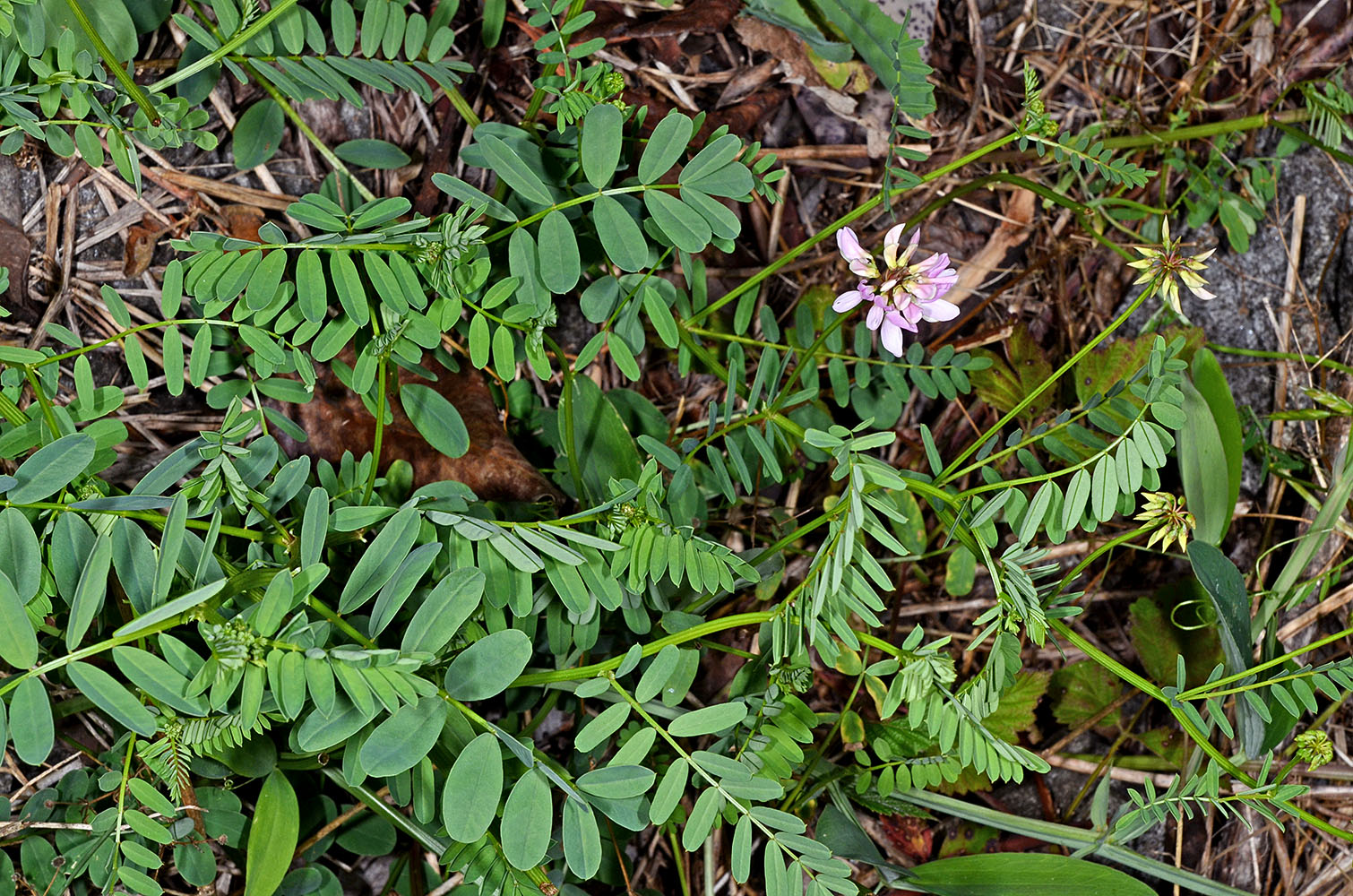
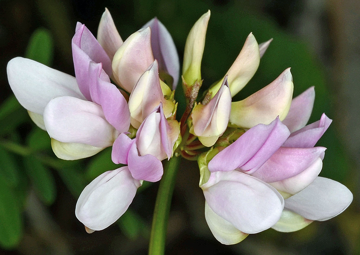
| Sulphur Springs Rd., 80 ft. E of jct. with Wildview Place, ca. 2.1 mi. W of Lewisburg, 615 ft. elev., N44.63276, W123.28125, Benton Co., OR, 6/14/2013 | Sulphur Springs Rd., 80 ft. E of jct. with Wildview Place, ca. 2.1 mi. W of Lewisburg, 615 ft. elev., N44.63276, W123.28125, Benton Co., OR, 5/28/2013 | Sulphur Springs Rd., 80 ft. E of jct. with Wildview Place, ca. 2.1 mi. W of Lewisburg, 615 ft. elev., N44.63276, W123.28125, Benton Co., OR, 5/28/2013 |
|
|
|
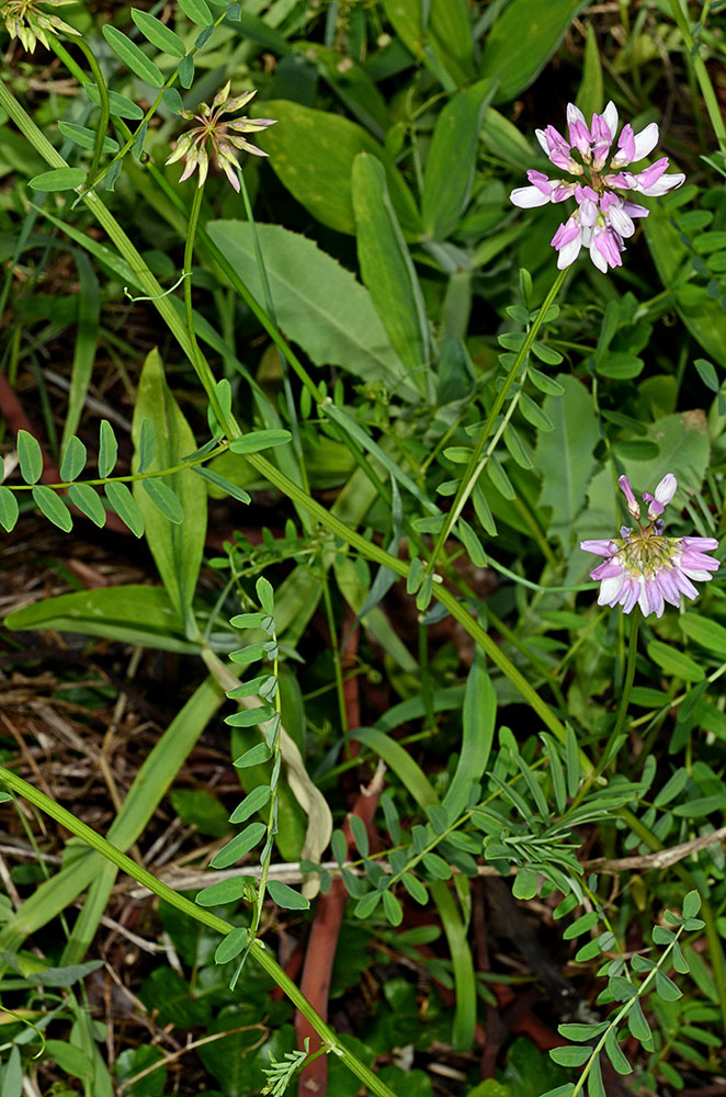
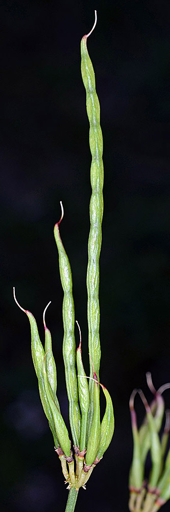
| Sulphur Springs Rd., 80 ft. E of jct. with Wildview Place, ca. 2.1 mi. W of Lewisburg, 615 ft. elev., N44.63276, W123.28125, Benton Co., OR, 5/28/2013 | Sulphur Springs Rd., 80 ft. E of jct. with Wildview Place, ca. 2.1 mi. W of Lewisburg, 615 ft. elev., N44.63276, W123.28125, Benton Co., OR, 6/14/2013 | Sulphur Springs Rd., 80 ft. E of jct. with Wildview Place, ca. 2.1 mi. W of Lewisburg, 615 ft. elev., N44.63276, W123.28125, Benton Co., OR, 6/14/2013 | Sulphur Springs Rd., 80 ft. E of jct. with Wildview Place, ca. 2.1 mi. W of Lewisburg, 615 ft. elev., N44.63276, W123.28125, Benton Co., OR, 6/14/2013 |
 |
 |
 |
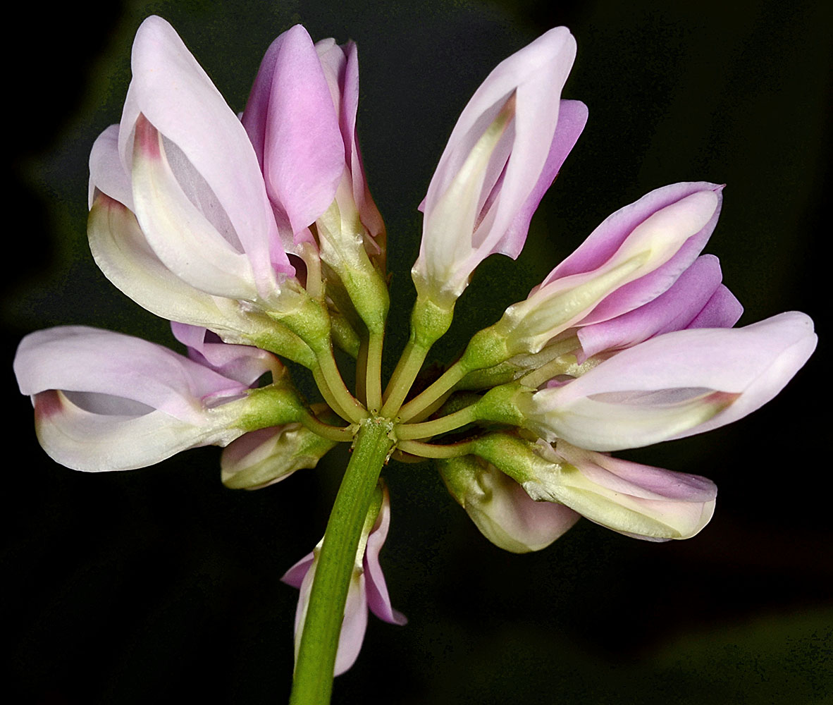 |
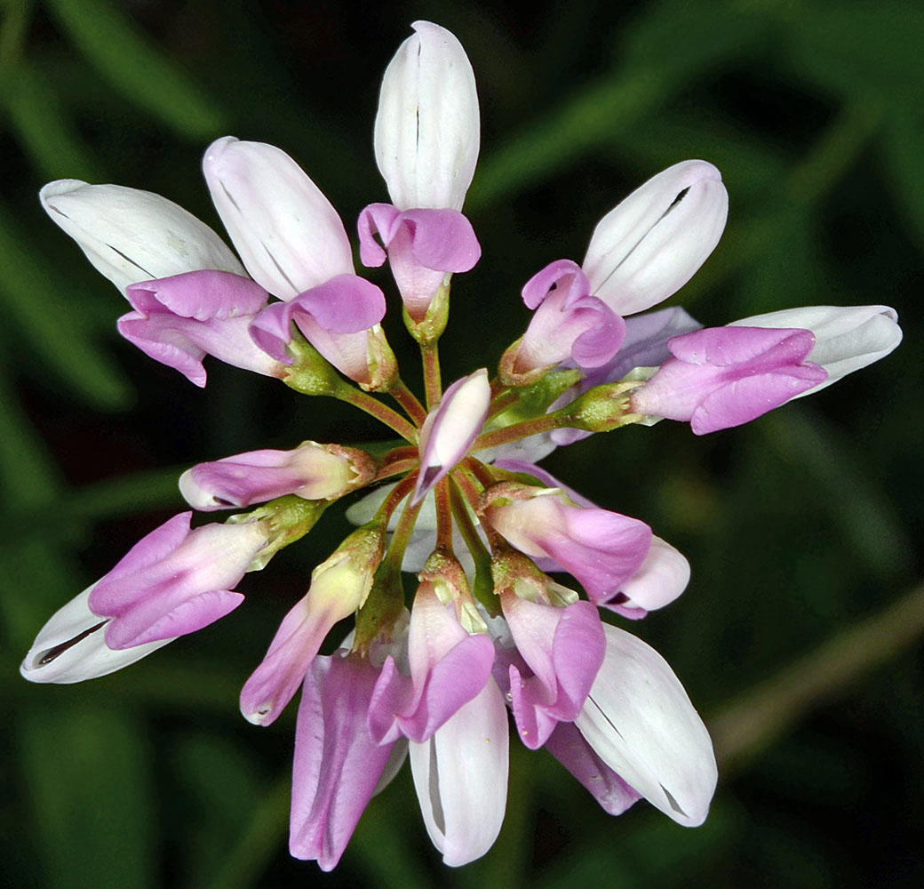
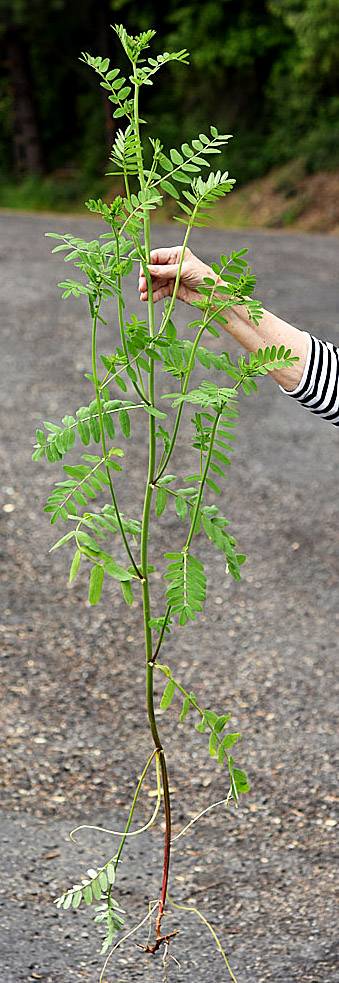
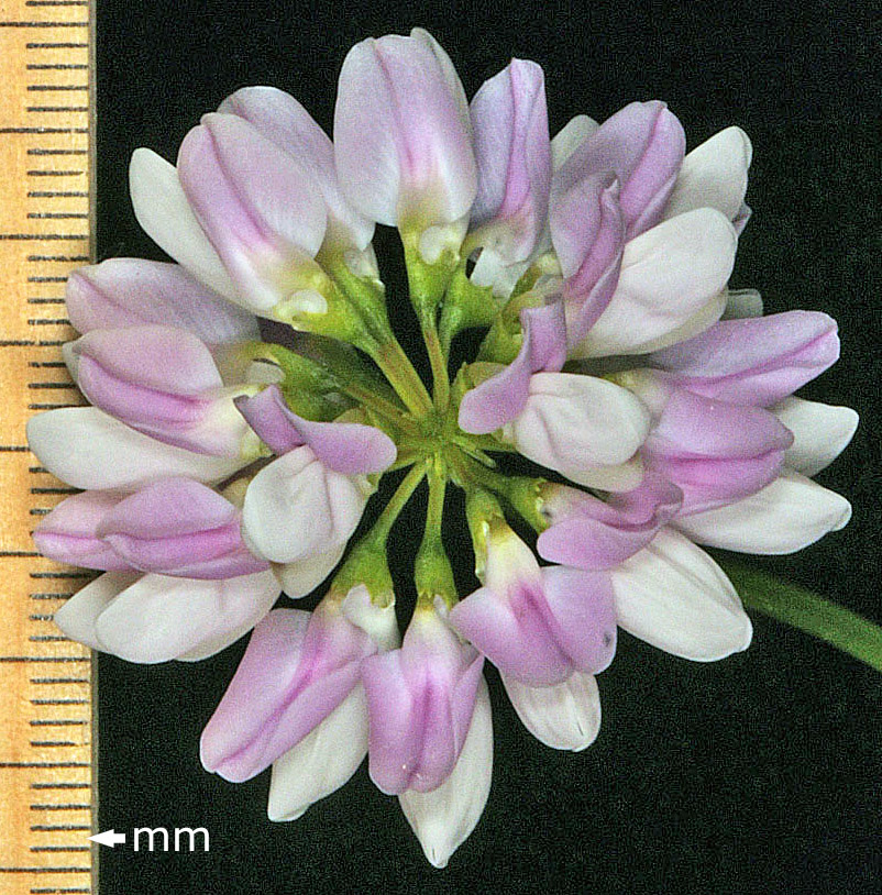
| Sulphur Springs Rd., 80 ft. E of jct. with Wildview Place, ca. 2.1 mi. W of Lewisburg, 615 ft. elev., N44.63276, W123.28125, Benton Co., OR, 6/14/2013 | Sulphur Springs Rd., 80 ft. E of jct. with Wildview Place, ca. 2.1 mi. W of Lewisburg, 615 ft. elev., N44.63276, W123.28125, Benton Co., OR, 6/14/2013 | ||
 |
 |
| E Juda Jim St., 0.1 mi. E of N 1st Ave., 4250 ft. elev., N42.57795, W121.86008, Klamath Co., OR, 7/26/2015 | E Juda Jim St., 0.1 mi. E of N 1st Ave., 4250 ft. elev., N42.57795, W121.86008, Klamath Co., OR, 7/26/2015 | Along Hwy 2, 3.1 mi. W of Laclede, 4.7 air mi. SE of Priest River, N48.15472, W116.81615, Bonner Co., IDAHO, 6/7/2020, © Robert L. Carr | Along Hwy 2, 3.1 mi. W of Laclede, 4.7 air mi. SE of Priest River, N48.15472, W116.81615, Bonner Co., IDAHO, 6/7/2020, © Robert L. Carr |
 |
 |
 |
 |
| Along Hwy 2, 3.1 mi. W of Laclede, 4.7 air mi. SE of Priest River, N48.15472, W116.81615, Bonner Co., IDAHO, 6/7/2020, © Robert L. Carr | ||
 |