


| Oregon Flora Image Project | |
| Salix lasiandra Benth. | [see var.] - native Salicaceae |
Click on an image for a larger version. All images © Gerald D. Carr unless otherwise noted.
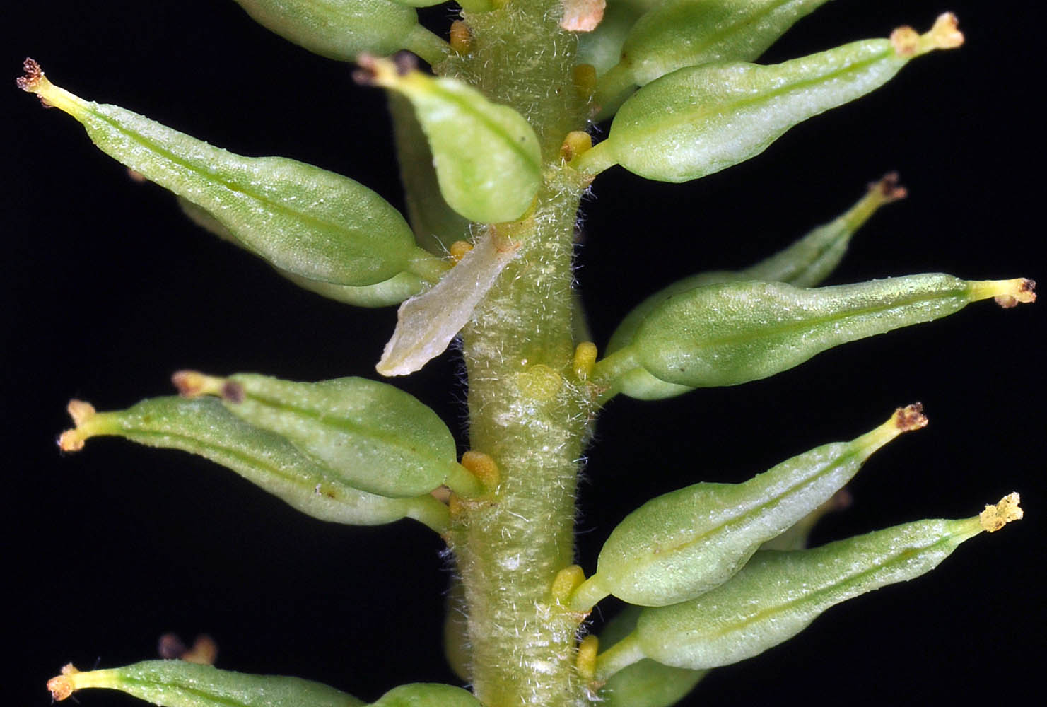
| var. caudata (Nutt.) Sudw. | tail leaf willow |
| S Griffith (S Watt) Rd., 0.5 mi. S of jct. with Hwy 904, ca. 4.5 air mi. WSW of Cheney, 2236 ft. elev., N47.45631, W117.67221, Spokane Co., WASHINGTON, 4/22/2015, © Robert L. Carr | S Griffith (S Watt) Rd., 0.5 mi. S of jct. with Hwy 904, ca. 4.5 air mi. WSW of Cheney, 2236 ft. elev., N47.45631, W117.67221, Spokane Co., WASHINGTON, 4/22/2015, © Robert L. Carr | S Griffith (S Watt) Rd., 0.5 mi. S of jct. with Hwy 904, ca. 4.5 air mi. WSW of Cheney, 2236 ft. elev., N47.45631, W117.67221, Spokane Co., WASHINGTON, 4/22/2015, © Robert L. Carr | S Griffith (S Watt) Rd., 0.5 mi. S of jct. with Hwy 904, ca. 4.5 air mi. WSW of Cheney, 2236 ft. elev., N47.45631, W117.67221, Spokane Co., WASHINGTON, 4/22/2015, © Robert L. Carr |
|
|
|
|
| S Griffith (S Watt) Rd., 0.5 mi. S of jct. with Hwy 904, ca. 4.5 air mi. WSW of Cheney, 2236 ft. elev., N47.45631, W117.67221, Spokane Co., WASHINGTON, 4/22/2015, © Robert L. Carr | S Griffith (S Watt) Rd., 0.5 mi. S of jct. with Hwy 904, ca. 4.5 air mi. WSW of Cheney, 2236 ft. elev., N47.45631, W117.67221, Spokane Co., WASHINGTON, 4/22/2015, © Robert L. Carr | S Griffith (S Watt) Rd., 0.5 mi. S of jct. with Hwy 904, ca. 4.5 air mi. WSW of Cheney, 2236 ft. elev., N47.45631, W117.67221, Spokane Co., WASHINGTON, 4/22/2015, © Robert L. Carr |
 |
 |
 |
| var. lasiandra | Pacific willow |
| Alsea Hwy (SR-34), 5.6 mi. SW of jct. with Hwy 20, SW of Philomath, 445 ft. elev., N44.48202, W123.45775, Benton Co., OR, 4/28/2010 | Jackson-Frazier Wetlands at N end of NE Lancaster St., , creek crossing between parking area and kiosk, N44.60423, W123.23931, Corvallis, Benton Co., OR, 4/12/2010 | ||
 |
 |
| Jackson-Frazier Wetlands at N end of NE Lancaster St., , creek crossing between parking area and kiosk, N44.60423, W123.23931, Corvallis, Benton Co., OR, 4/12/2010 | Jackson-Frazier Wetlands at N end of NE Lancaster St., , creek crossing between parking area and kiosk, N44.60423, W123.23931, Corvallis, Benton Co., OR, 4/12/2010 | Sunset Park, SW 45th. St. at SW Country Club Dr., Corvallis, Benton Co., OR, 4/15/2010 |
 |
 |
 |
| Alsea Hwy (SR-34), 5.6 mi. SW of jct. with Hwy 20, SW of Philomath, 445 ft. elev., N44.48202, W123.45775, Benton Co., OR, 4/28/2010 | Jackson-Frazier Wetlands at N end of NE Lancaster St., , creek crossing between parking area and kiosk, N44.60423, W123.23931, Corvallis, Benton Co., OR, 4/12/2010 | Jackson-Frazier Wetlands at N end of NE Lancaster St., , creek crossing between parking area and kiosk, N44.60423, W123.23931, Corvallis, Benton Co., OR, 4/12/2010 |
 |
 |
 |
| Alsea Hwy (SR-34), 5.6 mi. SW of jct. with Hwy 20, SW of Philomath, 445 ft. elev., N44.48202, W123.45775, Benton Co., OR, 4/28/2010 | ||
 |