
| Oregon Flora Image Project | |
| Rumex crispus L. | curly dock - exotic,
naturalized Polygonaceae |
Click on an image for a larger version. All images © Gerald D. Carr unless otherwise noted.
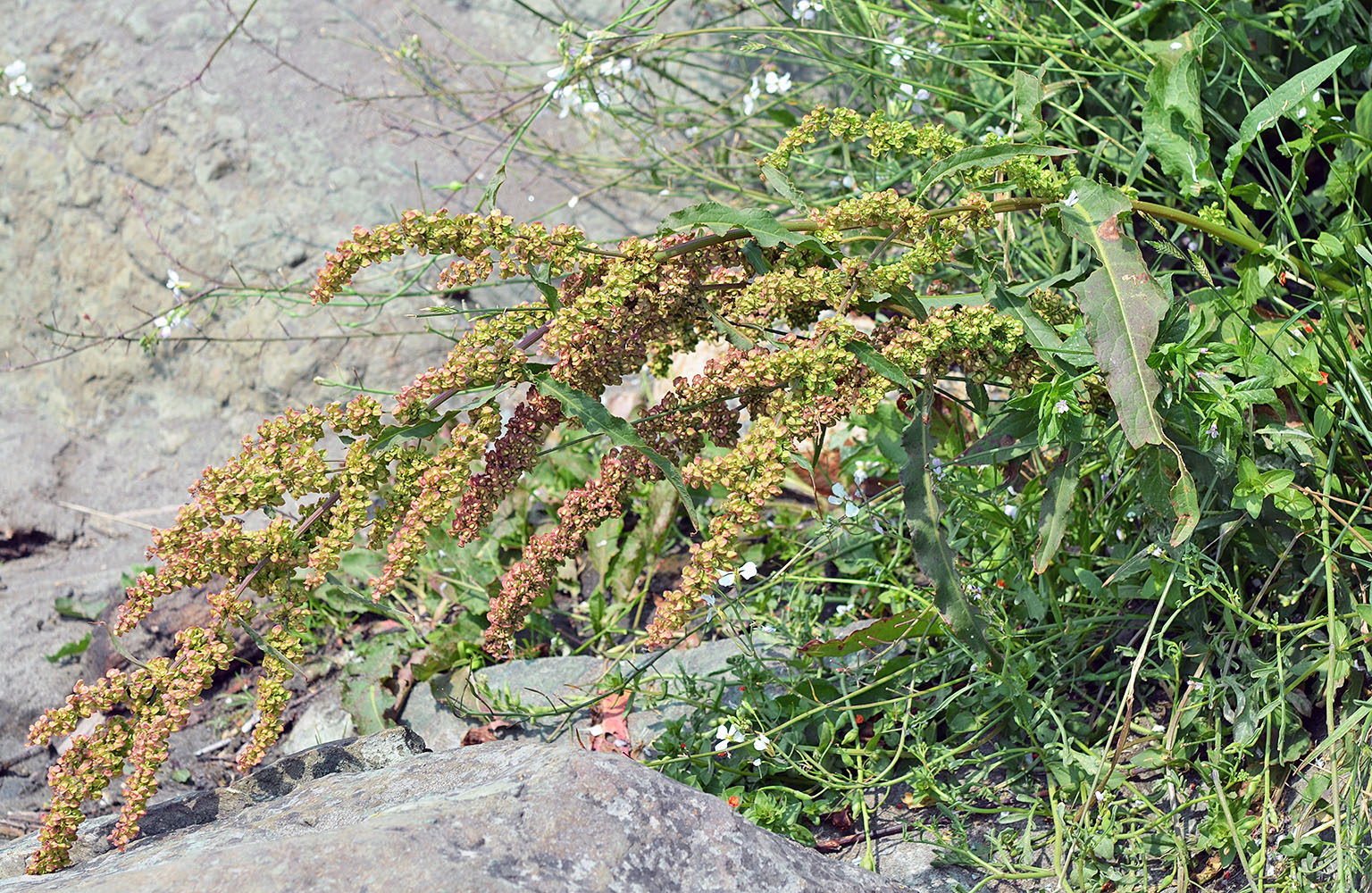
| just S of Lower Parking Lot, Harris Beach State Park, NW of Brookings 12 ft. elev., N42.06794, W124.31457, Curry Co., OR, 7/31/2015 | just S of Lower Parking Lot, Harris Beach State Park, NW of Brookings 12 ft. elev., N42.06794, W124.31457, Curry Co., OR, 7/31/2015 | ||
|
|
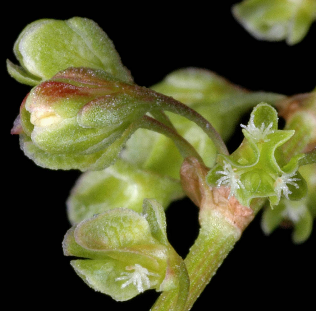
| Bellfountain Rd., ca. 0.9 mi. SW of Gray Creek, N44.39118, W123.36509, ca. 2.1 mi. N of Bellfountain, Benton Co., OR, 6/7/2008 | Bellfountain Rd., ca. 0.9 mi. SW of Gray Creek, N44.39118, W123.36509, ca. 2.1 mi. N of Bellfountain, Benton Co., OR, 6/7/2008 | Bellfountain Rd., ca. 0.9 mi. SW of Gray Creek, N44.39118, W123.36509, ca. 2.1 mi. N of Bellfountain, Benton Co., OR, 6/7/2008 |
 |
 |
 |
| Bellfountain Rd., ca. 0.9 mi. SW of Gray Creek, N44.39118, W123.36509, ca. 2.1 mi. N of Bellfountain, Benton Co., OR, 6/7/2008 | Bellfountain Rd., ca. 0.9 mi. SW of Gray Creek, N44.39118, W123.36509, ca. 2.1 mi. N of Bellfountain, Benton Co., OR, 6/7/2008 | Vernal area in wheat field, W side of Hwy 99, 1.0 mi. SE of Monroe, Benton Co., OR, 6/29/2008 |
 |
 |
 |
| Vernal area in wheat field, W side of Hwy 99, 1.0 mi. SE of Monroe, Benton Co., OR, 6/29/2008 | StoneyBrook Lots, SW Corvallis, Benton Co., OR, 5/30/2006 | StoneyBrook Lots, SW Corvallis, Benton Co., OR, 5/30/2006 |
 |
 |
 |