| Oregon Flora Image Project | |
| Purshia tridentata (Pursh) DC. | bitterbrush - native Rosaceae |
Click on an image for a larger version. All images © Gerald D. Carr unless otherwise noted.
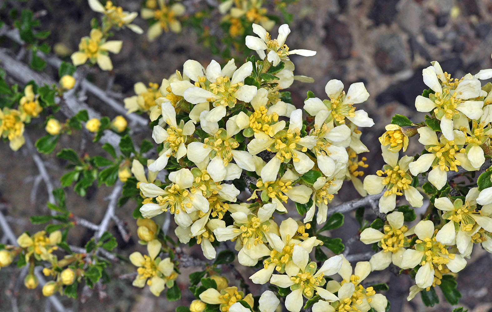
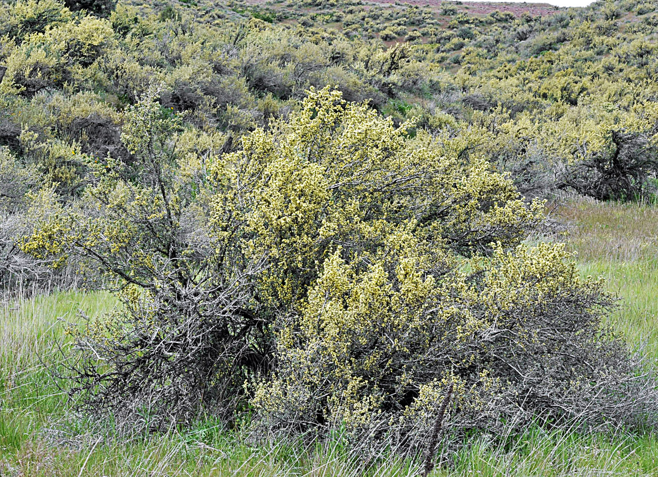
| Hwy 20, 4.2 mi. SW of jct. with Drewsey Rd., ENE of Burns, 3690 ft. elev., N43.75279, W118.42566, Harney Co., OR, 5/26/2010 | Hwy 20, 4.2 mi. SW of jct. with Drewsey Rd., ENE of Burns, 3690 ft. elev., N43.75279, W118.42566, Harney Co., OR, 5/26/2010 | ||
|
|
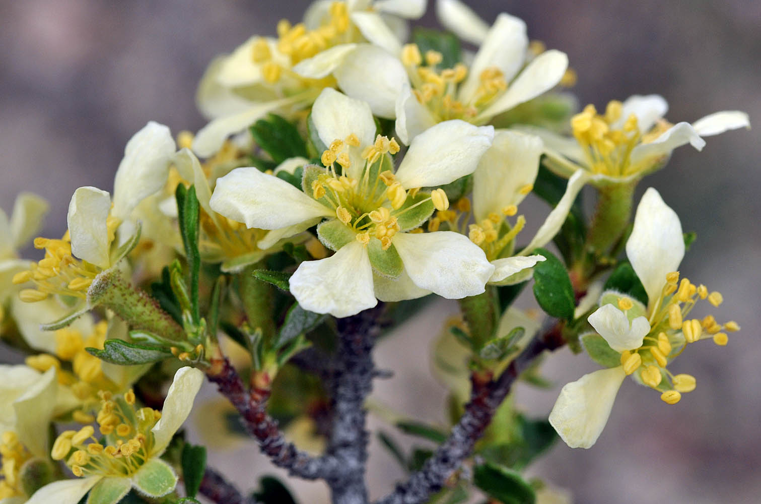
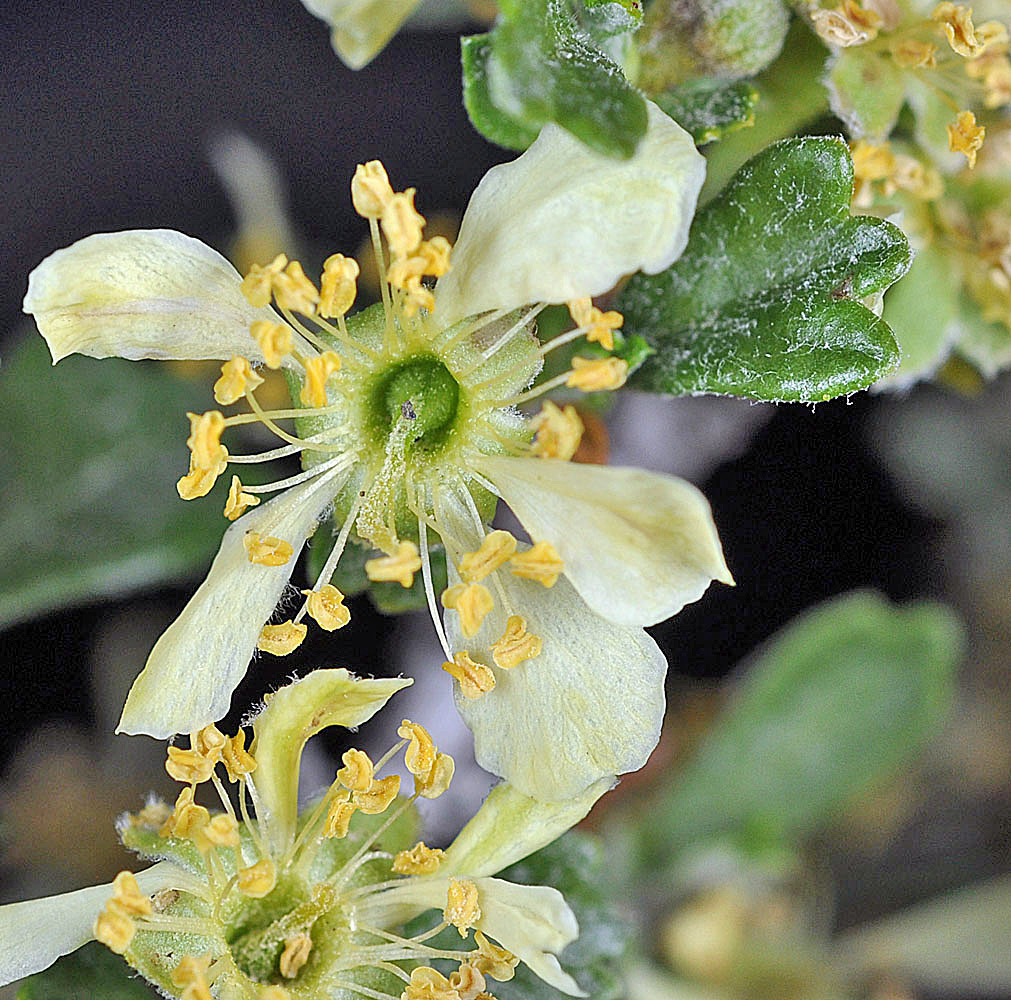
| Avery Rd. extension to Avery Gravel Pit, ca. 0.7 mi SE of jct with SR 14, 45.66214N, 121.03059W, Klickitat Co., WASHINGTON, 4/28/2008 | Avery Rd. extension to Avery Gravel Pit, ca. 0.7 mi SE of jct with SR 14, 45.66214N, 121.03059W, Klickitat Co., WASHINGTON, 4/28/2008 | ||
 |
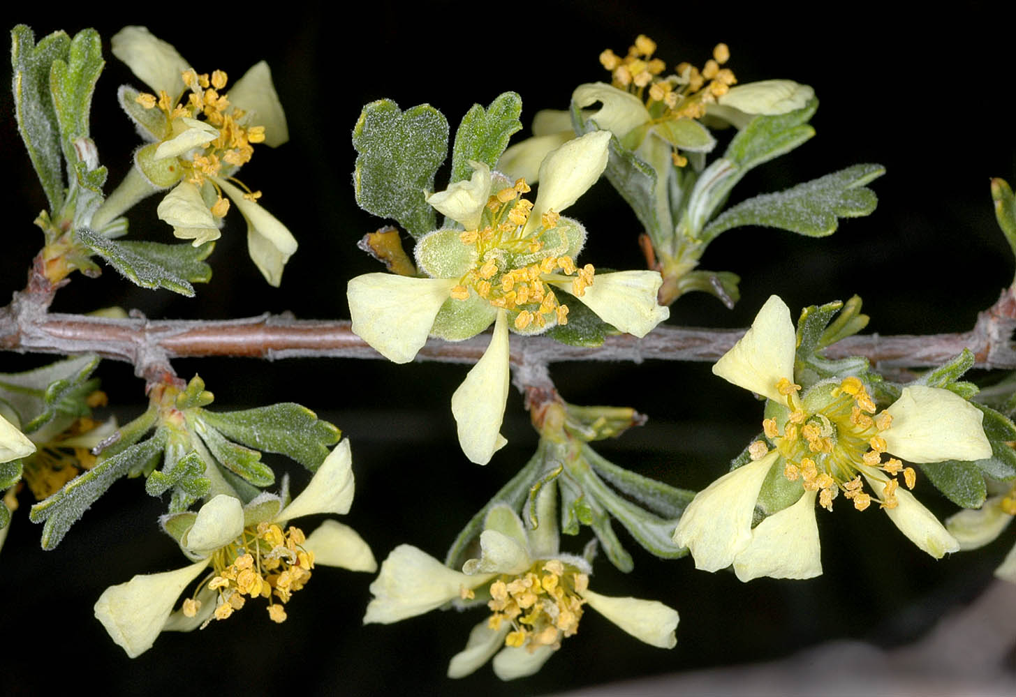 |
| Avery Rd. extension to Avery Gravel Pit, ca. 0.7 mi SE of jct with SR 14, 45.66214N, 121.03059W, Klickitat Co., WASHINGTON, 4/28/2008 | Avery Rd. extension to Avery Gravel Pit, ca. 0.7 mi SE of jct with SR 14, 45.66214N, 121.03059W, Klickitat Co., WASHINGTON, 4/28/2008 | ||
 |
 |
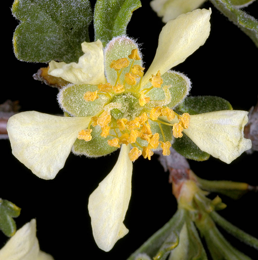
| Juniper Dunes Wilderness Area, S end of Joy Rd., ca. 18 air mi. NE of Pasco, Franklin Co., WASHINGTON, 4/22/2010, © Robert L. Carr | Along Middle Rd., 0.3 mi. N of Bickleton, Klickitat Co., WASHINGTON, 5/30/2010, © Robert L. Carr | ||
 |
 |
| Juniper Dunes Wilderness Area, S end of Joy Rd., ca. 18 air mi. NE of Pasco, Franklin Co., WASHINGTON, 4/22/2010, © Robert L. Carr | Juniper Dunes Wilderness Area, S end of Joy Rd., ca. 18 air mi. NE of Pasco, Franklin Co., WASHINGTON, 4/22/2010, © Robert L. Carr | ||
 |
 |