| Glide Wildflower Show, Glide, Douglas Co., OR, 4/9/2006 | Glide Wildflower Show, Glide, Douglas Co., OR, 4/9/2006 | Glide Wildflower Show, Glide, Douglas Co., OR, 4/9/2006 |
 |
 |
 |
| Oregon Flora Image Project | |
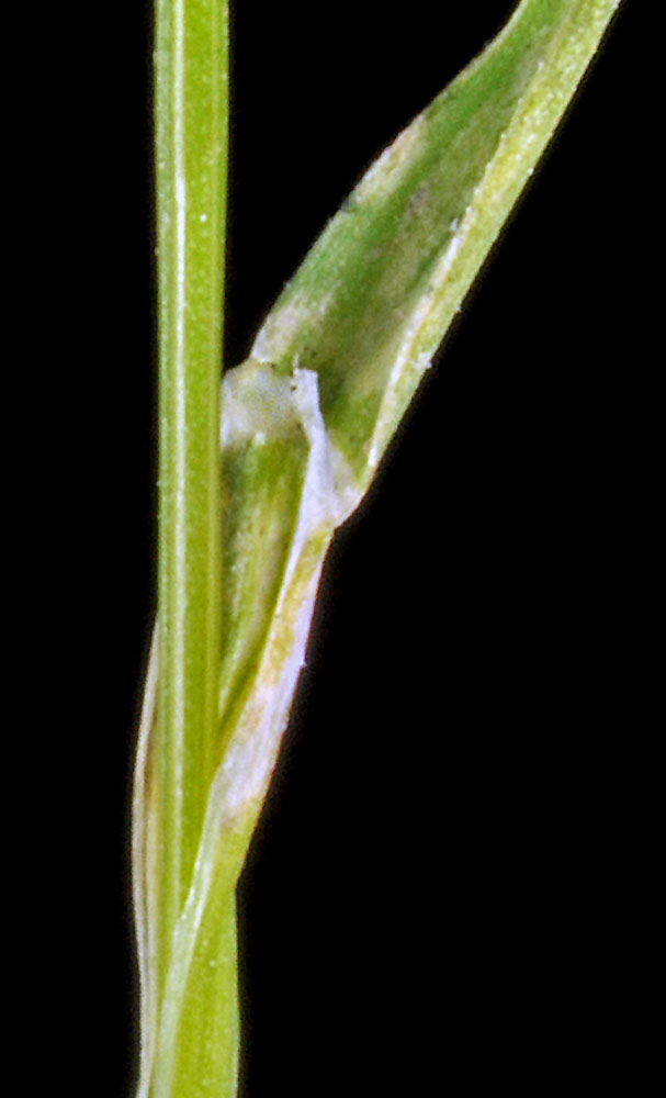
| Poa annua L. | annual bluegrass - exotic, naturalized Poaceae |
Click on an image for a larger version. All images © Gerald D. Carr unless otherwise noted.
| Glide Wildflower Show, Glide, Douglas Co., OR, 4/9/2006 | Glide Wildflower Show, Glide, Douglas Co., OR, 4/9/2006 | Glide Wildflower Show, Glide, Douglas Co., OR, 4/9/2006 |
|
|
|
| NW shore of Columbia River, 0.34 mi. SW of the Vernita Bridge (Hwy 24), SE of Mattawa, 410 ft. elev., N46.64149, W119.73998, Grant Co., WASHINGTON, 6/17/2013, © Robert L. Carr | NW shore of Columbia River, 0.34 mi. SW of the Vernita Bridge (Hwy 24), SE of Mattawa, 410 ft. elev., N46.64149, W119.73998, Grant Co., WASHINGTON, 6/17/2013, © Robert L. Carr | NW shore of Columbia River, 0.34 mi. SW of the Vernita Bridge (Hwy 24), SE of Mattawa, 410 ft. elev., N46.64149, W119.73998, Grant Co., WASHINGTON, 6/17/2013, © Robert L. Carr |
 |
 |
 |
| NW shore of Columbia River, 0.34 mi. SW of the Vernita Bridge (Hwy 24), SE of Mattawa, 410 ft. elev., N46.64149, W119.73998, Grant Co., WASHINGTON, 6/17/2013, © Robert L. Carr | NW shore of Columbia River, 0.34 mi. SW of the Vernita Bridge (Hwy 24), SE of Mattawa, 410 ft. elev., N46.64149, W119.73998, Grant Co., WASHINGTON, 6/17/2013, © Robert L. Carr | NW shore of Columbia River, 0.34 mi. SW of the Vernita Bridge (Hwy 24), SE of Mattawa, 410 ft. elev., N46.64149, W119.73998, Grant Co., WASHINGTON, 6/17/2013, © Robert L. Carr | NW shore of Columbia River, 0.34 mi. SW of the Vernita Bridge (Hwy 24), SE of Mattawa, 410 ft. elev., N46.64149, W119.73998, Grant Co., WASHINGTON, 6/17/2013, © Robert L. Carr | NW shore of Columbia River, 0.34 mi. SW of the Vernita Bridge (Hwy 24), SE of Mattawa, 410 ft. elev., N46.64149, W119.73998, Grant Co., WASHINGTON, 6/17/2013, © Robert L. Carr |
 |
 |
 |
 |
 |