

| Oregon Flora Image Project | |
| Nemacladus rigidus Curran | stoutstem threadplant - native Campanulaceae (including Lobeliaceae) |
Click on an image for a larger version. All images © Gerald D. Carr unless otherwise noted.
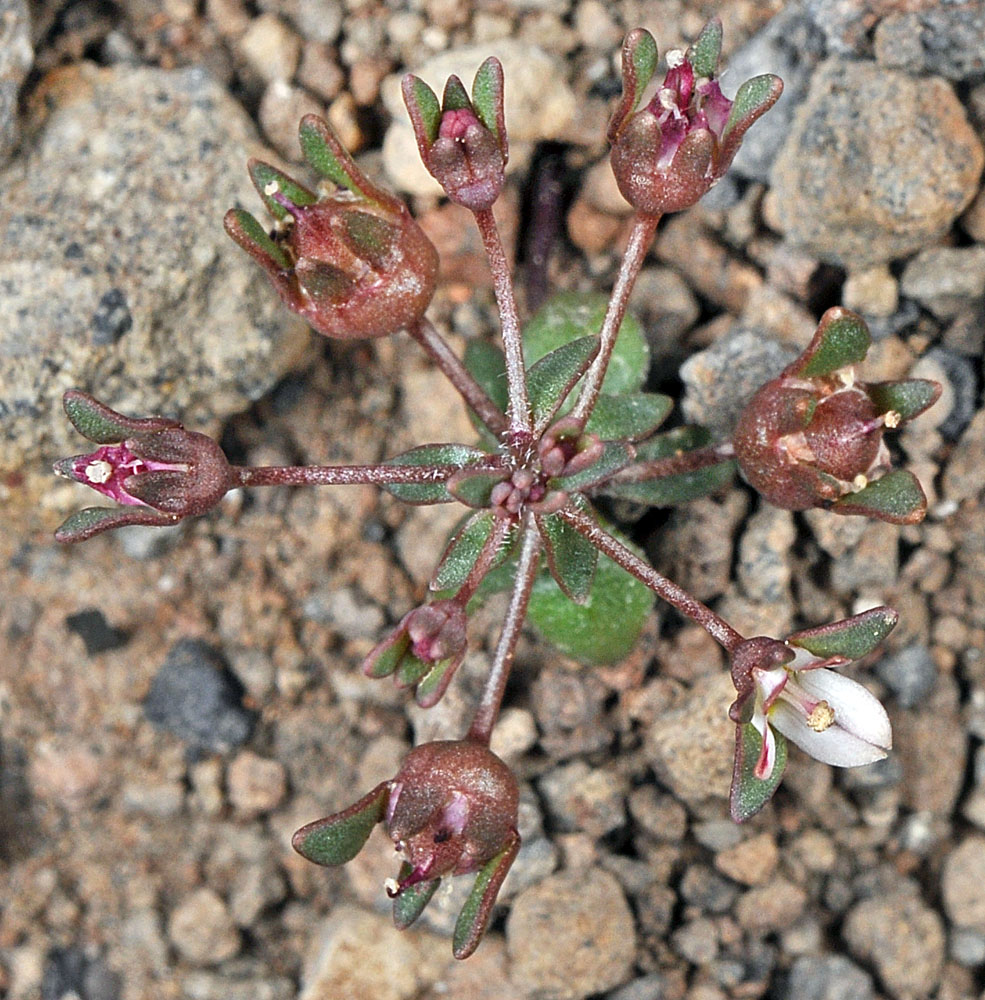
| Black Hills, ca. 5.3 mi. S of Christmas Valley, 4962 ft. elev., N43.16627, W120.67736, Lake Co., OR, 6/28/2012 | Black Hills, ca. 5.3 mi. S of Christmas Valley, 4962 ft. elev., N43.16627, W120.67736, Lake Co., OR, 6/28/2012 | Black Hills, ca. 5.3 mi. S of Christmas Valley, 4962 ft. elev., N43.16627, W120.67736, Lake Co., OR, 6/28/2012 |
|
|
|
| Black Hills, ca. 5.3 mi. S of Christmas Valley, 4962 ft. elev., N43.16627, W120.67736, Lake Co., OR, 6/28/2012 | Black Hills, ca. 5.3 mi. S of Christmas Valley, 4962 ft. elev., N43.16627, W120.67736, Lake Co., OR, 6/28/2012 | ||
 |
 |
| Black Hills, ca. 5.3 mi. S of Christmas Valley, 4962 ft. elev., N43.16627, W120.67736, Lake Co., OR, 6/28/2012 | Black Hills, ca. 5.3 mi. S of Christmas Valley, 4962 ft. elev., N43.16627, W120.67736, Lake Co., OR, 6/28/2012 | Black Hills, ca. 5.3 mi. S of Christmas Valley, 4962 ft. elev., N43.16627, W120.67736, Lake Co., OR, 6/28/2012 |
 |
 |
 |
| Squaw Creek Rd., 2.2 mi. S f Hwy s0, 8.2 air mi. SW of Harper Junction, 2875 ft. elev., N43.75891, W117.70230, Malheur Co., OR, 6/11/2019 | Squaw Creek Rd., 2.2 mi. S f Hwy s0, 8.2 air mi. SW of Harper Junction, 2875 ft. elev., N43.75891, W117.70230, Malheur Co., OR, 6/11/2019 | Squaw Creek Rd., 2.2 mi. S f Hwy s0, 8.2 air mi. SW of Harper Junction, 2875 ft. elev., N43.75891, W117.70230, Malheur Co., OR, 6/11/2019 |
 |
 |
 |