
| Oregon Flora Image Project | |
| Lysimachia terrestris (L.) Britton, Sterns & Poggenb. | bog loosestrife - exotic,
naturalized Primulaceae |
Click on an image for a larger version. All images © Gerald D. Carr unless otherwise noted.
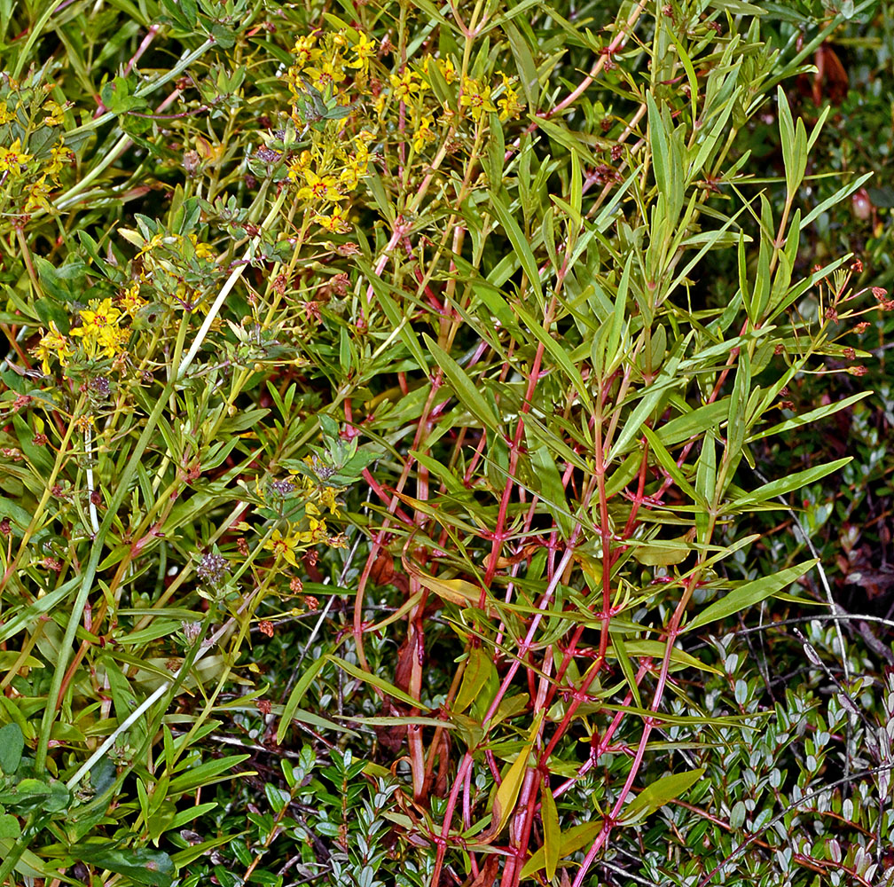
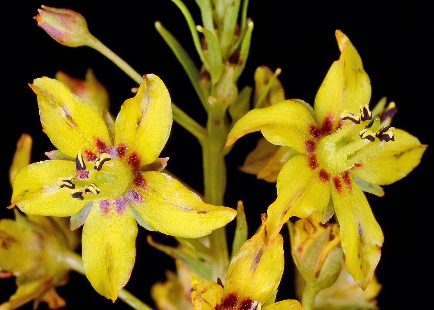
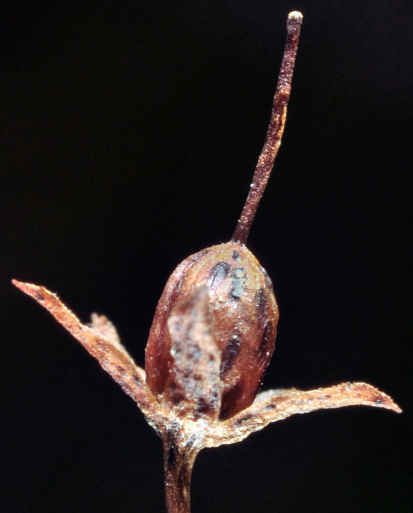
| Ditch at margin of cranberry bog, Randolph Rd., ca. 0.4 mi. SE of jct. with Hwy 101, 45 ft. elev., N43.17627, W124.36068, Coos Co., OR, 8/11/2014 | Ditch at margin of cranberry bog, Randolph Rd., ca. 0.4 mi. SE of jct. with Hwy 101, 45 ft. elev., N43.17627, W124.36068, Coos Co., OR, 8/11/2014 | Ditch at margin of cranberry bog, Randolph Rd., ca. 0.4 mi. SE of jct. with Hwy 101, 45 ft. elev., N43.17627, W124.36068, Coos Co., OR, 8/11/2014 |
|
|
|
| Ditch at margin of cranberry bog, Randolph Rd., ca. 0.4 mi. SE of jct. with Hwy 101, 45 ft. elev., N43.17627, W124.36068, Coos Co., OR, 8/11/2014 | Ditch at margin of cranberry bog, Randolph Rd., ca. 0.4 mi. SE of jct. with Hwy 101, 45 ft. elev., N43.17627, W124.36068, Coos Co., OR, 8/11/2014 | ||
 |
 |
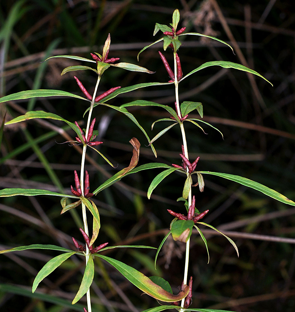
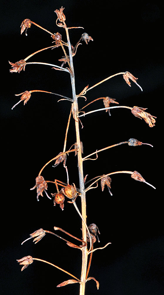
| near N end of Delmoor Loop Rd., 0.24 mi. E of jct. with Hwy 101, 0.7 mi. S of Allendale, N 46.07587, W123.91228, 25 ft. elev., Clatsop Co., OR, 10/15/2011 | near N end of Delmoor Loop Rd., 0.24 mi. E of jct. with Hwy 101, 0.7 mi. S of Allendale, N 46.07587, W123.91228, 25 ft. elev., Clatsop Co., OR, 10/15/2011 | near N end of Delmoor Loop Rd., 0.24 mi. E of jct. with Hwy 101, 0.7 mi. S of Allendale, N 46.07587, W123.91228, 25 ft. elev., Clatsop Co., OR, 10/15/2011 |
 |
 |
 |