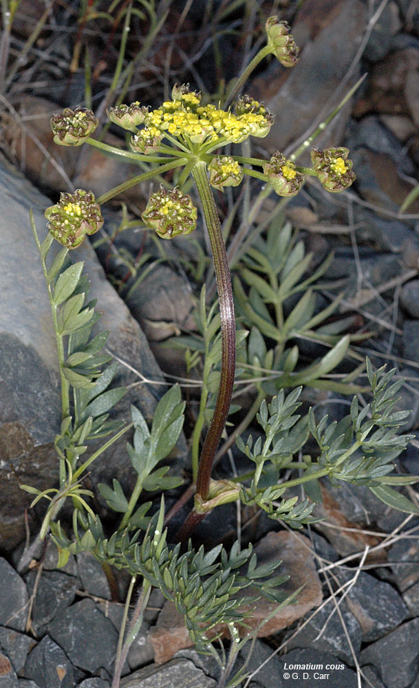
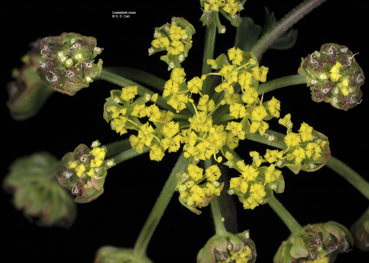
| Hwy 20, 26.6 mi NE of Burns, Harney Co., OR, 5/30/2006 | Hwy 20, 26.6 mi NE of Burns, Harney Co., OR, 5/30/2006 | Hwy 20, 26.6 mi NE of Burns, Harney Co., OR, 5/30/2006 | Hwy 20, 26.6 mi NE of Burns, Harney Co., OR, 5/30/2006 |
 |
 |
 |
 |
| Oregon Flora Image Project | |
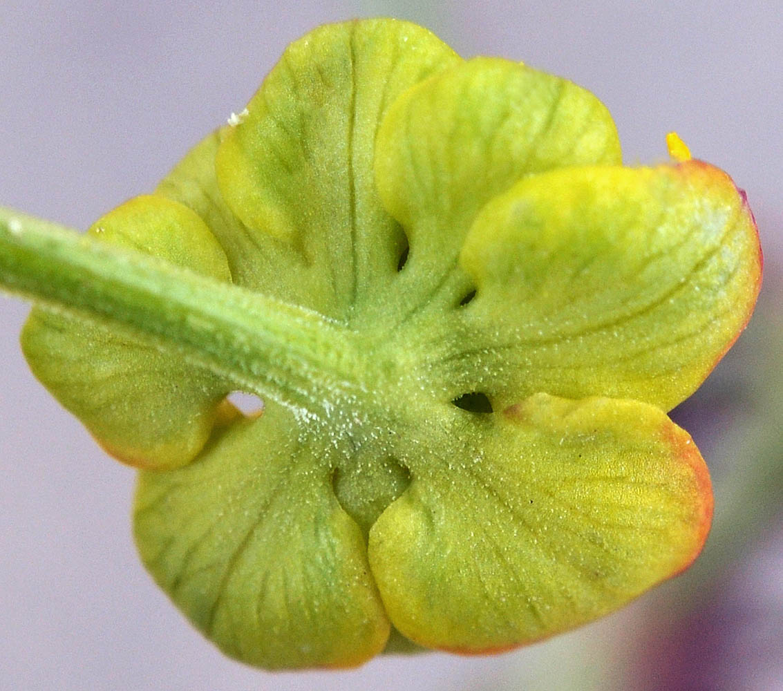
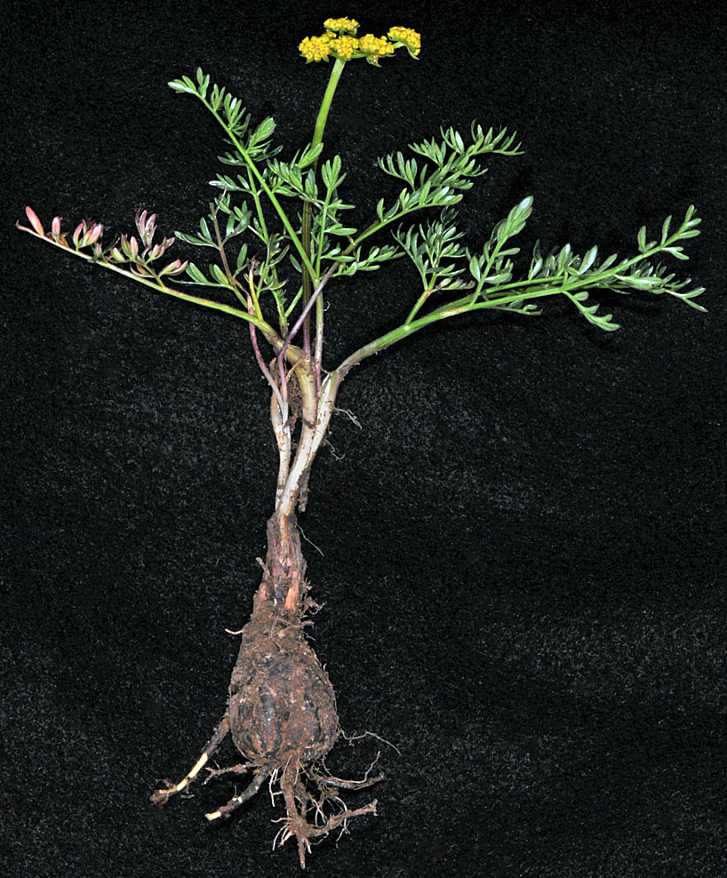
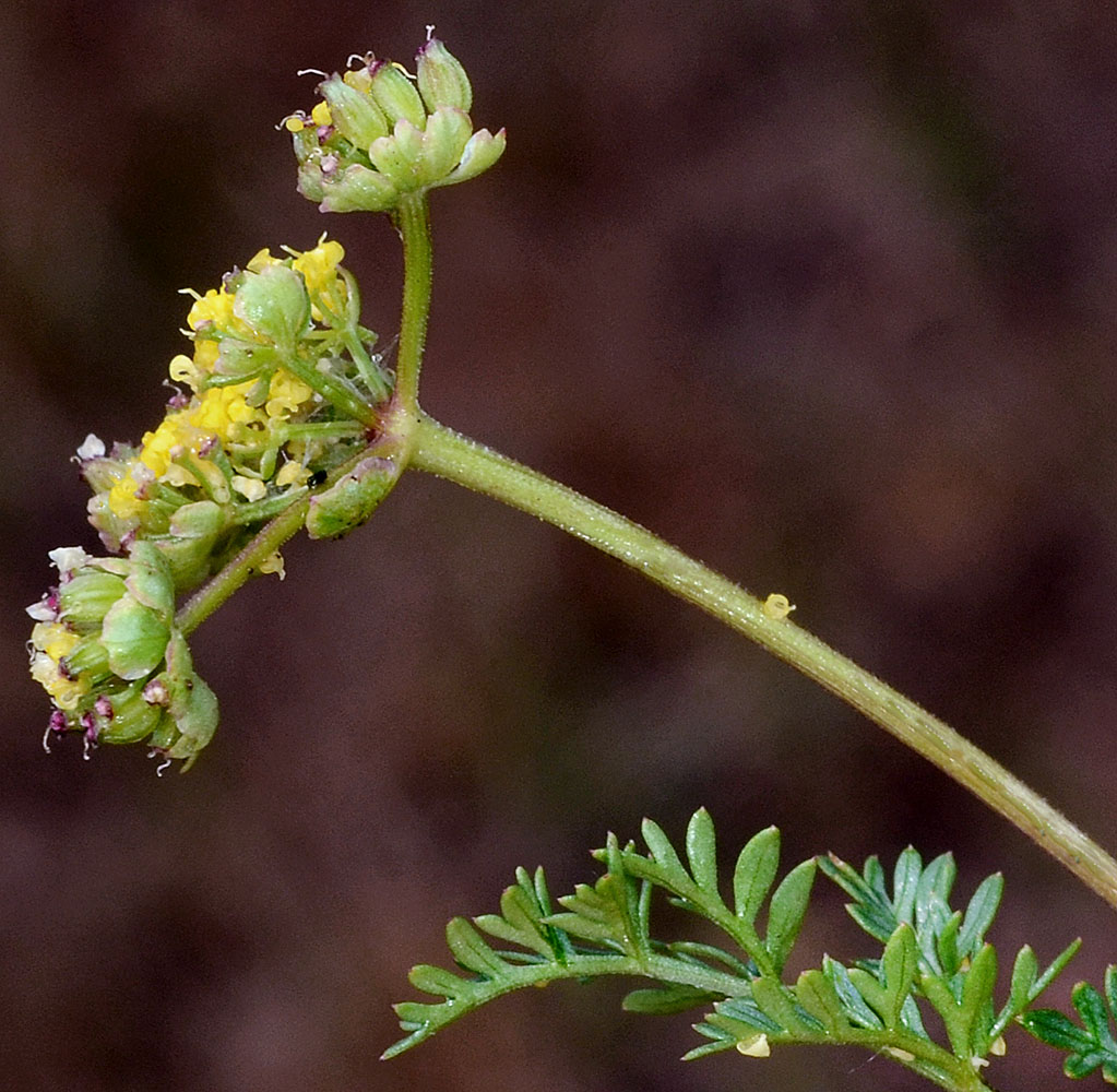
| Lomatium cous (S. Watson) J.M. Coult. & Rose | cous - native Apiaceae |
Click on an image for a larger version. All images © Gerald D. Carr unless otherwise noted.
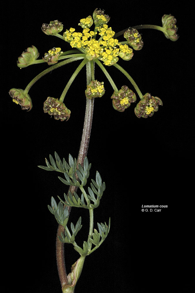
| Hwy 20, 26.6 mi NE of Burns, Harney Co., OR, 5/30/2006 | Hwy 20, 26.6 mi NE of Burns, Harney Co., OR, 5/30/2006 | Hwy 20, 26.6 mi NE of Burns, Harney Co., OR, 5/30/2006 | Hwy 20, 26.6 mi NE of Burns, Harney Co., OR, 5/30/2006 |
|
|
|
|
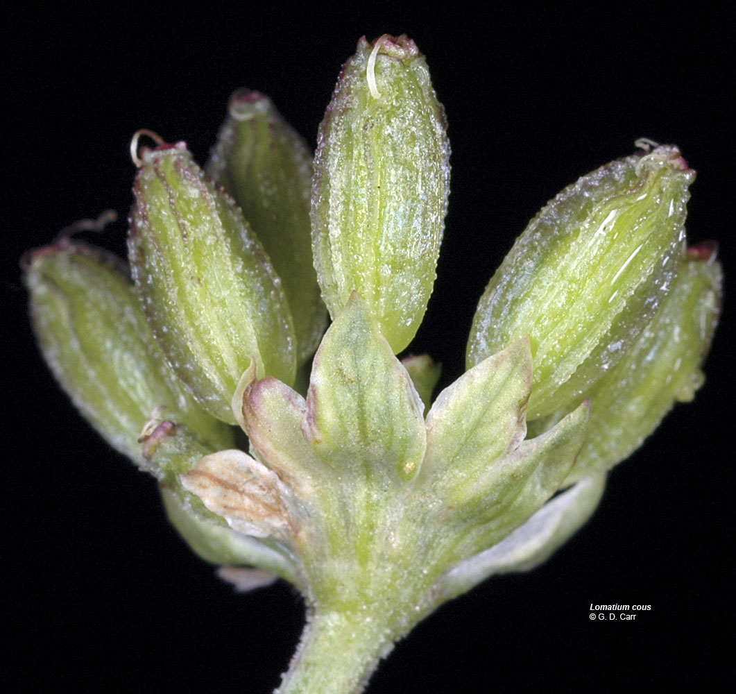
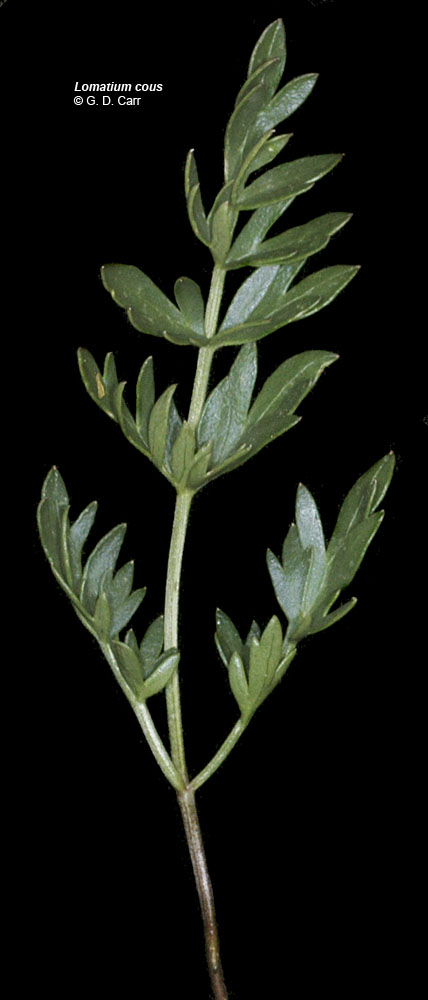
| Hwy 20, 26.6 mi NE of Burns, Harney Co., OR, 5/30/2006 | Hwy 20, 26.6 mi NE of Burns, Harney Co., OR, 5/30/2006 | Hwy 20, 26.6 mi NE of Burns, Harney Co., OR, 5/30/2006 |
 |
 |
 |
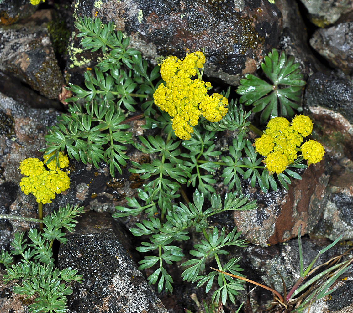
| Hwy 97, 7.0 mi. NE of jct. with Hwy 197, 5.0 mi. W of Shaniko, 3450 ft. elev., N44.99078, W120.84929, Wasco Co., OR, 3/29/2010 | Hwy 97, 7.0 mi. NE of jct. with Hwy 197, 5.0 mi. W of Shaniko, 3450 ft. elev., N44.99078, W120.84929, Wasco Co., OR, 3/29/2010 | Hwy 97, 7.0 mi. NE of jct. with Hwy 197, 5.0 mi. W of Shaniko, 3450 ft. elev., N44.99078, W120.84929, Wasco Co., OR, 3/29/2010 |
 |
 |
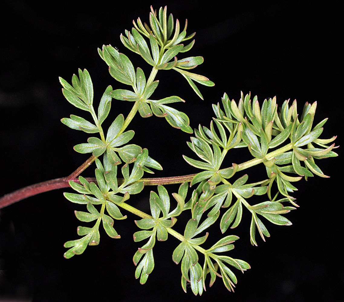 |
| Hwy 97, 7.0 mi. NE of jct. with Hwy 197, 5.0 mi. W of Shaniko, 3450 ft. elev., N44.99078, W120.84929, Wasco Co., OR, 3/29/2010 | Hwy 20, Stinkingwater Pass, 5.9 mi. NE of Buchanan, 4850 ft. elev., N43.69129, W118.53926, Harney Co., OR, 5/26/2010 | Hwy 20, Stinkingwater Pass, 5.9 mi. NE of Buchanan, 4850 ft. elev., N43.69129, W118.53926, Harney Co., OR, 5/26/2010 |
 |
 |
 |
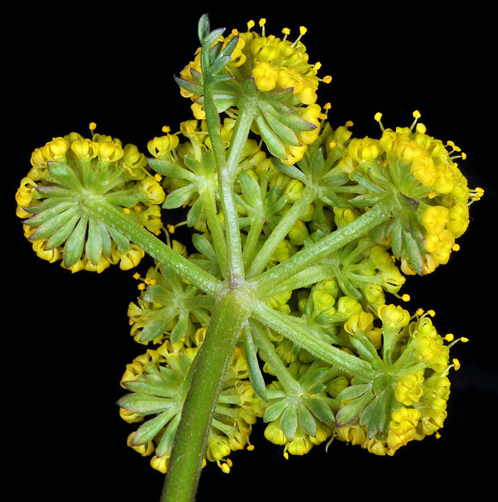
| near the corner of Spofford and Walla Walla River Rds., SE of Milton-Freewater, N45.90229, W118.33606, Umatilla Co., OR, 4/13/2011, © Robert L. Carr | ca. 470 ft. NW of jct. of Hwy 66 with Coral Creek Rd., between Lincoln and Mount View, 3695 ft. elev., N42.11084, W122.39382, Jackson Co., OR, 5/16/2013 | ||
 |
 |
| ca. 470 ft. NW of jct. of Hwy 66 with Coral Creek Rd., between Lincoln and Mount View, 3695 ft. elev., N42.11084, W122.39382, Jackson Co., OR, 5/16/2013 | ca. 470 ft. NW of jct. of Hwy 66 with Coral Creek Rd., between Lincoln and Mount View, 3695 ft. elev., N42.11084, W122.39382, Jackson Co., OR, 5/16/2013 | ca. 470 ft. NW of jct. of Hwy 66 with Coral Creek Rd., between Lincoln and Mount View, 3695 ft. elev., N42.11084, W122.39382, Jackson Co., OR, 5/16/2013 |
 |
 |
 |
| ca. 470 ft. NW of jct. of Hwy 66 with Coral Creek Rd., between Lincoln and Mount View, 3695 ft. elev., N42.11084, W122.39382, Jackson Co., OR, 5/16/2013 | ca. 470 ft. NW of jct. of Hwy 66 with Coral Creek Rd., between Lincoln and Mount View, 3695 ft. elev., N42.11084, W122.39382, Jackson Co., OR, 5/16/2013 | ||
 |
 |