
| Oregon Flora Image Project | |
| Lilium pardalinum Kellogg | [see ssp.] - native Liliaceae |
Click on an image for a larger version. All images © Gerald D. Carr unless otherwise noted.
| ssp. pardalinum | leopard lily |
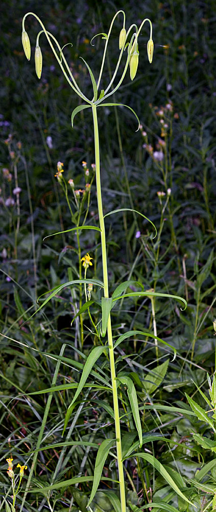
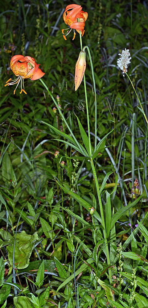
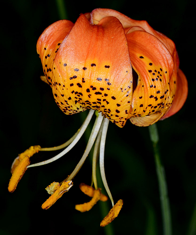
| Moon Point Trail, ca. 0.1 mi. S of Trailhead on NFD Rd. 439, Warner Mt., ca. 13.8 air mi. SSE of Oakridge, 5130 ft. elev., N43.55580, W122.39414, Lane Co., OR, 8/10/2012 | Moon Point Trail, ca. 0.1 mi. S of Trailhead on NFD Rd. 439, Warner Mt., ca. 13.8 air mi. SSE of Oakridge, 5130 ft. elev., N43.55580, W122.39414, Lane Co., OR, 8/10/2012 | Moon Point Trail, ca. 0.1 mi. S of Trailhead on NFD Rd. 439, Warner Mt., ca. 13.8 air mi. SSE of Oakridge, 5130 ft. elev., N43.55580, W122.39414, Lane Co., OR, 8/10/2012 | Moon Point Trail, ca. 0.1 mi. S of Trailhead on NFD Rd. 439, Warner Mt., ca. 13.8 air mi. SSE of Oakridge, 5130 ft. elev., N43.55580, W122.39414, Lane Co., OR, 8/10/2012 |
|
|
|
|
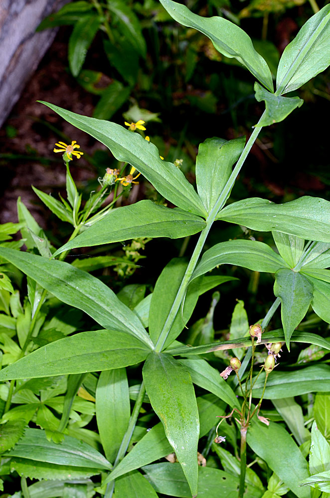
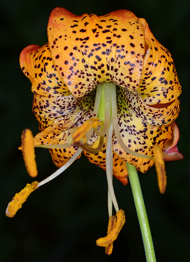
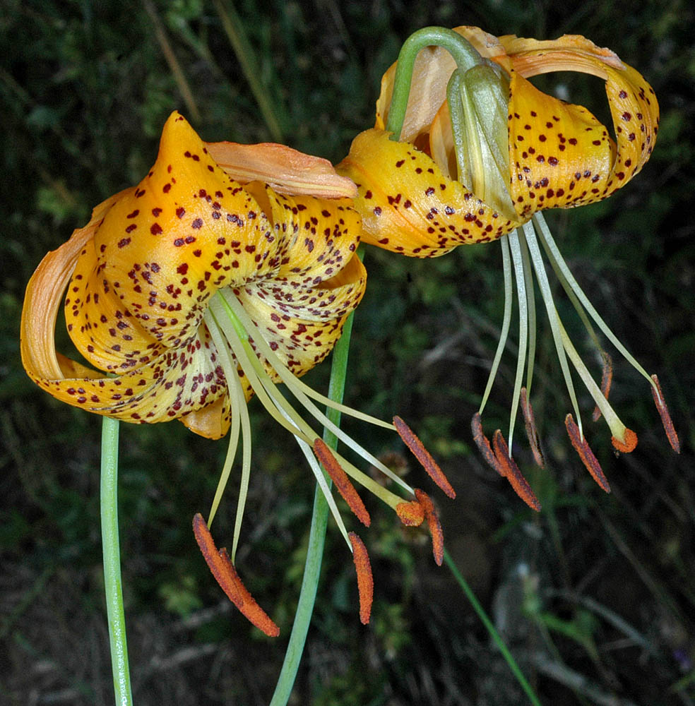
| Moon Point Trail, ca. 0.1 mi. S of Trailhead on NFD Rd. 439, Warner Mt., ca. 13.8 air mi. SSE of Oakridge, 5130 ft. elev., N43.55580, W122.39414, Lane Co., OR, 8/10/2012 | Moon Point Trail, ca. 0.1 mi. S of Trailhead on NFD Rd. 439, Warner Mt., ca. 13.8 air mi. SSE of Oakridge, 5130 ft. elev., N43.55580, W122.39414, Lane Co., OR, 8/10/2012 | Moon Point Trail, ca. 0.1 mi. S of Trailhead on NFD Rd. 439, Warner Mt., ca. 13.8 air mi. SSE of Oakridge, 5130 ft. elev., N43.55580, W122.39414, Lane Co., OR, 8/10/2012 | Moon Point Trail, ca. 0.1 mi. S of Trailhead on NFD Rd. 439, Warner Mt., ca. 13.8 air mi. SSE of Oakridge, 5130 ft. elev., N43.55580, W122.39414, Lane Co., OR, 8/10/2012 |
 |
 |
 |
 |
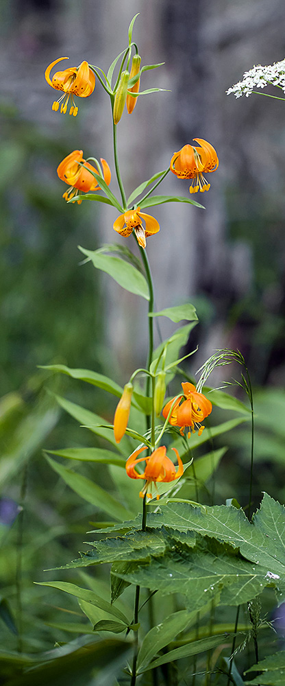
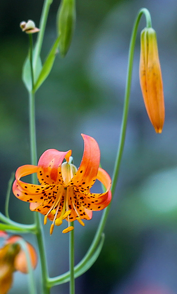
| NFD Rd. 4713, 5.2 mi. NE of North Umpqua Hwy (SR138), E of Steamboat, N43.33946, W122.66758, ca. 3250 ft. elev., Douglas Co., OR, 7/14/2008 [Identification by Mark W. Skinner] | NFD Rd. 4713, 5.2 mi. NE of North Umpqua Hwy (SR138), E of Steamboat, N43.33946, W122.66758, ca. 3250 ft. elev., Douglas Co., OR, 7/14/2008 [Identification by Mark W. Skinner] | ||
 |
 |
| ssp. shastense (Eastwood) M.W Skinner | Shasta lily |
| Moist area near stream, near CSU (San Francisco) Field Station, northern Sierra Nevada, CALIFORNIA, 6/28/2014, © John C. Game 2014 | Moist area near stream, near CSU (San Francisco) Field Station, northern Sierra Nevada, CALIFORNIA, 6/28/2014, © John C. Game 2014 | Moist area near stream, near CSU (San Francisco) Field Station, northern Sierra Nevada, CALIFORNIA, 6/28/2014, © John C. Game 2014 |
 |
 |
 |
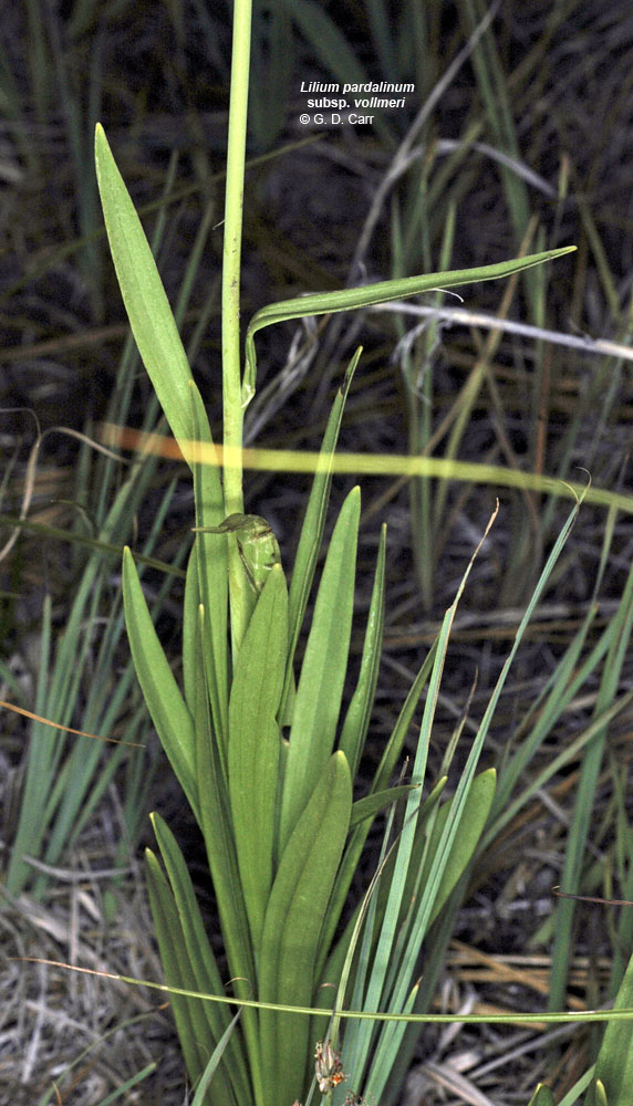
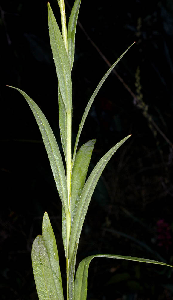
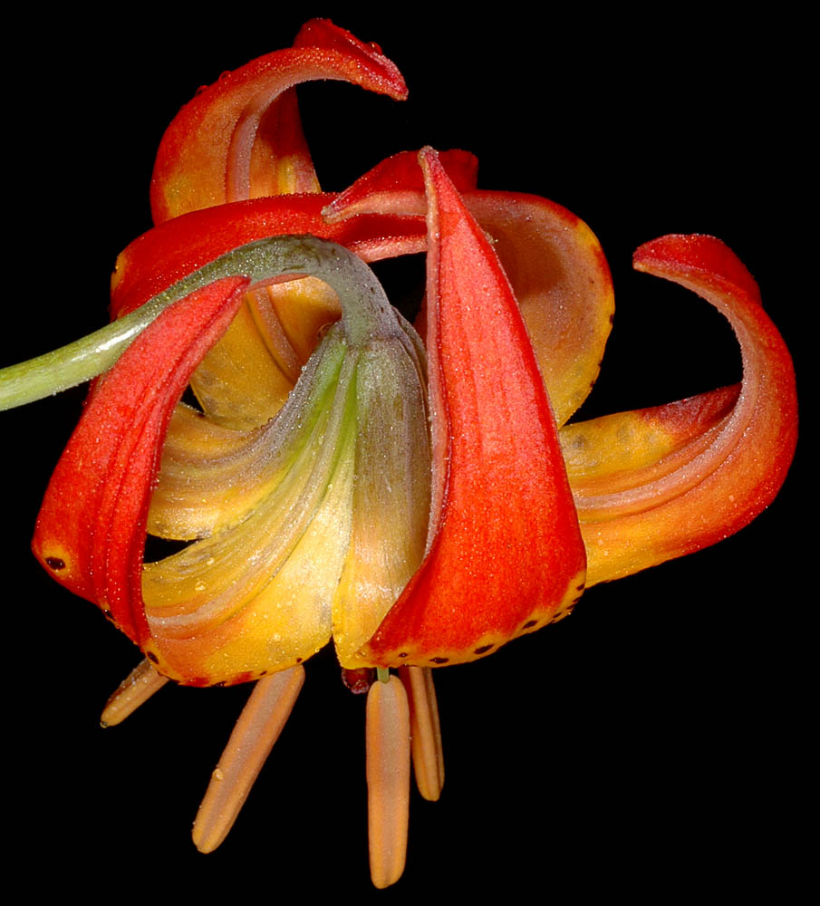
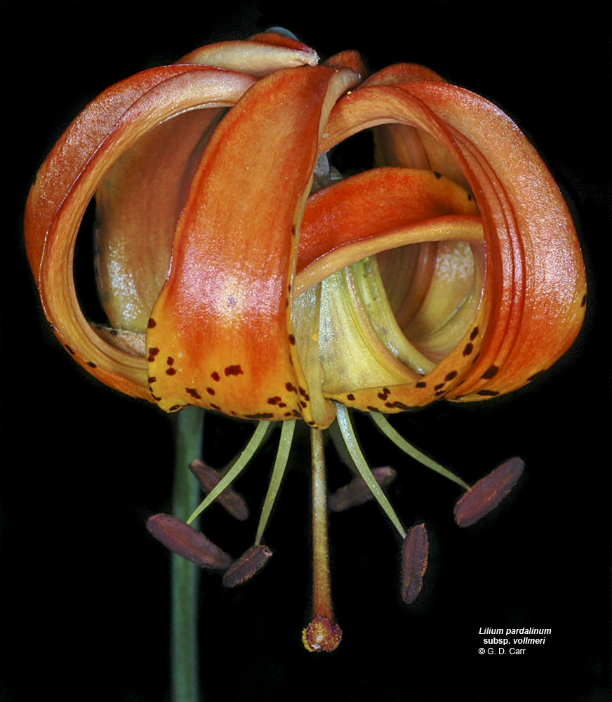
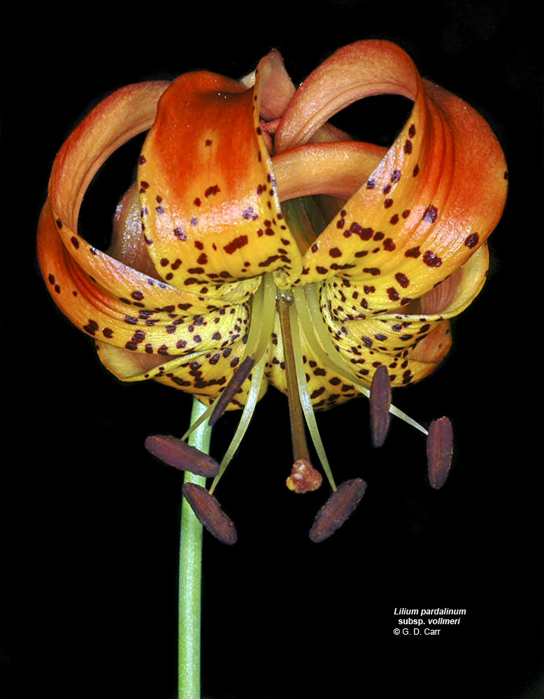
| ssp. vollmeri (Eastwood) M.W Skinner | Vollmer's lily |
| SW of $8 Mt., in Darlingtonia fen on S-facing slope between Natl. For. Dev. Rd. 4201 and Illinois R., opposite mouth of Josephine Cr., Josephine Co., OR, 6/12/2007 | NFD Rd. 4201, opposite (N of) confluence of Josephine Cr. and Illinois R., SW of $8 Mt., ca. 2.6 mi. W of Hwy 199, N42.24494, W123.68424, Josephine Co., OR, 6/14/2008 | NFD Rd. 4201, opposite (N of) confluence of Josephine Cr. and Illinois R., SW of $8 Mt., ca. 2.6 mi. W of Hwy 199, N42.24494, W123.68424, Josephine Co., OR, 6/14/2008 | NFD Rd. 4201, opposite (N of) confluence of Josephine Cr. and Illinois R., SW of $8 Mt., ca. 2.6 mi. W of Hwy 199, N42.24494, W123.68424, Josephine Co., OR, 6/14/2008 |
 |
 |
 |
 |
| NFD Rd. 4201, opposite (N of) confluence of Josephine Cr. and Illinois R., SW of $8 Mt., ca. 2.6 mi. W of Hwy 199, N42.24494, W123.68424, Josephine Co., OR, 6/14/2008 | SW of $8 Mt., in Darlingtonia fen on S-facing slope between Natl. For. Dev. Rd. 4201 and Illinois R., opposite mouth of Josephine Cr., Josephine Co., OR, 6/12/2007 | SW of $8 Mt., in Darlingtonia fen on S-facing slope between Natl. For. Dev. Rd. 4201 and Illinois R., opposite mouth of Josephine Cr., Josephine Co., OR, 6/12/2007 |
 |
 |
 |