

| Oregon Flora Image Project | |
| Lewisia columbiana (Howell) B.L. Rob. | [see var.] - native Montiaceae (formerly Portulacaceae) |
Click on an image for a larger version. All images © Gerald D. Carr unless otherwise noted.
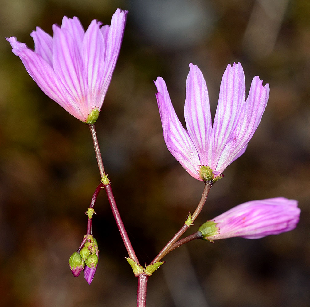
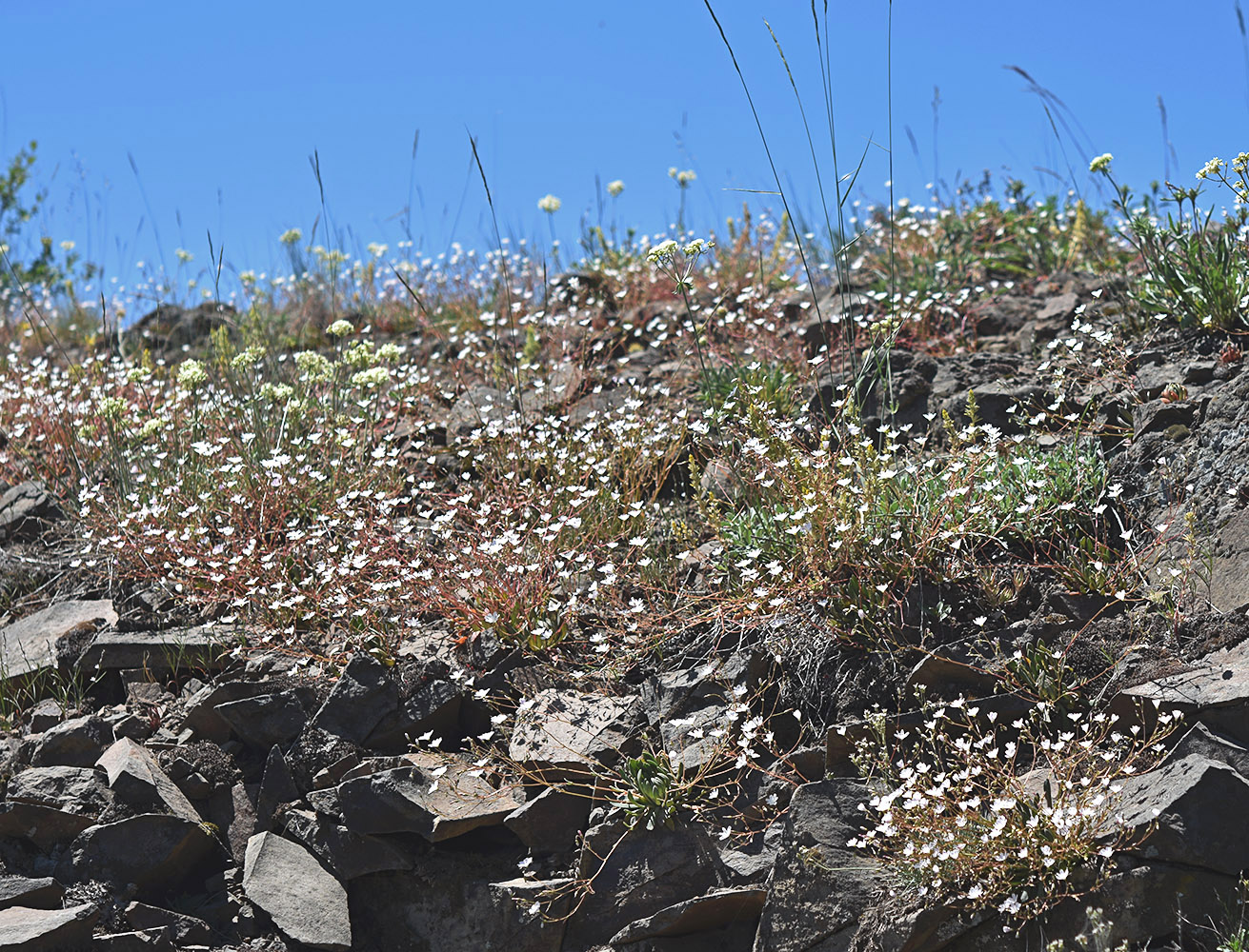
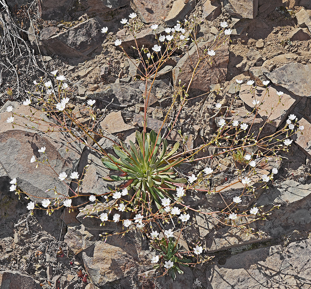
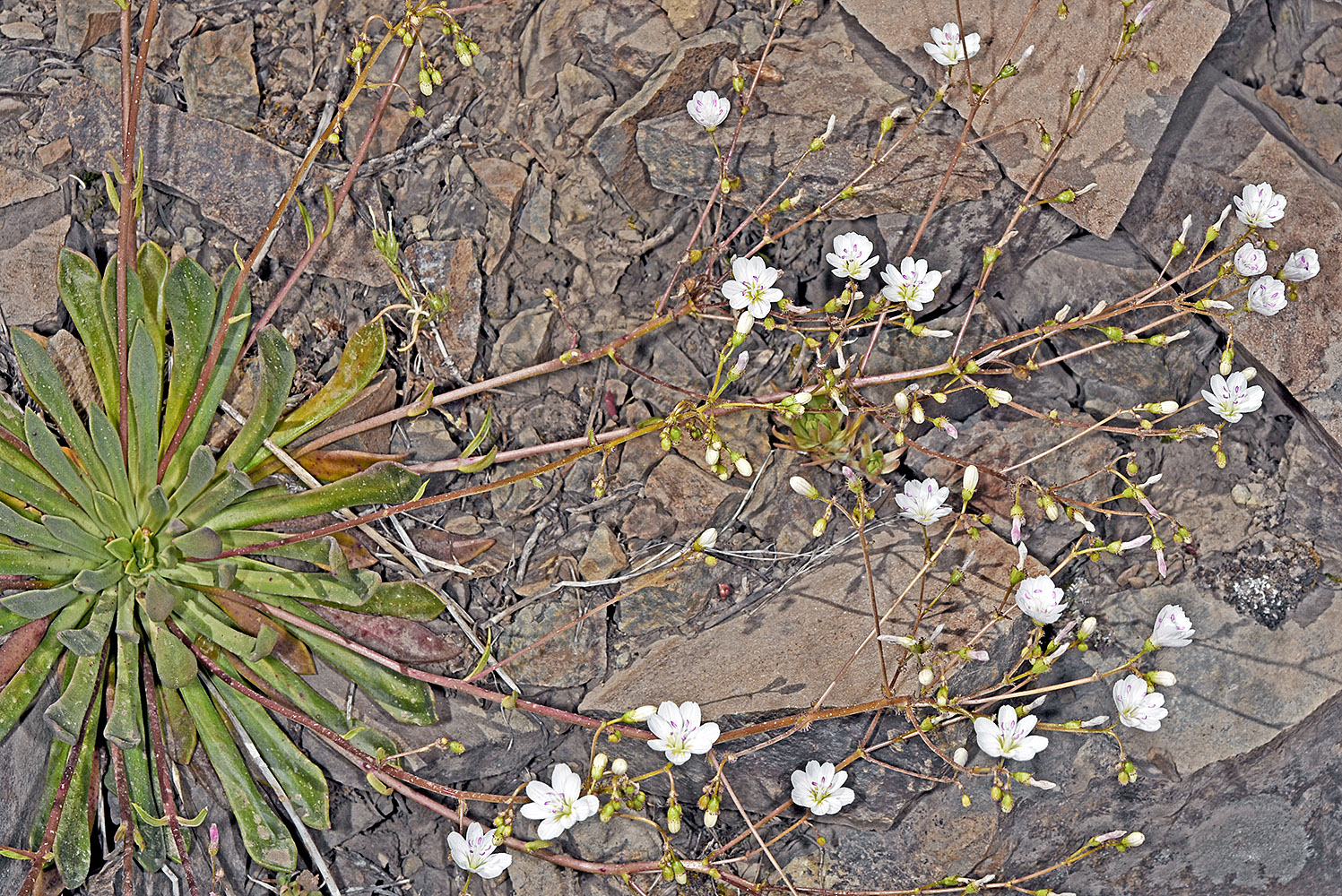
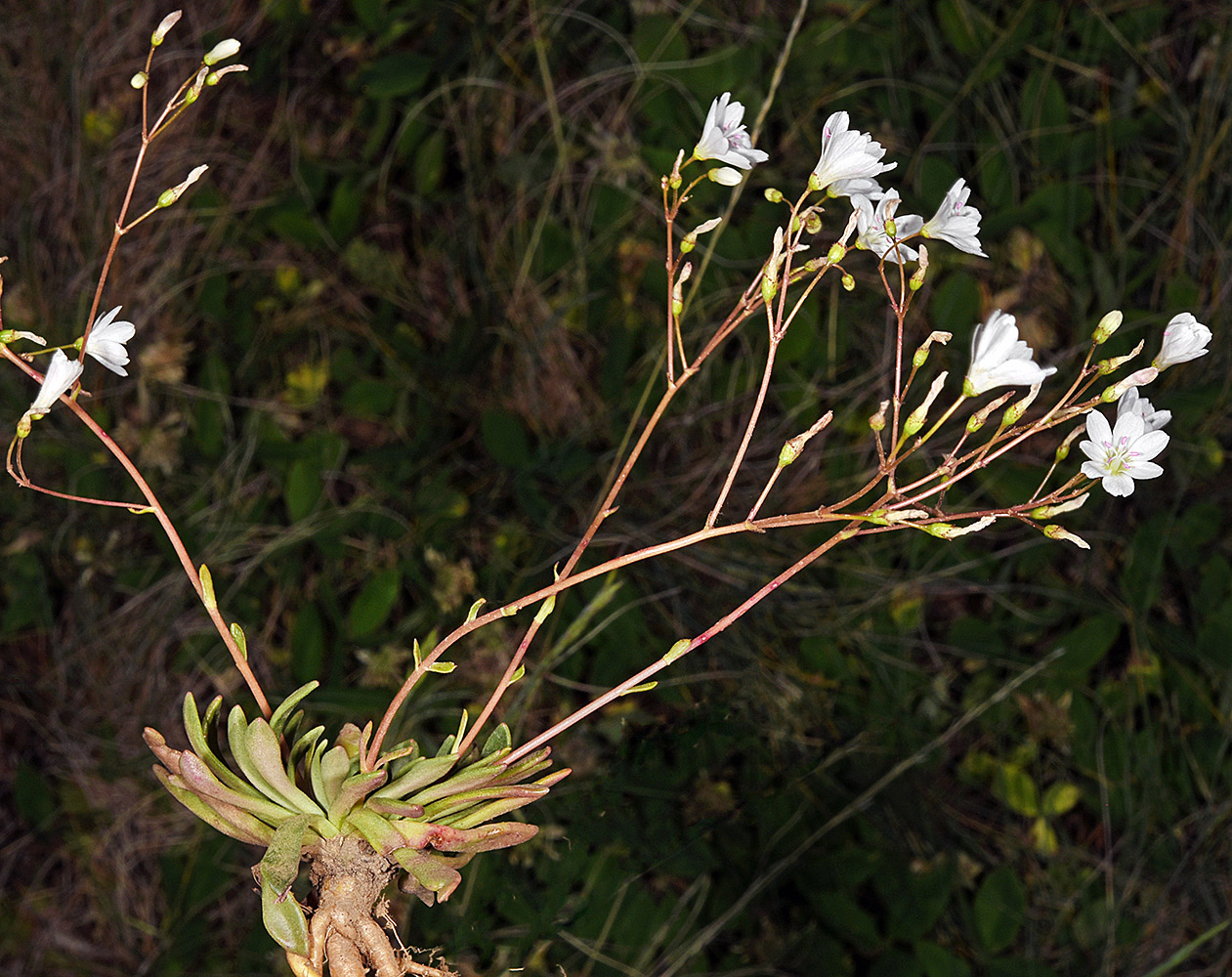
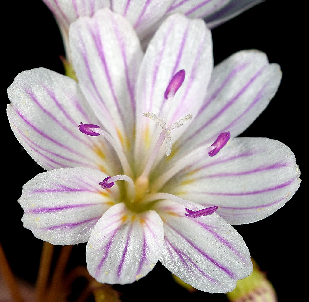
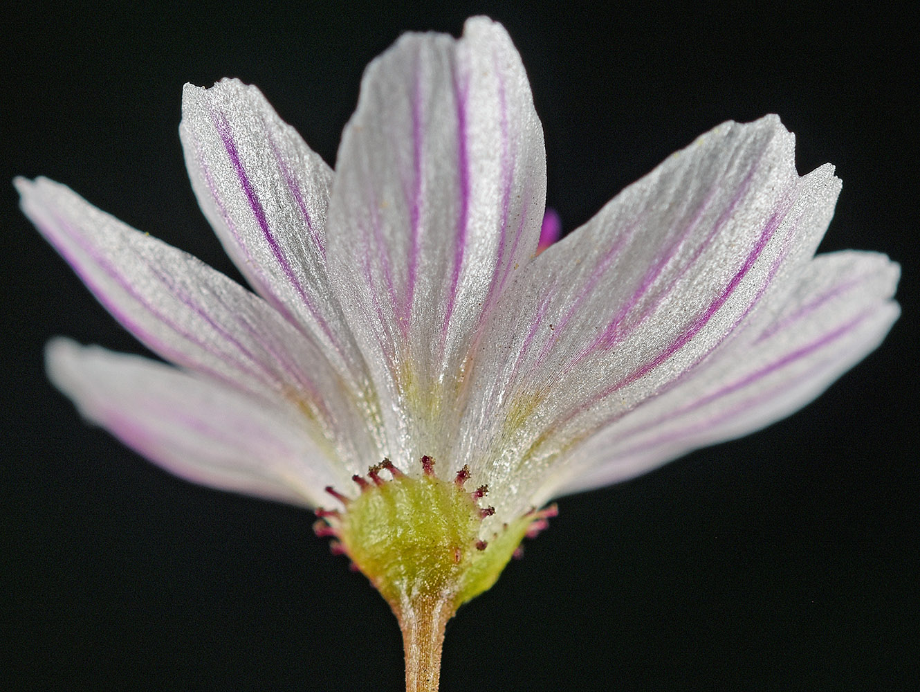
| var. rupicola (English) C.L. Hitchc. | rosy lewisia |
| Saddle Mt. Trail, just E of the E rim of the saddle, 2930-2950 ft. elev., N45.96528, W123.68138, Clatsop Co., OR, 6/17/2013 | Saddle Mt. Trail, just E of the E rim of the saddle, 2930-2950 ft. elev., N45.96528, W123.68138, Clatsop Co., OR, 6/17/2013 | ||
|
|
| Saddle Mt. Trail, just E of the E rim of the saddle, 2930-2950 ft. elev., N45.96528, W123.68138, Clatsop Co., OR, 6/17/2013 | Saddle Mt. Trail, just E of the E rim of the saddle, 2930-2950 ft. elev., N45.96528, W123.68138, Clatsop Co., OR, 6/17/2013 | Saddle Mt. Trail, just E of the E rim of the saddle, 2930-2950 ft. elev., N45.96528, W123.68138, Clatsop Co., OR, 6/17/2013 |
 |
 |
 |
| Saddle Mt. Trail, just E of the E rim of the saddle, 2930-2950 ft. elev., N45.96528, W123.68138, Clatsop Co., OR, 6/17/2013 | Saddle Mt. Trail, NW rim of saddle to summit, 2950 to 3270 ft. elev., N45.96823, W123.68551, Clatsop Co., OR, 6/17/2013 | ||
 |
 |
| Saddle Mt. Trail, just E of the E rim of the saddle, 2930-2950 ft. elev., N45.96528, W123.68138, Clatsop Co., OR, 6/17/2013 | Saddle Mt. Trail, just E of the E rim of the saddle, 2930-2950 ft. elev., N45.96528, W123.68138, Clatsop Co., OR, 6/17/2013 | Saddle Mt. Trail, just E of the E rim of the saddle, 2930-2950 ft. elev., N45.96528, W123.68138, Clatsop Co., OR, 6/17/2013 |
 |
 |
 |
| var. wallowensis C.L. Hitchc. | Wallowa lewisia |
| W side of Hat Point Rd., 10.3 mi. SE of Imnaha, 5918 ft. elev., N45.47975, W116.75326, Wallowa Co., OR, 6/28/2017 | W side of Hat Point Rd., 10.3 mi. SE of Imnaha, 5918 ft. elev., N45.47975, W116.75326, Wallowa Co., OR, 6/28/2017 | W side of Hat Point Rd., 10.3 mi. SE of Imnaha, 5918 ft. elev., N45.47975, W116.75326, Wallowa Co., OR, 6/28/2017 |
 |
 |
 |
| Hat Point Rd., 12.3 mi. SE of Imnaha, 6347 ft. elev., N45.45879, W116.73619, Wallowa Co., OR, 6/28/2017 | W side of Hat Point Rd., 10.3 mi. SE of Imnaha, 5918 ft. elev., N45.47975, W116.75326, Wallowa Co., OR, 6/28/2017 | ||
 |
 |
| W side of Hat Point Rd., 10.3 mi. SE of Imnaha, 5918 ft. elev., N45.47975, W116.75326, Wallowa Co., OR, 6/28/2017 | W side of Hat Point Rd., 10.3 mi. SE of Imnaha, 5918 ft. elev., N45.47975, W116.75326, Wallowa Co., OR, 6/28/2017 | W side of Hat Point Rd., 10.3 mi. SE of Imnaha, 5918 ft. elev., N45.47975, W116.75326, Wallowa Co., OR, 6/28/2017 |
 |
 |
 |
| W side of Hat Point Rd., 10.3 mi. SE of Imnaha, 5918 ft. elev., N45.47975, W116.75326, Wallowa Co., OR, 6/28/2017 | W side of Hat Point Rd., 10.3 mi. SE of Imnaha, 5918 ft. elev., N45.47975, W116.75326, Wallowa Co., OR, 6/28/2017 | ||
 |
 |
| W side of Hat Point Rd., 10.3 mi. SE of Imnaha, 5918 ft. elev., N45.47975, W116.75326, Wallowa Co., OR, 6/28/2017 | ||
 |