


| Oregon Flora Image Project | |
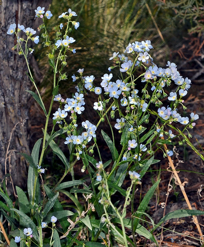
| Hackelia cusickii (Piper) Brand | Cusick's stickseed - native Boraginaceae |
Click on an image for a larger version. All images © Gerald D. Carr unless otherwise noted.
| Unnamed rd. 1.8 mi. W of jct. with Squaw Butte Rd. that is 1.8 mi. N of jct. with Hwy 20, ca. 8 mi. W of Riley, 5015 ft. elev., N43.51402, W119.68047, Harney Co., OR, 6/3/2013 | Unnamed rd. 1.8 mi. W of jct. with Squaw Butte Rd. that is 1.8 mi. N of jct. with Hwy 20, ca. 8 mi. W of Riley, 5015 ft. elev., N43.51402, W119.68047, Harney Co., OR, 6/3/2013 | Unnamed rd. 1.8 mi. W of jct. with Squaw Butte Rd. that is 1.8 mi. N of jct. with Hwy 20, ca. 8 mi. W of Riley, 5015 ft. elev., N43.51402, W119.68047, Harney Co., OR, 6/3/2013 |
|
|
|
| Unnamed rd. 1.8 mi. W of jct. with Squaw Butte Rd. that is 1.8 mi. N of jct. with Hwy 20, ca. 8 mi. W of Riley, 5015 ft. elev., N43.51402, W119.68047, Harney Co., OR, 6/3/2013 | Unnamed rd. 1.8 mi. W of jct. with Squaw Butte Rd. that is 1.8 mi. N of jct. with Hwy 20, ca. 8 mi. W of Riley, 5015 ft. elev., N43.51402, W119.68047, Harney Co., OR, 6/3/2013 | Unnamed rd. 1.8 mi. W of jct. with Squaw Butte Rd. that is 1.8 mi. N of jct. with Hwy 20, ca. 8 mi. W of Riley, 5015 ft. elev., N43.51402, W119.68047, Harney Co., OR, 6/3/2013 |
 |
 |
 |
| Unnamed rd. 1.8 mi. W of jct. with Squaw Butte Rd. that is 1.8 mi. N of jct. with Hwy 20, ca. 8 mi. W of Riley, 5015 ft. elev., N43.51402, W119.68047, Harney Co., OR, 6/3/2013 | Unnamed rd. 1.8 mi. W of jct. with Squaw Butte Rd. that is 1.8 mi. N of jct. with Hwy 20, ca. 8 mi. W of Riley, 5015 ft. elev., N43.51402, W119.68047, Harney Co., OR, 6/3/2013 | Near W shoulder of Squaw Butte Rd., 1.4 mi. S of entrance to Northern Great Basin Exptl. Range, 2.9 mi. S of jct with Hwy 20, 4855 ft. elev., N43.50091, W119.71829, Harney Co., OR, 6/3/2013 |
 |
 |
 |
| Near W shoulder of Squaw Butte Rd., 1.4 mi. S of entrance to Northern Great Basin Exptl. Range, 2.9 mi. S of jct with Hwy 20, 4855 ft. elev., N43.50091, W119.71829, Harney Co., OR, 6/3/2013 | Near W shoulder of Squaw Butte Rd., 1.4 mi. S of entrance to Northern Great Basin Exptl. Range, 2.9 mi. S of jct with Hwy 20, 4855 ft. elev., N43.50091, W119.71829, Harney Co., OR, 6/3/2013 | Near W shoulder of Squaw Butte Rd., 1.4 mi. S of entrance to Northern Great Basin Exptl. Range, 2.9 mi. S of jct with Hwy 20, 4855 ft. elev., N43.50091, W119.71829, Harney Co., OR, 6/3/2013 |
 |
 |
 |