


| Oregon Flora Image Project | |
| Pseudognaphalium macounii (Greene) Kartesz | sticky cudweed - native Asteraceae: Gnaphalieae |
Click on an image for a larger version. All images © Gerald D. Carr unless otherwise noted.
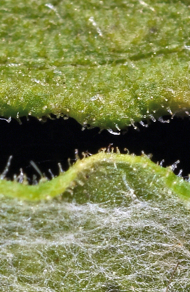
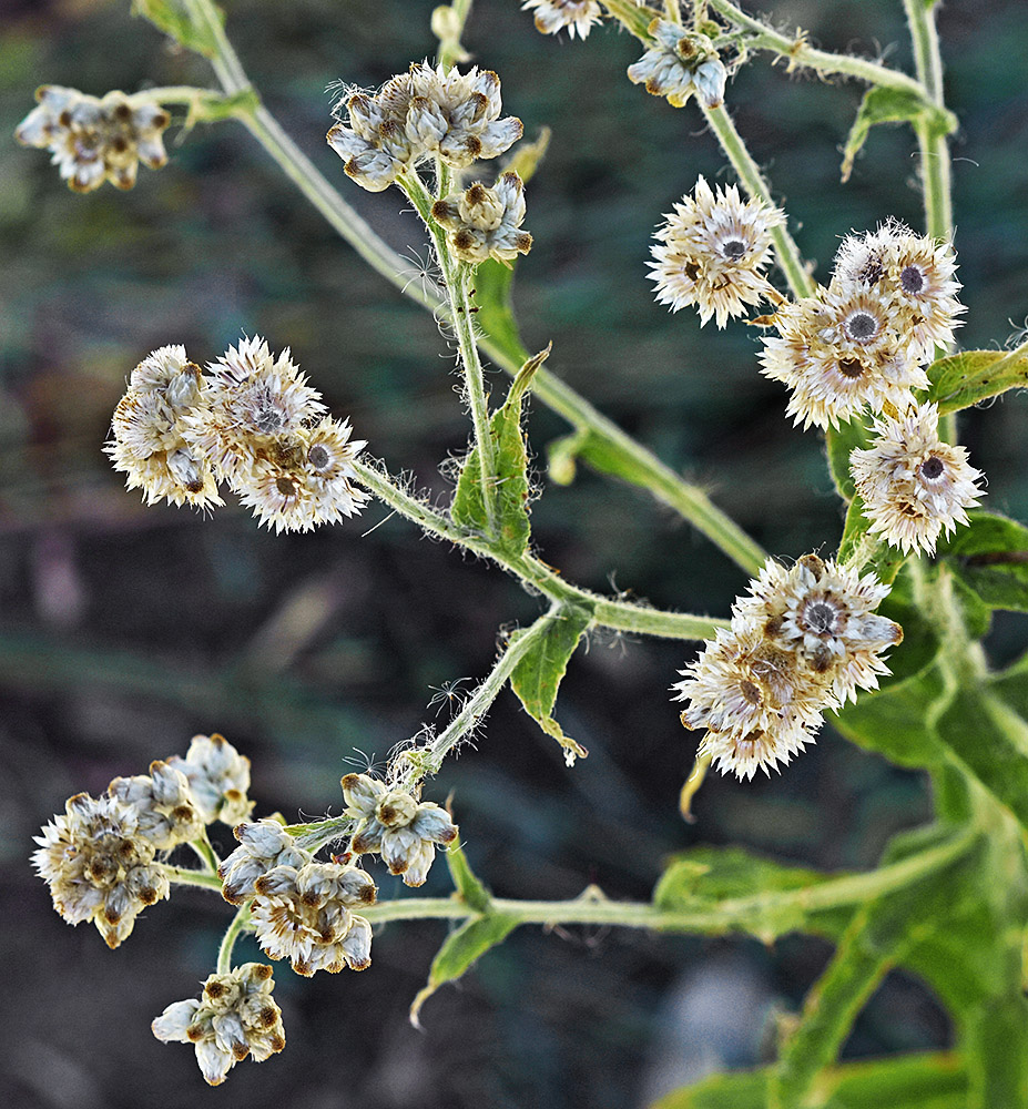
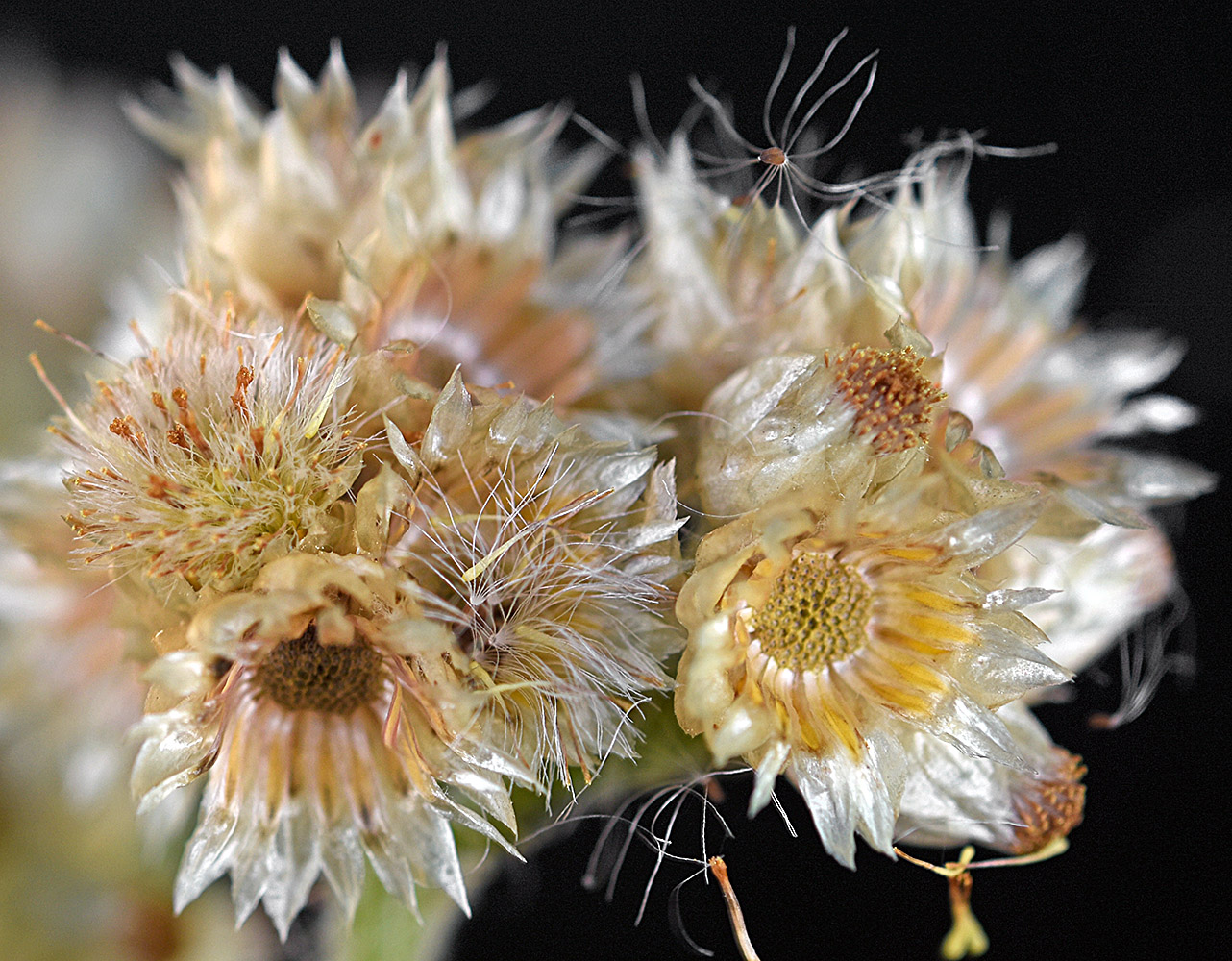
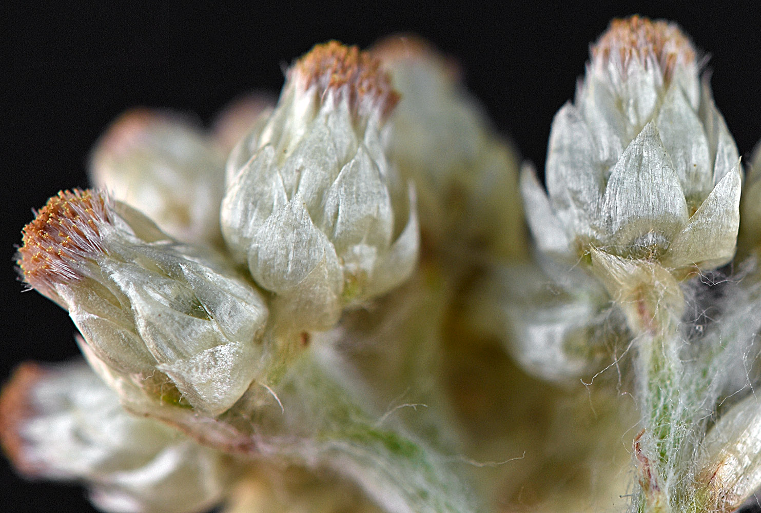
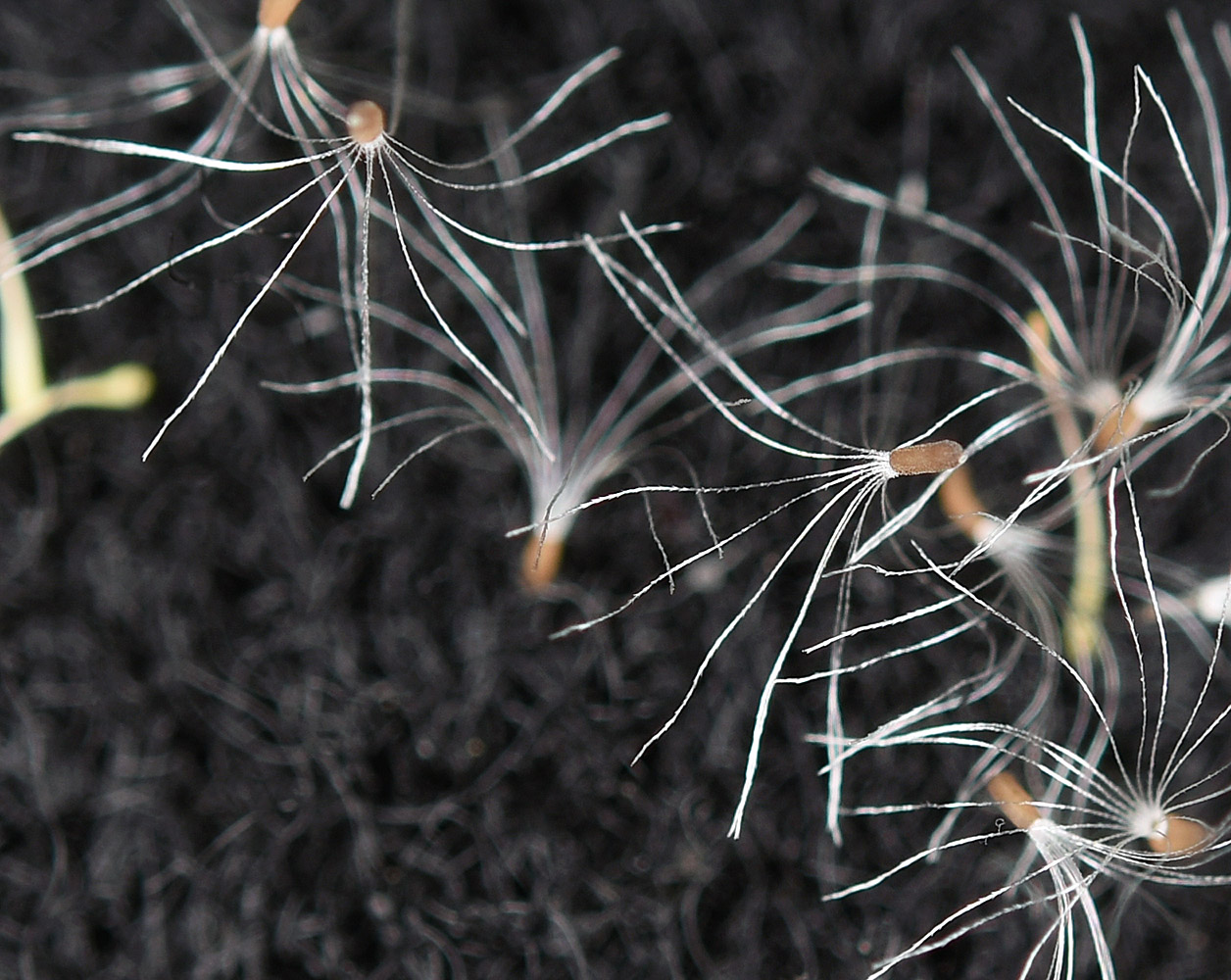
| Along Sherman Creek, off Hwy 20, 9.7 mi. WSW of jct. with Hwy 395, W of Kettle Falls, 2420 ft. elev., N48.57785, W118.28564, Ferry Co., WASHINGTON, 8/22/2016, © Robert L. Carr | Along Sherman Creek, off Hwy 20, 9.7 mi. WSW of jct. with Hwy 395, W of Kettle Falls, 2420 ft. elev., N48.57785, W118.28564, Ferry Co., WASHINGTON, 8/22/2016, © Robert L. Carr | Along Sherman Creek, off Hwy 20, 9.7 mi. WSW of jct. with Hwy 395, W of Kettle Falls, 2420 ft. elev., N48.57785, W118.28564, Ferry Co., WASHINGTON, 8/22/2016, © Robert L. Carr | Along Sherman Creek, off Hwy 20, 9.7 mi. WSW of jct. with Hwy 395, W of Kettle Falls, 2420 ft. elev., N48.57785, W118.28564, Ferry Co., WASHINGTON, 8/22/2016, © Robert L. Carr |
|
|
|
|
| Along Sherman Creek, off Hwy 20, 9.7 mi. WSW of jct. with Hwy 395, W of Kettle Falls, 2420 ft. elev., N48.57785, W118.28564, Ferry Co., WASHINGTON, 8/22/2016, © Robert L. Carr | Along Sherman Creek, off Hwy 20, 9.7 mi. WSW of jct. with Hwy 395, W of Kettle Falls, 2420 ft. elev., N48.57785, W118.28564, Ferry Co., WASHINGTON, 8/22/2016, © Robert L. Carr | Along Sherman Creek, off Hwy 20, 9.7 mi. WSW of jct. with Hwy 395, W of Kettle Falls, 2420 ft. elev., N48.57785, W118.28564, Ferry Co., WASHINGTON, 8/22/2016, © Robert L. Carr |
 |
 |
 |