
| Oregon Flora Image Project | |
| Gilia sinuata Benth. | rosy gilia -
native Polemoniaceae |
Click on an image for a larger version. All images © Gerald D. Carr unless otherwise noted.
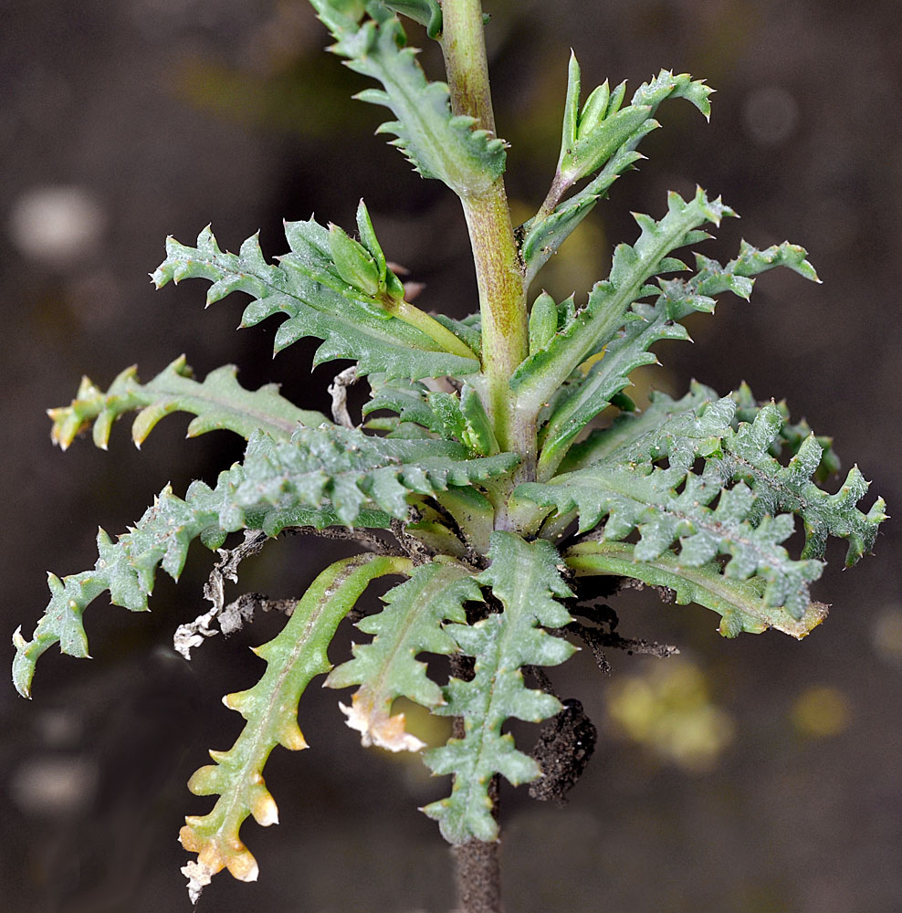
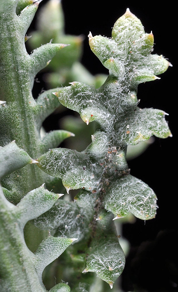
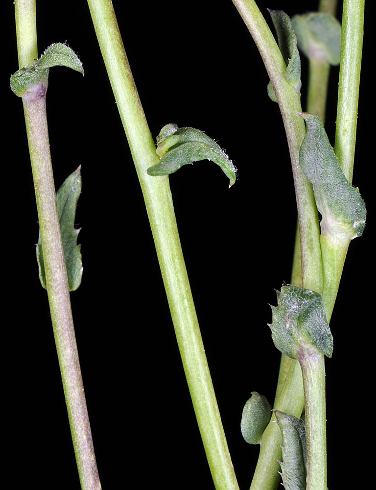
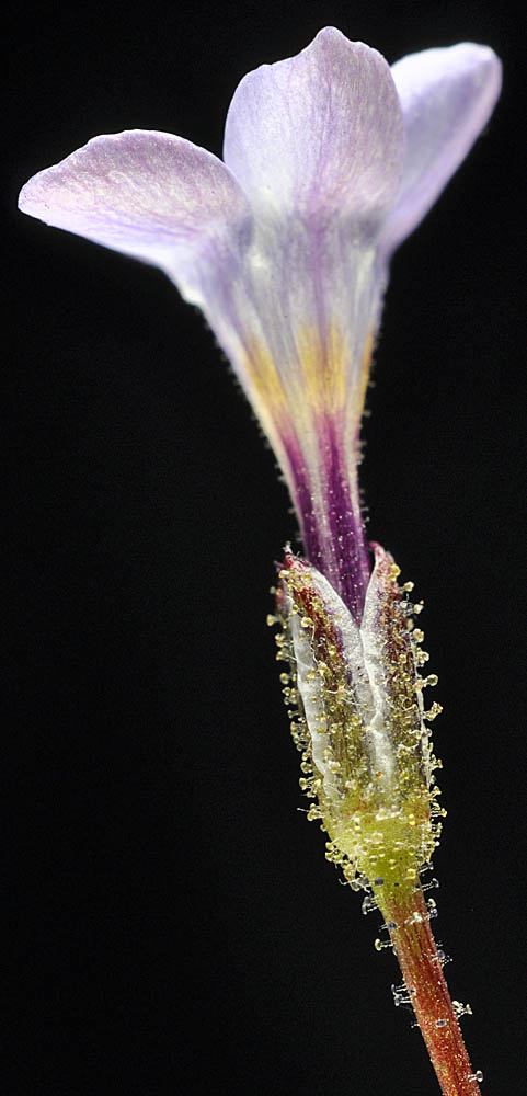
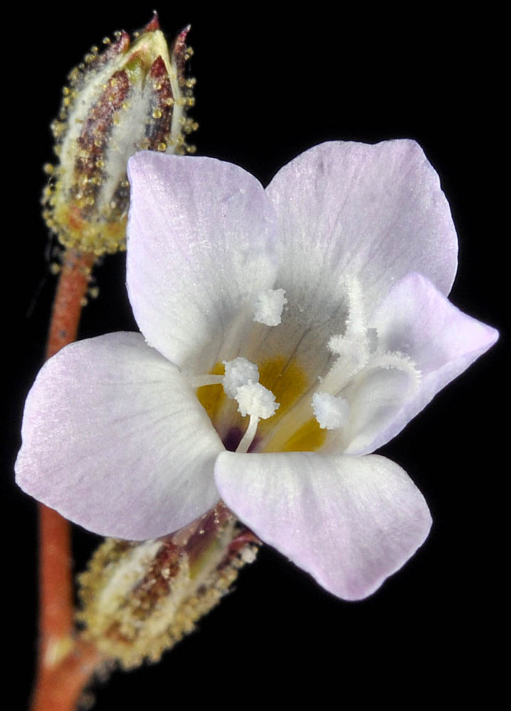
| Unnamed connecting rd. to Mickey Hot Springs, ca. 1.1 mi. E of Fields-Denio Rd., N42.66682, W118.43077, 4140 ft. elev., Harney Co., OR, 6/7/2011 | Unnamed connecting rd. to Mickey Hot Springs, ca. 1.1 mi. E of Fields-Denio Rd., N42.66682, W118.43077, 4140 ft. elev., Harney Co., OR, 6/7/2011 | Unnamed connecting rd. to Mickey Hot Springs, ca. 1.1 mi. E of Fields-Denio Rd., N42.66682, W118.43077, 4140 ft. elev., Harney Co., OR, 6/7/2011 | Unnamed connecting rd. to Mickey Hot Springs, ca. 1.1 mi. E of Fields-Denio Rd., N42.66682, W118.43077, 4140 ft. elev., Harney Co., OR, 6/7/2011 |
|
|
|
|
| Unnamed connecting rd. to Mickey Hot Springs, ca. 1.1 mi. E of Fields-Denio Rd., N42.66682, W118.43077, 4140 ft. elev., Harney Co., OR, 6/7/2011 | Unnamed connecting rd. to Mickey Hot Springs, ca. 1.1 mi. E of Fields-Denio Rd., N42.66682, W118.43077, 4140 ft. elev., Harney Co., OR, 6/7/2011 | Unnamed connecting rd. to Mickey Hot Springs, ca. 1.1 mi. E of Fields-Denio Rd., N42.66682, W118.43077, 4140 ft. elev., Harney Co., OR, 6/7/2011 |
 |
 |
 |
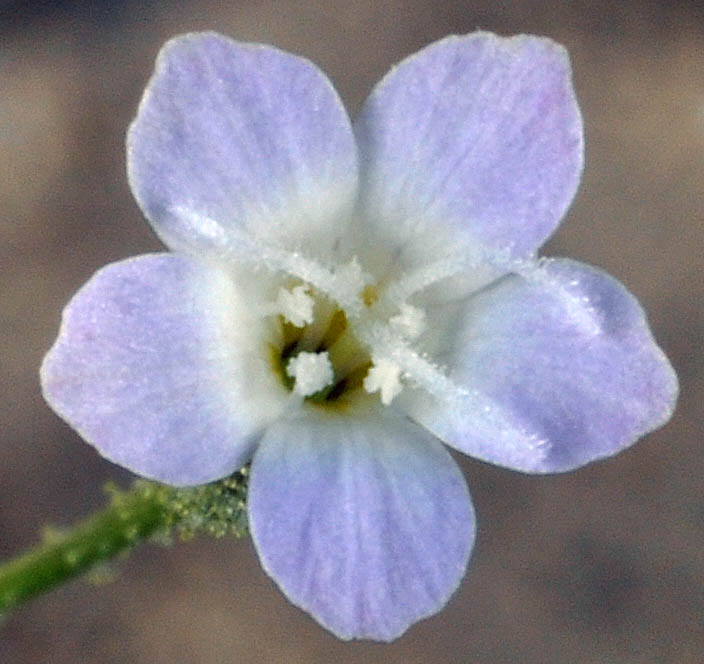
| Hwy 24, ca. 1 mi. NE of Vernita Bridge, SE of Mattawa, 550 ft. elev., N46.65188, W119.71817, Grant Co., WASHINGTON, 4/26/2010, © Robert L. Carr | Hwy 24, ca. 1 mi. NE of Vernita Bridge, SE of Mattawa, 550 ft. elev., N46.65188, W119.71817, Grant Co., WASHINGTON, 4/26/2010, © Robert L. Carr | Hwy 24, ca. 1 mi. NE of Vernita Bridge, SE of Mattawa, 550 ft. elev., N46.65188, W119.71817, Grant Co., WASHINGTON, 4/26/2010, © Robert L. Carr |
 |
 |
 |
| Hwy 24, ca. 1 mi. NE of Vernita Bridge, SE of Mattawa, 550 ft. elev., N46.65188, W119.71817, Grant Co., WASHINGTON, 4/26/2010, © Robert L. Carr | Hwy 24, ca. 1 mi. NE of Vernita Bridge, SE of Mattawa, 550 ft. elev., N46.65188, W119.71817, Grant Co., WASHINGTON, 4/26/2010, © Robert L. Carr | Hwy 24, ca. 1 mi. NE of Vernita Bridge, SE of Mattawa, 550 ft. elev., N46.65188, W119.71817, Grant Co., WASHINGTON, 4/26/2010, © Robert L. Carr | Hwy 24, ca. 1 mi. NE of Vernita Bridge, SE of Mattawa, 550 ft. elev., N46.65188, W119.71817, Grant Co., WASHINGTON, 4/26/2010, © Robert L. Carr |
 |
 |
 |
 |
| Hwy 24, ca. 1 mi. NE of Vernita Bridge, SE of Mattawa, 550 ft. elev., N46.65188, W119.71817, Grant Co., WASHINGTON, 4/26/2010, © Robert L. Carr | Hwy 24, ca. 1 mi. NE of Vernita Bridge, SE of Mattawa, 550 ft. elev., N46.65188, W119.71817, Grant Co., WASHINGTON, 4/26/2010, © Robert L. Carr | Hwy 24, ca. 1 mi. NE of Vernita Bridge, SE of Mattawa, 550 ft. elev., N46.65188, W119.71817, Grant Co., WASHINGTON, 4/26/2010, © Robert L. Carr |
 |
 |
 |
| Hwy 24, 0.9 mi. NE of Vernita Bridge (Columbia River), N46.65017, W119.72352, 470 ft. elev., Grant Co., WASHINGTON, 5/28/2009, © Robert L. Carr | Hwy 24, 0.9 mi. NE of Vernita Bridge (Columbia River), N46.65017, W119.72352, 470 ft. elev., Grant Co., WASHINGTON, 5/28/2009, © Robert L. Carr | Hwy 24, 0.9 mi. NE of Vernita Bridge (Columbia River), N46.65017, W119.72352, 470 ft. elev., Grant Co., WASHINGTON, 5/28/2009, © Robert L. Carr |
 |
 |
 |