


| Oregon Flora Image Project | |
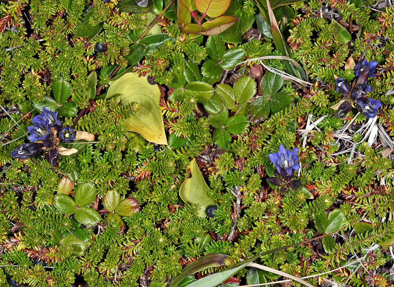
| Gentiana affinis Griseb. | prairie gentian - native Gentianaceae |
Click on an image for a larger version. All images © Gerald D. Carr unless otherwise noted.
| Dry meadow on W side of Godowa Springs Rd. (NFD Rd. 3462), 8.7 mi. N of Beatty, 1.3 air mi. W of Ponina Butte, 4900 ft. elev., N42.55845, W121.26465, Klamath Co., OR, 7/26/2015 | Dry meadow on W side of Godowa Springs Rd. (NFD Rd. 3462), 8.7 mi. N of Beatty, 1.3 air mi. W of Ponina Butte, 4900 ft. elev., N42.55845, W121.26465, Klamath Co., OR, 7/26/2015 | Dry meadow on W side of Godowa Springs Rd. (NFD Rd. 3462), 8.7 mi. N of Beatty, 1.3 air mi. W of Ponina Butte, 4900 ft. elev., N42.55845, W121.26465, Klamath Co., OR, 7/26/2015 | Otter Point State Recreation Site, 0.11 air mi. SW of parking area, 97 ft. elev., n42.46328, W124.42403, Curry Co., OR, 6/25/2017 |
|
|
|
|
| Otter Point State Recreation Site, 0.11 air mi. SW of parking area, 97 ft. elev., n42.46328, W124.42403, Curry Co., OR, 6/25/2017 | Otter Point State Recreation Site, 0.11 air mi. SW of parking area, 97 ft. elev., n42.46328, W124.42403, Curry Co., OR, 6/25/2017 | Otter Point State Recreation Site, 0.11 air mi. SW of parking area, 97 ft. elev., n42.46328, W124.42403, Curry Co., OR, 6/25/2017 | Vic. intersection of S. Ritchey Rd. and Cheney-Tyler Hwy. (904), ca. 7 mi. SW of Cheney, Spokane Co., WASHINGTON, 9/2/2007 |
 |
 |
 |
 |
| Vic. intersection of S. Ritchey Rd. and Cheney-Tyler Hwy. (904), ca. 7 mi. SW of Cheney, Spokane Co., WASHINGTON, 9/2/2007 | Vic. intersection of S. Ritchey Rd. and Cheney-Tyler Hwy. (904), ca. 7 mi. SW of Cheney, Spokane Co., WASHINGTON, 9/2/2007 | Vic. intersection of S. Ritchey Rd. and Cheney-Tyler Hwy. (904), ca. 7 mi. SW of Cheney, Spokane Co., WASHINGTON, 9/2/2007 | Vic. intersection of S. Ritchey Rd. and Cheney-Tyler Hwy. (904), ca. 7 mi. SW of Cheney, Spokane Co., WASHINGTON, 9/2/2007 |
 |
 |
 |
 |