


| Oregon Flora Image Project | |
| Eriogonum nudum Douglas ex Benth. | [see var.] -
native Polygonaceae |
Click on an image for a larger version. All images © Gerald D. Carr unless otherwise noted.
| var. nudum | barestem buckwheat |
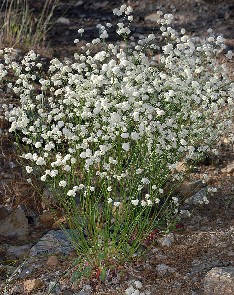
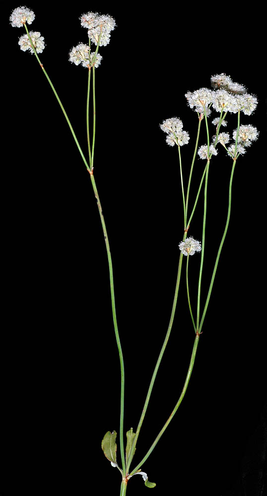
| Between Metolius Springs and Camp Sherman, Jefferson Co., OR, 7/7/2006 | NFD Rd. 4713, 0.6 mi. SE of North Umpqua Hwy (SR138), SE of Steamboat, N43.33275, W122.70485, ca. 1450 ft. elev., Douglas Co., OR, 7/14/2008 | Iron Mountain Trail, 4700-5400 ft. elev., Linn Co., OR, 7/7/2006 |
|
|
|
| NFD Rd. 4201, N side of Illinois R. crossing, SW of $8 Mt., N42.24628, W123.68883, Josephine Co., OR, 6/13/2008 | NFD Rd. 4201, N side of Illinois R. crossing, SW of $8 Mt., N42.24628, W123.68883, Josephine Co., OR, 6/13/2008 | NFD Rd. 4201, N side of Illinois R. crossing, SW of $8 Mt., N42.24628, W123.68883, Josephine Co., OR, 6/13/2008 |
 |
 |
 |
| Marys Peak Rd., ca. 2920 ft. elev., N44.50077, W123.56120, Benton Co., OR, 7/25/2007 | Marys Peak Rd., ca. 2920 ft. elev., N44.50077, W123.56120, Benton Co., OR, 7/25/2007 | Marys Peak Rd., ca. 2920 ft. elev., N44.50077, W123.56120, Benton Co., OR, 7/25/2007 |
 |
 |
 |
| var. oblongifolium S. Watson | naked buckwheat |
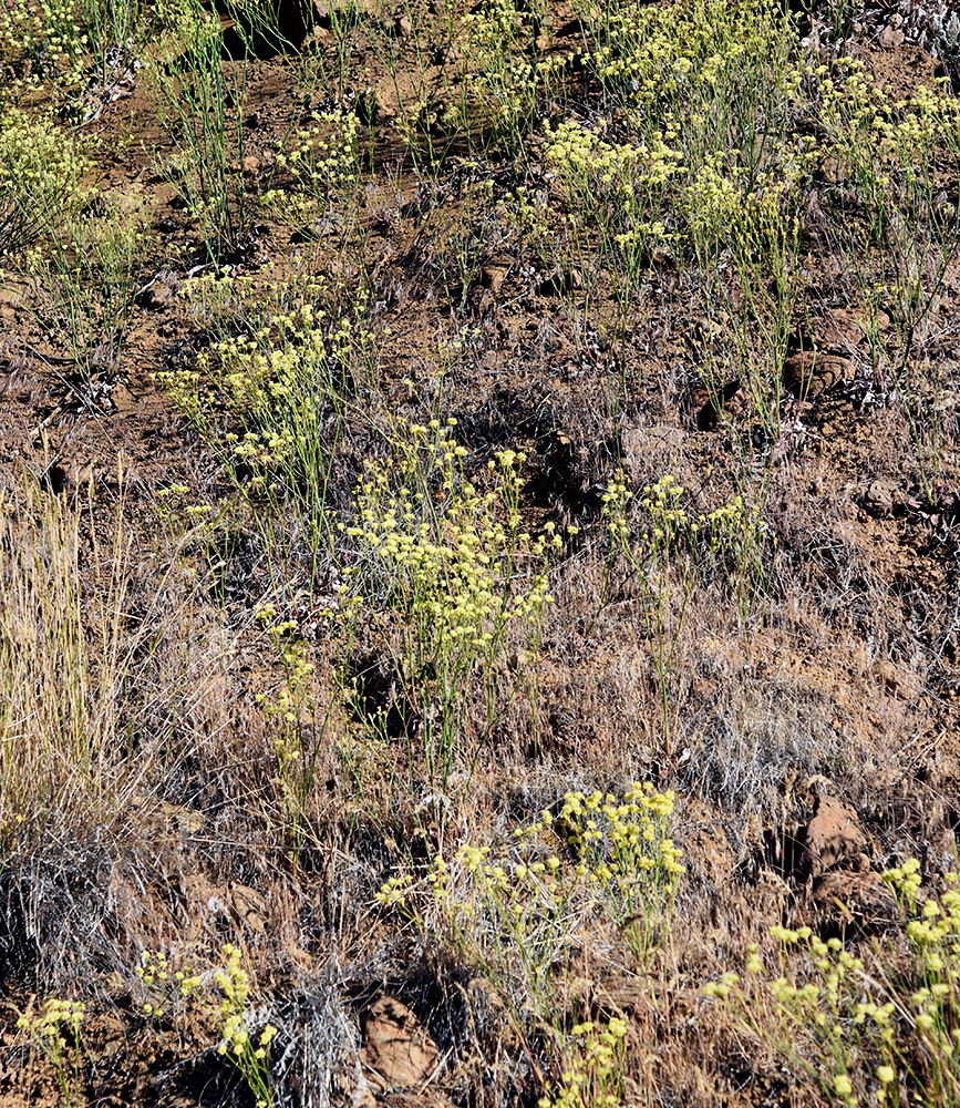
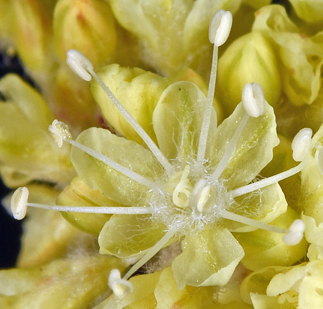
| Gravel pit E off Highland Ave, just NE of I-5 rest area at MP63, N of Grants Pass, 1422 ft. elev., N42.52304, W123.35828, Josephine Co., OR, 5/15/2013 | Gravel pit E off Highland Ave, just NE of I-5 rest area at MP63, N of Grants Pass, 1422 ft. elev., N42.52304, W123.35828, Josephine Co., OR, 5/15/2013 | ||
 |
 |
| Gravel pit E off Highland Ave, just NE of I-5 rest area at MP63, N of Grants Pass, 1422 ft. elev., N42.52304, W123.35828, Josephine Co., OR, 5/15/2013 | Gravel pit E off Highland Ave, just NE of I-5 rest area at MP63, N of Grants Pass, 1422 ft. elev., N42.52304, W123.35828, Josephine Co., OR, 5/15/2013 | Gravel pit E off Highland Ave, just NE of I-5 rest area at MP63, N of Grants Pass, 1422 ft. elev., N42.52304, W123.35828, Josephine Co., OR, 5/15/2013 |
 |
 |
 |
| Gravel pit E off Highland Ave, just NE of I-5 rest area at MP63, N of Grants Pass, 1422 ft. elev., N42.52304, W123.35828, Josephine Co., OR, 5/15/2013 | ||
 |
| var. pubiflorum Benth. | Fremont's wild buckwheat |
| N side of Hwy 140, 9.7 mi. WNW of Adel, 5355 ft. elev., N42.21489, W120.05841, Lake Co. OR, 7/3/2018 | N side of Hwy 140, 9.7 mi. WNW of Adel, 5355 ft. elev., N42.21489, W120.05841, Lake Co. OR, 7/3/2018 | N side of Hwy 140, 9.7 mi. WNW of Adel, 5355 ft. elev., N42.21489, W120.05841, Lake Co. OR, 7/3/2018 | N side of Hwy 140, 9.7 mi. WNW of Adel, 5355 ft. elev., N42.21489, W120.05841, Lake Co. OR, 7/3/2018 |
 |
 |
 |
 |
| N side of Hwy 140, 9.7 mi. WNW of Adel, 5355 ft. elev., N42.21489, W120.05841, Lake Co. OR, 7/3/2018 | N side of Hwy 140, 9.7 mi. WNW of Adel, 5355 ft. elev., N42.21489, W120.05841, Lake Co. OR, 7/3/2018 | ||
 |
 |
| N side of Hwy 140, 9.7 mi. WNW of Adel, 5355 ft. elev., N42.21489, W120.05841, Lake Co. OR, 7/3/2018 | S shoulder of entrance rd. to Warner Canyon Ski Area, just off Hwy 140, 5720 ft. elev., N42.23768, W120.29529, Lake Co., OR, 7/3/2018 | S shoulder of entrance rd. to Warner Canyon Ski Area, just off Hwy 140, 5720 ft. elev., N42.23768, W120.29529, Lake Co., OR, 7/3/2018 |
 |
 |
 |
| S shoulder of entrance rd. to Warner Canyon Ski Area, just off Hwy 140, 5720 ft. elev., N42.23768, W120.29529, Lake Co., OR, 7/3/2018 | S shoulder of entrance rd. to Warner Canyon Ski Area, just off Hwy 140, 5720 ft. elev., N42.23768, W120.29529, Lake Co., OR, 7/3/2018 | S shoulder of entrance rd. to Warner Canyon Ski Area, just off Hwy 140, 5720 ft. elev., N42.23768, W120.29529, Lake Co., OR, 7/3/2018 |
 |
 |
 |