


| Oregon Flora Image Project | |
| Eremogone aculeata (S. Watson) Ikonnikov | prickly sandwort - native Caryophyllaceae |
Click on an image for a larger version. All images © Gerald D. Carr unless otherwise noted.
| Mt. Howard, meadow just above (SE) of tram terminus, 8170 ft. elev., N45.26242, W117.17919, Wallowa Co., OR, 7/26/2010 | Mt. Howard, meadow just above (SE) of tram terminus, 8170 ft. elev., N45.26242, W117.17919, Wallowa Co., OR, 7/26/2010 (© Robert L. Carr) | Mt. Howard, meadow just above (SE) of tram terminus, 8170 ft. elev., N45.26242, W117.17919, Wallowa Co., OR, 7/26/2010 |
|
|
|
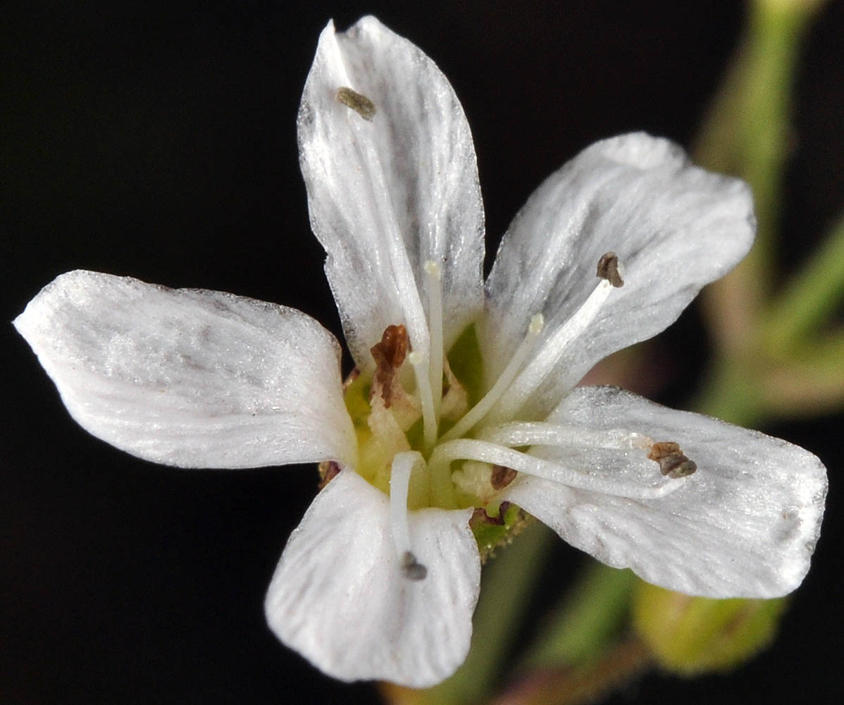
| Mt. Howard, meadow just above (SE) of tram terminus, 8170 ft. elev., N45.26242, W117.17919, Wallowa Co., OR, 7/26/2010 | Mt. Howard, meadow just above (SE) of tram terminus, 8170 ft. elev., N45.26242, W117.17919, Wallowa Co., OR, 7/26/2010 | Mt. Howard, meadow just above (SE) of tram terminus, 8170 ft. elev., N45.26242, W117.17919, Wallowa Co., OR, 7/26/2010 | Mt. Howard, meadow just above (SE) of tram terminus, 8170 ft. elev., N45.26242, W117.17919, Wallowa Co., OR, 7/26/2010 |
 |
 |
 |
 |
| Mt. Howard, meadow just above (SE) of tram terminus, 8170 ft. elev., N45.26242, W117.17919, Wallowa Co., OR, 7/26/2010 | Mt. Howard, meadow just above (SE) of tram terminus, 8170 ft. elev., N45.26242, W117.17919, Wallowa Co., OR, 7/26/2010 | Mt. Howard, meadow just above (SE) of tram terminus, 8170 ft. elev., N45.26242, W117.17919, Wallowa Co., OR, 7/26/2010 |
 |
 |
 |
| Kiger Creek Overlook, 0.4 mi. N of Steens Mt. Rd., 5.9 mi. SE of Fish Lake, 22.7 mi. SE of Frenchglen, 8900 ft. elev., N42.70867, W118.57535, Harney Co., OR, 9/20/2009 | Kiger Creek Overlook, 0.4 mi. N of Steens Mt. Rd., 5.9 mi. SE of Fish Lake, 22.7 mi. SE of Frenchglen, 8900 ft. elev., N42.70867, W118.57535, Harney Co., OR, 9/20/2009 | Kiger Creek Overlook, 0.4 mi. N of Steens Mt. Rd., 5.9 mi. SE of Fish Lake, 22.7 mi. SE of Frenchglen, 8900 ft. elev., N42.70867, W118.57535, Harney Co., OR, 9/20/2009 | Kiger Creek Overlook, 0.4 mi. N of Steens Mt. Rd., 5.9 mi. SE of Fish Lake, 22.7 mi. SE of Frenchglen, 8900 ft. elev., N42.70867, W118.57535, Harney Co., OR, 9/20/2009 |
 |
 |
 |
 |
| Kiger Creek Overlook, 0.4 mi. N of Steens Mt. Rd., 5.9 mi. SE of Fish Lake, 22.7 mi. SE of Frenchglen, 8900 ft. elev., N42.70867, W118.57535, Harney Co., OR, 9/20/2009 | Steens Mountain Loop Rd., 21.1 mi. ESE of Frenchglen, N42.70074, W118.59363, 8530 ft. elev., Harney Co., OR, 9/2/2011 | Steens Mountain Loop Rd., 21.1 mi. ESE of Frenchglen, N42.70074, W118.59363, 8530 ft. elev., Harney Co., OR, 9/2/2011 |
 |
 |
 |