

| Oregon Flora Image Project | |
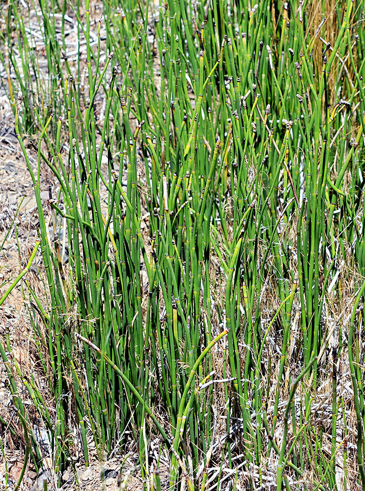
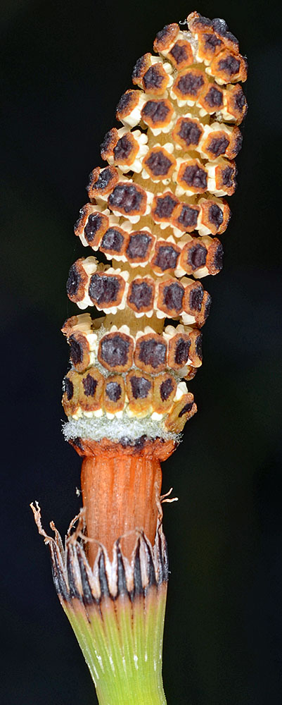
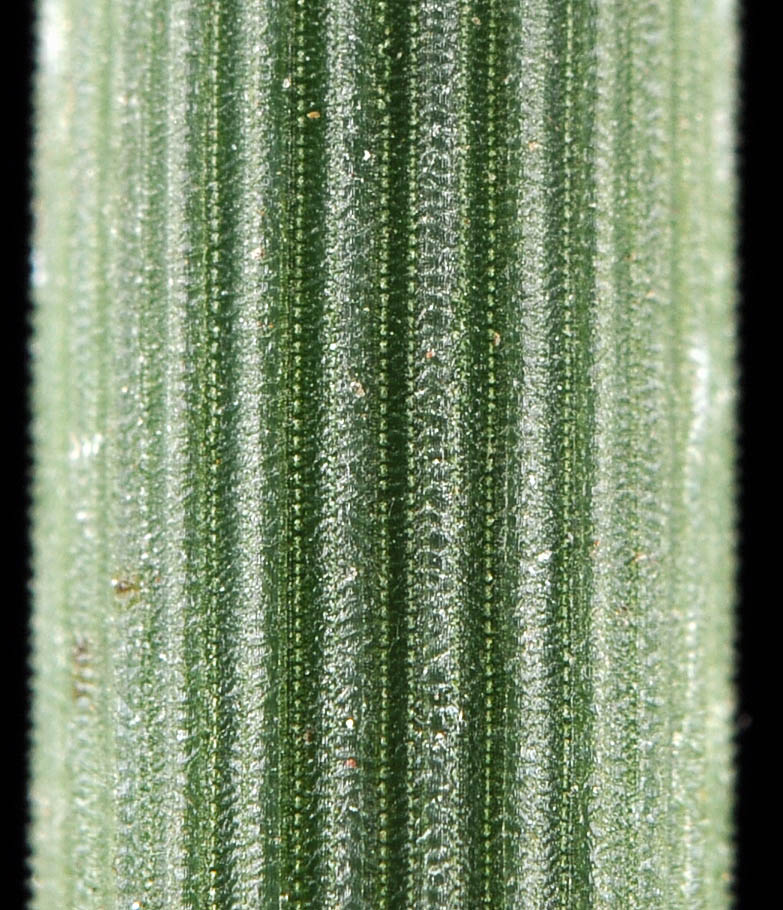
| Equisetum laevigatum A. Br. | smooth scouring rush - native Equisetaceae |
Click on an image for a larger version. All images © Gerald D. Carr unless otherwise noted.
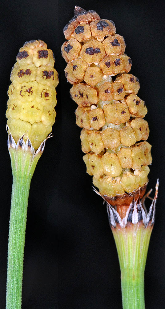
| off Hwy. 26, ca. 27 mi. E of Prineville, at jct.with N.F. Rd. 2630, Marks Creek Sno Park, 4425 ft. elev., N44.48076, W120.40393, Crook Co., OR, 6/30/2016 [Halse 9782] | Ochoco Creek Rd., 5.2 mi. NE of jct. with Hwy 26, ENE of Prineville, 3730 ft. elev., N44.36989, W120.47087, Crook Co., OR, 7/11/2013 | Ochoco Creek Rd., 5.2 mi. NE of jct. with Hwy 26, ENE of Prineville, 3730 ft. elev., N44.36989, W120.47087, Crook Co., OR, 7/11/2013 | Ochoco Creek Rd., 5.2 mi. NE of jct. with Hwy 26, ENE of Prineville, 3730 ft. elev., N44.36989, W120.47087, Crook Co., OR, 7/11/2013 |
|
|
|
|
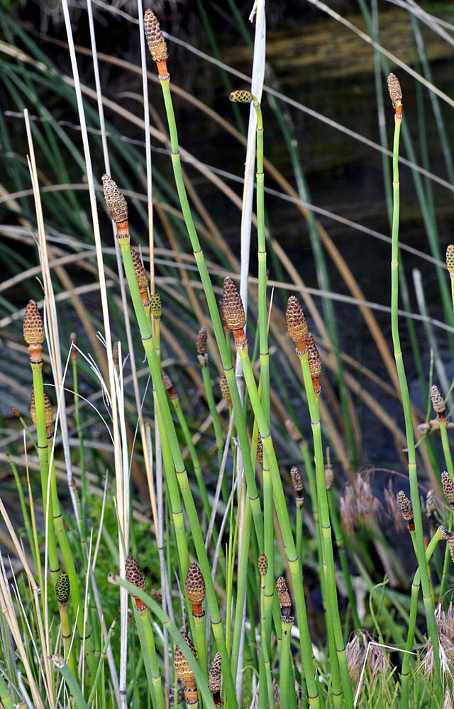
| Steptoe Canyon Rd., 0.1 mi. S of Rimrock Rd., 2.3 mi. SW of Hwy 195 at Colton, 2780 ft. elev., N46.54987, W117.16537, Whitman Co., WASHINGTON, 7/24/2010 | Steptoe Canyon Rd., 0.1 mi. S of Rimrock Rd., 2.3 mi. SW of Hwy 195 at Colton, 2780 ft. elev., N46.54987, W117.16537, Whitman Co., WASHINGTON, 7/24/2010 | Steptoe Canyon Rd., 0.1 mi. S of Rimrock Rd., 2.3 mi. SW of Hwy 195 at Colton, 2780 ft. elev., N46.54987, W117.16537, Whitman Co., WASHINGTON, 7/24/2010 | Steptoe Canyon Rd., 0.1 mi. S of Rimrock Rd., 2.3 mi. SW of Hwy 195 at Colton, 2780 ft. elev., N46.54987, W117.16537, Whitman Co., WASHINGTON, 7/24/2010 |
 |
 |
 |
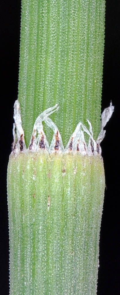 |
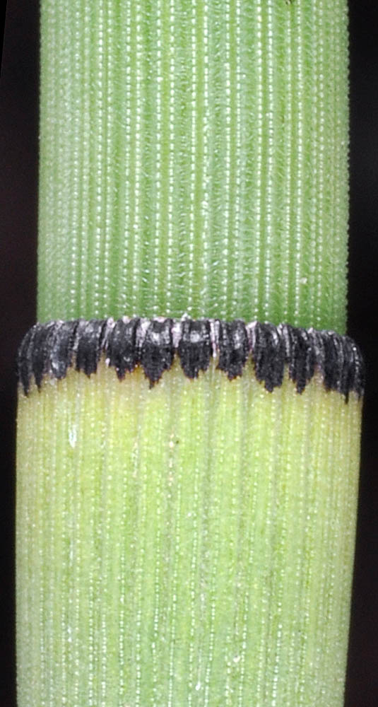
| Steptoe Canyon Rd., 0.1 mi. S of Rimrock Rd., 2.3 mi. SW of Hwy 195 at Colton, 2780 ft. elev., N46.54987, W117.16537, Whitman Co., WASHINGTON, 7/24/2010 | Steptoe Canyon Rd., 0.1 mi. S of Rimrock Rd., 2.3 mi. SW of Hwy 195 at Colton, 2780 ft. elev., N46.54987, W117.16537, Whitman Co., WASHINGTON, 7/24/2010 | Along Hwy 22, 6.8 mi. SE of jct. with Hwy 97 at Toppenish, 700 ft. elev., N46.30840, W120.20711, Yakima Co., WASHINGTON, 5/30/2010 (© Robert L. Carr) | Along Hwy 22, 6.8 mi. SE of jct. with Hwy 97 at Toppenish, 700 ft. elev., N46.30840, W120.20711, Yakima Co., WASHINGTON, 5/30/2010 (© Robert L. Carr) | Along Hwy 22, 6.8 mi. SE of jct. with Hwy 97 at Toppenish, 700 ft. elev., N46.30840, W120.20711, Yakima Co., WASHINGTON, 5/30/2010 (© Robert L. Carr) |
 |
 |
 |
 |
 |
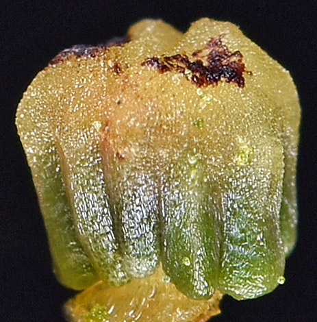
| Along Lamont Rd., 0.63 mi. SW of Hwy 23. NE edge of Lamont, 1961 ft. elev., N47.20524, W117.90172, Whitman Co., WASHINGTON, 5/23/2018, © Robert L. Carr | Along Lamont Rd., 0.63 mi. SW of Hwy 23. NE edge of Lamont, 1961 ft. elev., N47.20524, W117.90172, Whitman Co., WASHINGTON, 5/23/2018, © Robert L. Carr | Along Lamont Rd., 0.63 mi. SW of Hwy 23. NE edge of Lamont, 1961 ft. elev., N47.20524, W117.90172, Whitman Co., WASHINGTON, 5/23/2018, © Robert L. Carr |
 |
 |
 |