

| Oregon Flora Image Project | |
| Cymopterus terebinthinus (Hook.) Torrey & A. Gray | [see var.] - native Apiaceae |
Click on an image for a larger version. All images © Gerald D. Carr unless otherwise noted.
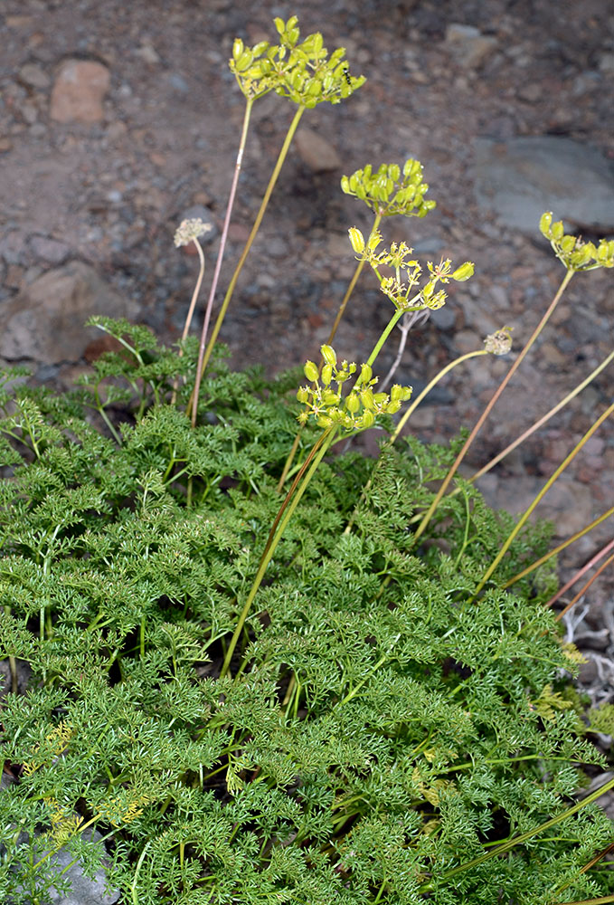
| var. foeniculaceus (Torrey & A. Gray) Cronquist | fennel spring parsley |
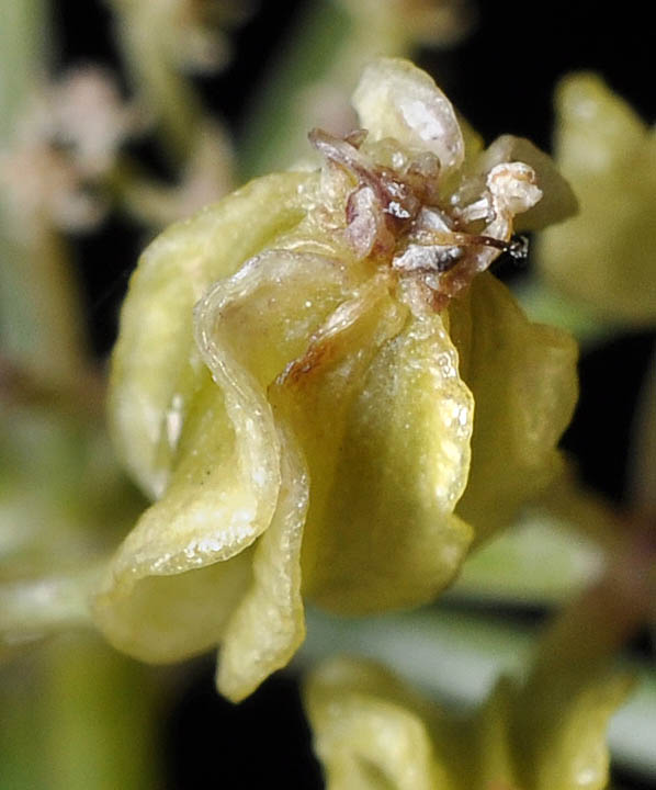
| NFD Rd. 1640 (vic. Roads end at Strawberry Mt. Wilderness), 10 mi. N of jct. with NFD Rd. 16, NE of Seneca, 7975 ft. elev., N44.27707, W118.69857, Grant Co., OR, 8/1/2013 | NFD Rd. 1640 (vic. Roads end at Strawberry Mt. Wilderness), 10 mi. N of jct. with NFD Rd. 16, NE of Seneca, 7975 ft. elev., N44.27707, W118.69857, Grant Co., OR, 8/1/2013 | NFD Rd. 1640 (vic. Roads end at Strawberry Mt. Wilderness), 10 mi. N of jct. with NFD Rd. 16, NE of Seneca, 7975 ft. elev., N44.27707, W118.69857, Grant Co., OR, 8/1/2013 |
|
|
|
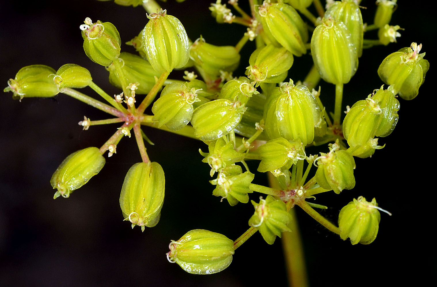
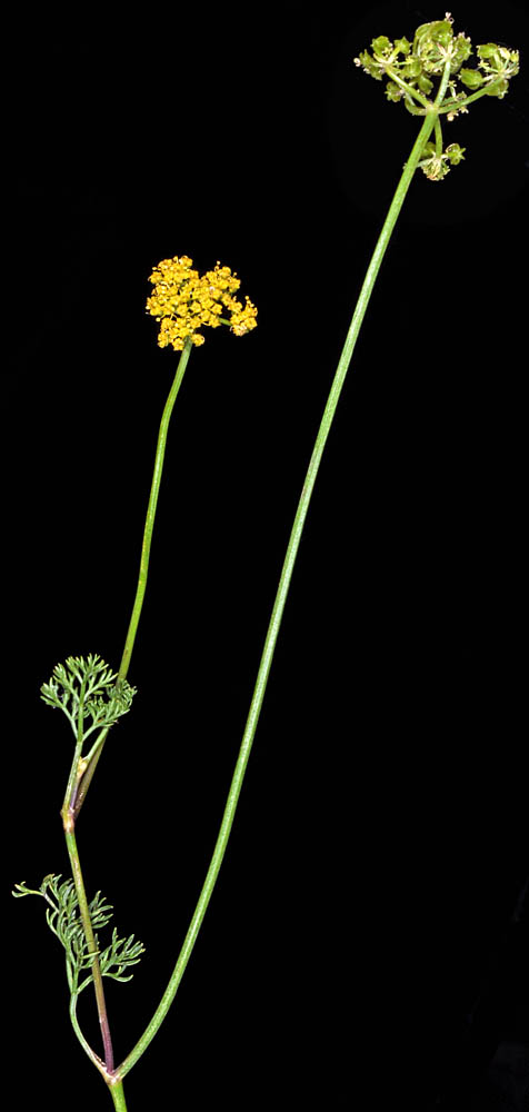
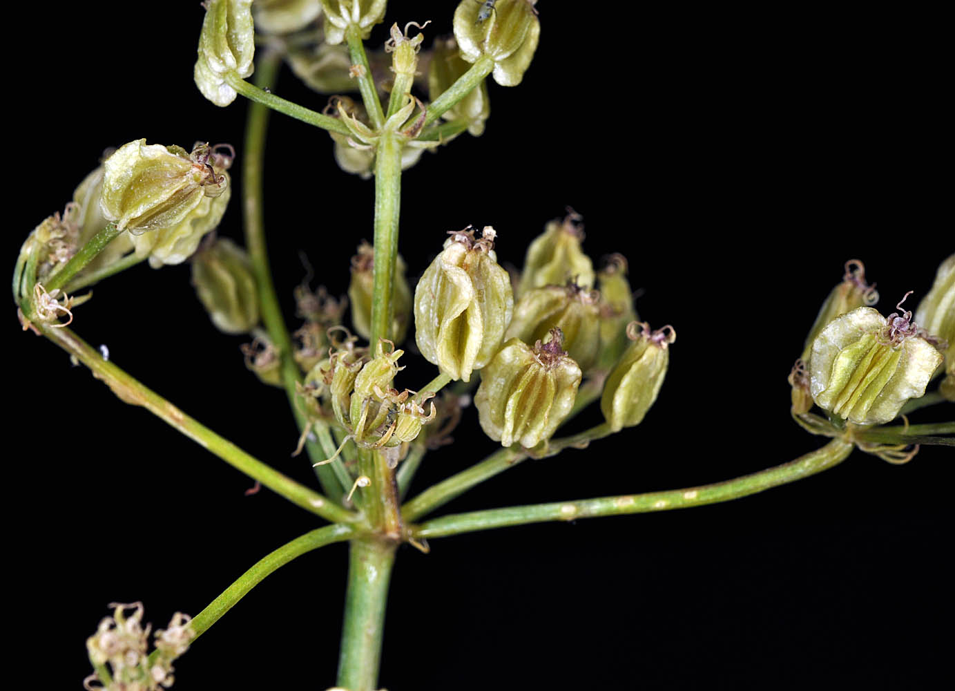
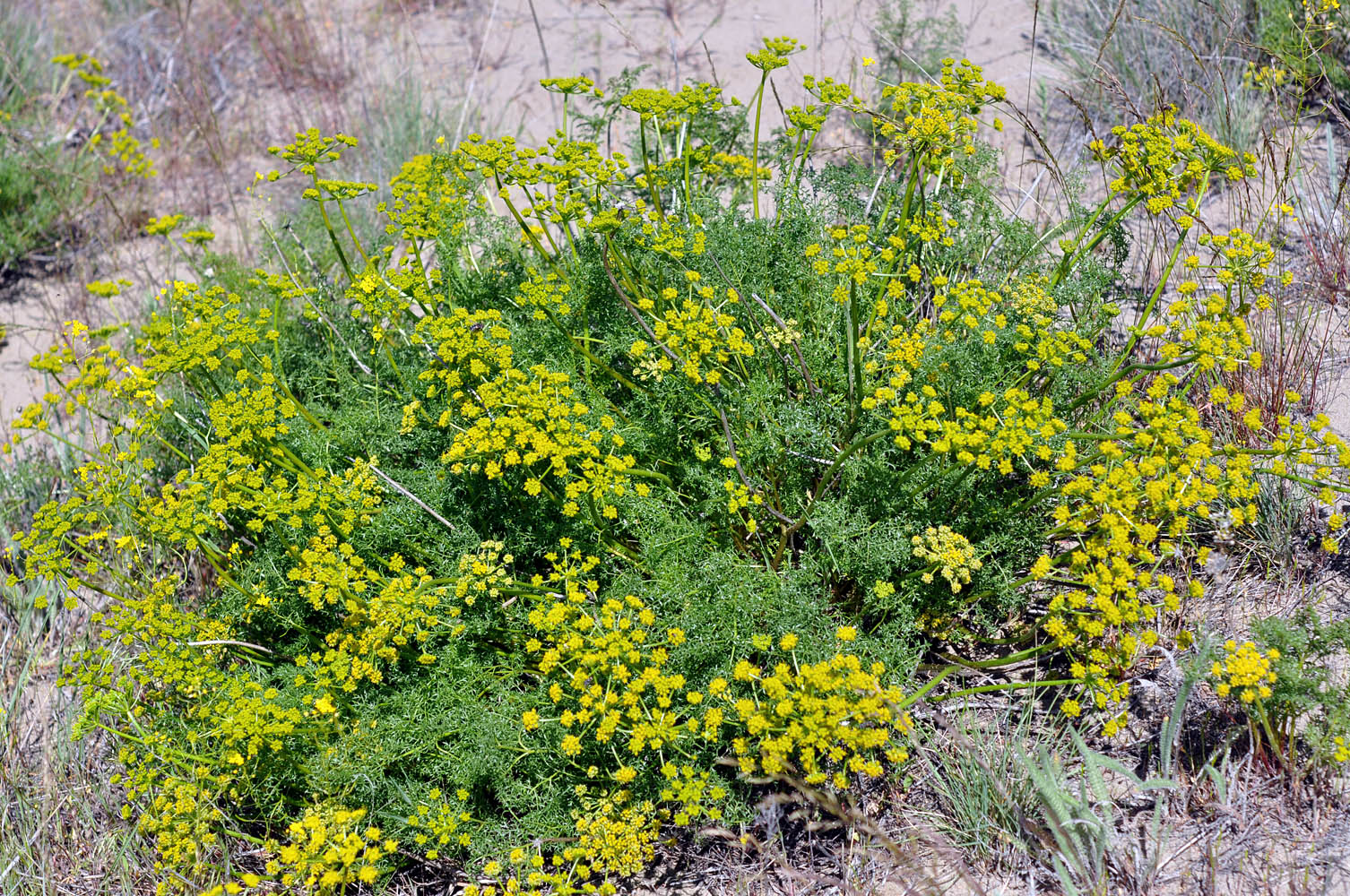
| NFD Rd. 1640 (vic. Roads end at Strawberry Mt. Wilderness), 10 mi. N of jct. with NFD Rd. 16, NE of Seneca, 7975 ft. elev., N44.27707, W118.69857, Grant Co., OR, 8/1/2013 | SR 207, 6.0 mi. N of jct. with Hwy 26, N of Mitchell, 3525 ft. elev., N44.62885, W120.10759, Wheeler Co., OR, 7/6/2010 | SR 207, 6.0 mi. N of jct. with Hwy 26, N of Mitchell, 3525 ft. elev., N44.62885, W120.10759, Wheeler Co., OR, 7/6/2010 | SR 207, 6.0 mi. N of jct. with Hwy 26, N of Mitchell, 3525 ft. elev., N44.62885, W120.10759, Wheeler Co., OR, 7/6/2010 |
 |
 |
 |
 |
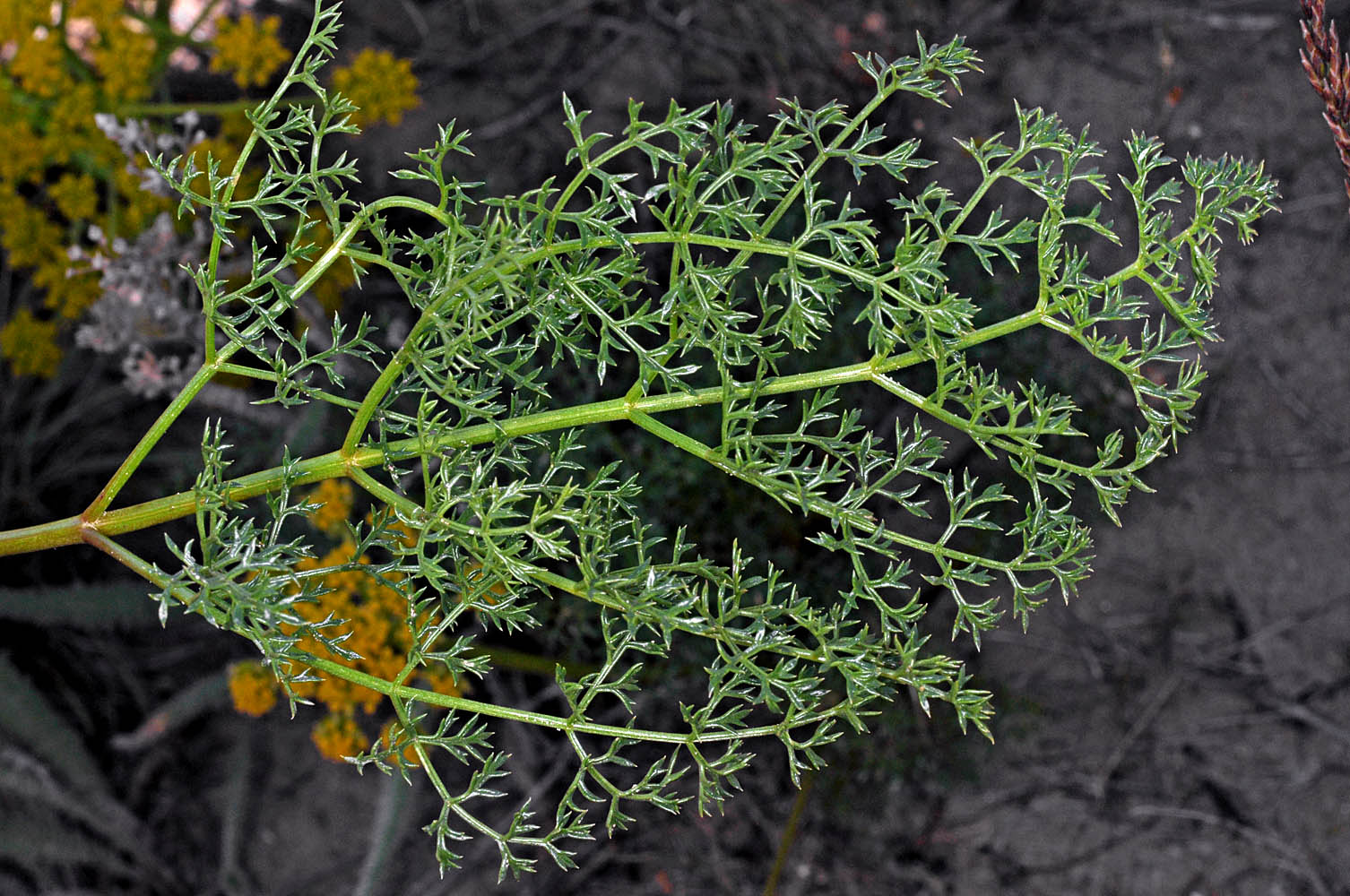
| SR 207, 6.0 mi. N of jct. with Hwy 26, N of Mitchell, 3525 ft. elev., N44.62885, W120.10759, Wheeler Co., OR, 7/6/2010 | SR 207, 6.0 mi. N of jct. with Hwy 26, N of Mitchell, 3525 ft. elev., N44.62885, W120.10759, Wheeler Co., OR, 7/6/2010 | SR 207, 6.0 mi. N of jct. with Hwy 26, N of Mitchell, 3525 ft. elev., N44.62885, W120.10759, Wheeler Co., OR, 7/6/2010 |
 |
 |
 |
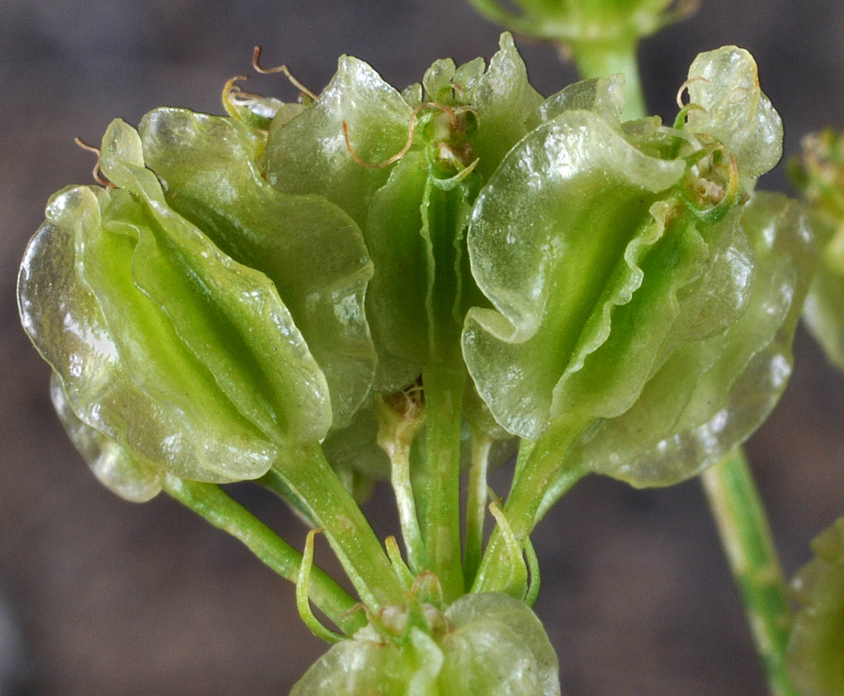
| var. terebinthinus | aromatic spring parsley |
| W of Rd. 100 and N of I-182, W of Pasco, Franklin Co., WASHINGTON, 4/6/2010, © Robert L. Carr | Juniper Dunes Wilderness Area, S end of Joy Rd., NE of Pasco, 850 ft. elev., N46.4268, W118.8252, Franklin Co., WASHINGTON, 4/22/2010, © Robert L. Carr | ||
 |
 |
| W of Rd. 100 and N of I-182, W of Pasco, Franklin Co., WASHINGTON, 4/6/2010, © Robert L. Carr | Juniper Dunes Wilderness Area, S end of Joy Rd., NE of Pasco, 850 ft. elev., N46.4268, W118.8252, Franklin Co., WASHINGTON, 4/22/2010, © Robert L. Carr | Juniper Dunes Wilderness Area, S end of Joy Rd., NE of Pasco, 850 ft. elev., N46.4268, W118.8252, Franklin Co., WASHINGTON, 4/22/2010, © Robert L. Carr |
 |
 |
 |
| W of Rd. 100 and N of I-182, W of Pasco, Franklin Co., WASHINGTON, 4/6/2010, © Robert L. Carr | Juniper Dunes Wilderness Area, S end of Joy Rd., NE of Pasco, 850 ft. elev., N46.4268, W118.8252, Franklin Co., WASHINGTON, 4/22/2010, © Robert L. Carr | ||
 |
 |
| Just N of Railway along Hwy 22, 7.6 mi. NW of Mabton, 670 ft., N46.26851, W120.13195, Yakima Co., WASHINGTON, 5/30/2010, © Robert L. Carr | Off Harris Rd., near jct. with Broadmoor Blvd., W of Pasco, 456 ft. elev., N46.27830, W119.22452, Franklin Co., WASHINGTON, 5/16/2009, © Robert L. Carr | Hwy 24, 2.1 mi. NE of Vernita Bridge (Columbia River), 560 ft. elev., N46.65742, W119.70212, Grant Co., WASHINGTON, 5/28/2009, © Robert L. Carr |
 |
 |
 |