

| Oregon Flora Image Project | |
| Cryptantha simulans Greene | pinewoods cryptantha - native Boraginaceae |
Click on an image for a larger version. All images © Gerald D. Carr unless otherwise noted.
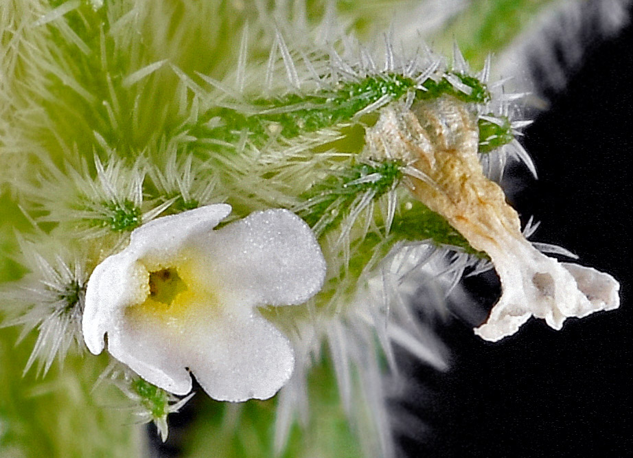
| Mt. Ashland Ski Rd., 0.2 mi. NW of jct. with Colestin Rd., of I-5, ca. 9 mi. S of Ashland, 4543 ft. elev., N42.07397, W122.61916, Jackson Co., OR, 6/20/2017 | Mt. Ashland Ski Rd., 0.2 mi. NW of jct. with Colestin Rd., of I-5, ca. 9 mi. S of Ashland, 4543 ft. elev., N42.07397, W122.61916, Jackson Co., OR, 6/20/2017 | Mt. Ashland Ski Rd., 0.2 mi. NW of jct. with Colestin Rd., of I-5, ca. 9 mi. S of Ashland, 4543 ft. elev., N42.07397, W122.61916, Jackson Co., OR, 6/20/2017 |
|
|
|
| Mt. Ashland Ski Rd., 0.2 mi. NW of jct. with Colestin Rd., of I-5, ca. 9 mi. S of Ashland, 4543 ft. elev., N42.07397, W122.61916, Jackson Co., OR, 6/20/2017 | Mt. Ashland Ski Rd., 0.2 mi. NW of jct. with Colestin Rd., of I-5, ca. 9 mi. S of Ashland, 4543 ft. elev., N42.07397, W122.61916, Jackson Co., OR, 6/20/2017 | Mt. Ashland Ski Rd., 0.2 mi. NW of jct. with Colestin Rd., of I-5, ca. 9 mi. S of Ashland, 4543 ft. elev., N42.07397, W122.61916, Jackson Co., OR, 6/20/2017 |
 |
 |
 |
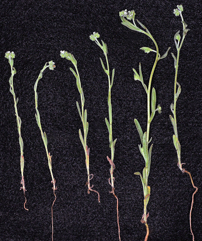
| Colockum Rd., 9.9 mi. NE of jct. with Gage Rd., NE of Ellensburg, 5009 ft. elev., N47.17319, W120.28663, Kittitas Co., WASHINGTON, 6/20/2013, © Robert L. Carr 2013 | Colockum Rd., 9.9 mi. NE of jct. with Gage Rd., NE of Ellensburg, 5009 ft. elev., N47.17319, W120.28663, Kittitas Co., WASHINGTON, 6/20/2013, © Robert L. Carr 2013 | Colockum Rd., 9.9 mi. NE of jct. with Gage Rd., NE of Ellensburg, 5009 ft. elev., N47.17319, W120.28663, Kittitas Co., WASHINGTON, 6/20/2013, © Robert L. Carr 2013 | Colockum Rd., 9.9 mi. NE of jct. with Gage Rd., NE of Ellensburg, 5009 ft. elev., N47.17319, W120.28663, Kittitas Co., WASHINGTON, 6/20/2013, © Robert L. Carr 2013 |
 |
 |
 |
 |
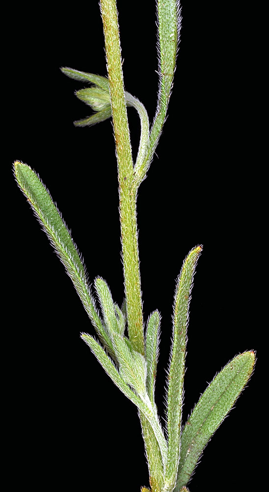
| Colockum Rd., 9.9 mi. NE of jct. with Gage Rd., NE of Ellensburg, 5009 ft. elev., N47.17319, W120.28663, Kittitas Co., WASHINGTON, 6/20/2013, © Robert L. Carr 2013 | Colockum Rd., 9.9 mi. NE of jct. with Gage Rd., NE of Ellensburg, 5009 ft. elev., N47.17319, W120.28663, Kittitas Co., WASHINGTON, 6/20/2013, © Robert L. Carr 2013 | Colockum Rd., 9.9 mi. NE of jct. with Gage Rd., NE of Ellensburg, 5009 ft. elev., N47.17319, W120.28663, Kittitas Co., WASHINGTON, 6/20/2013, © Robert L. Carr 2013 |
 |
 |
 |
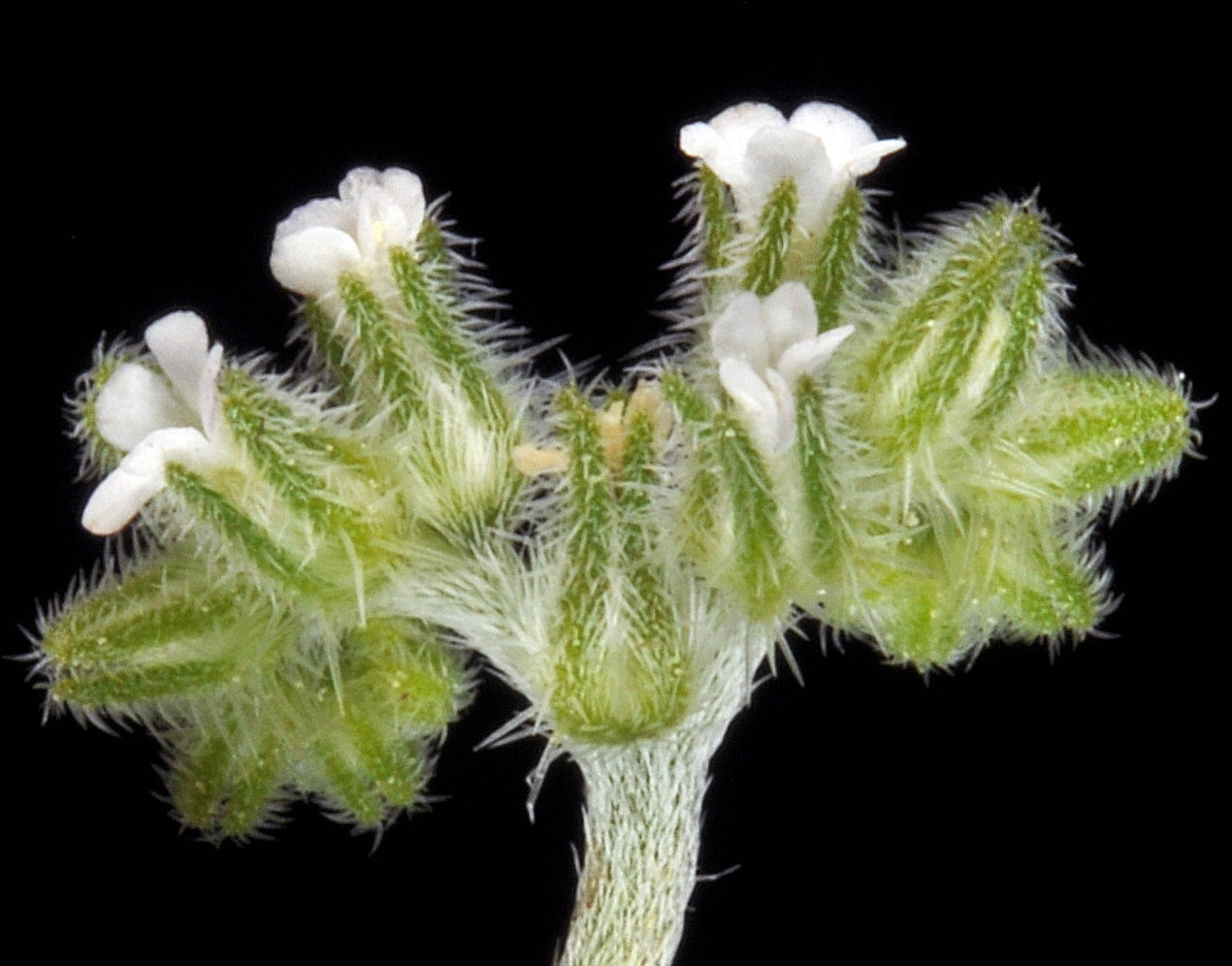
| Along the trail between Trout & Emerald Lakes, N of Hwy 20, ca. 9 air mi. WNW of Kettle Falls, Ferry Co., WASHINGTON, 6/11/2011, © Robert L. Carr | Along the trail between Trout & Emerald Lakes, N of Hwy 20, ca. 9 air mi. WNW of Kettle Falls, Ferry Co., WASHINGTON, 6/11/2011, © Robert L. Carr | Along the trail between Trout & Emerald Lakes, N of Hwy 20, ca. 9 air mi. WNW of Kettle Falls, Ferry Co., WASHINGTON, 6/11/2011, © Robert L. Carr |
 |
 |
 |
| Along the trail between Trout & Emerald Lakes, N of Hwy 20, ca. 9 air mi. WNW of Kettle Falls, Ferry Co., WASHINGTON, 6/11/2011, © Robert L. Carr | ||
 |