
| Oregon Flora Image Project | |
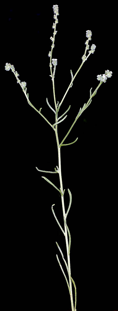
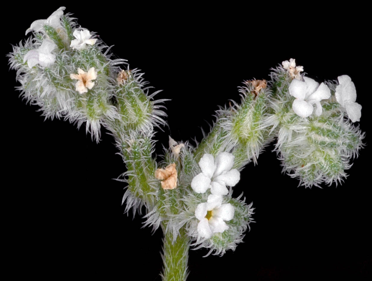
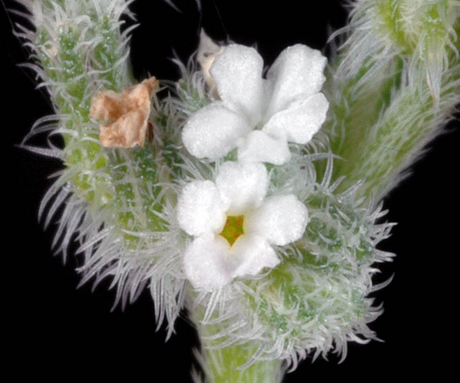
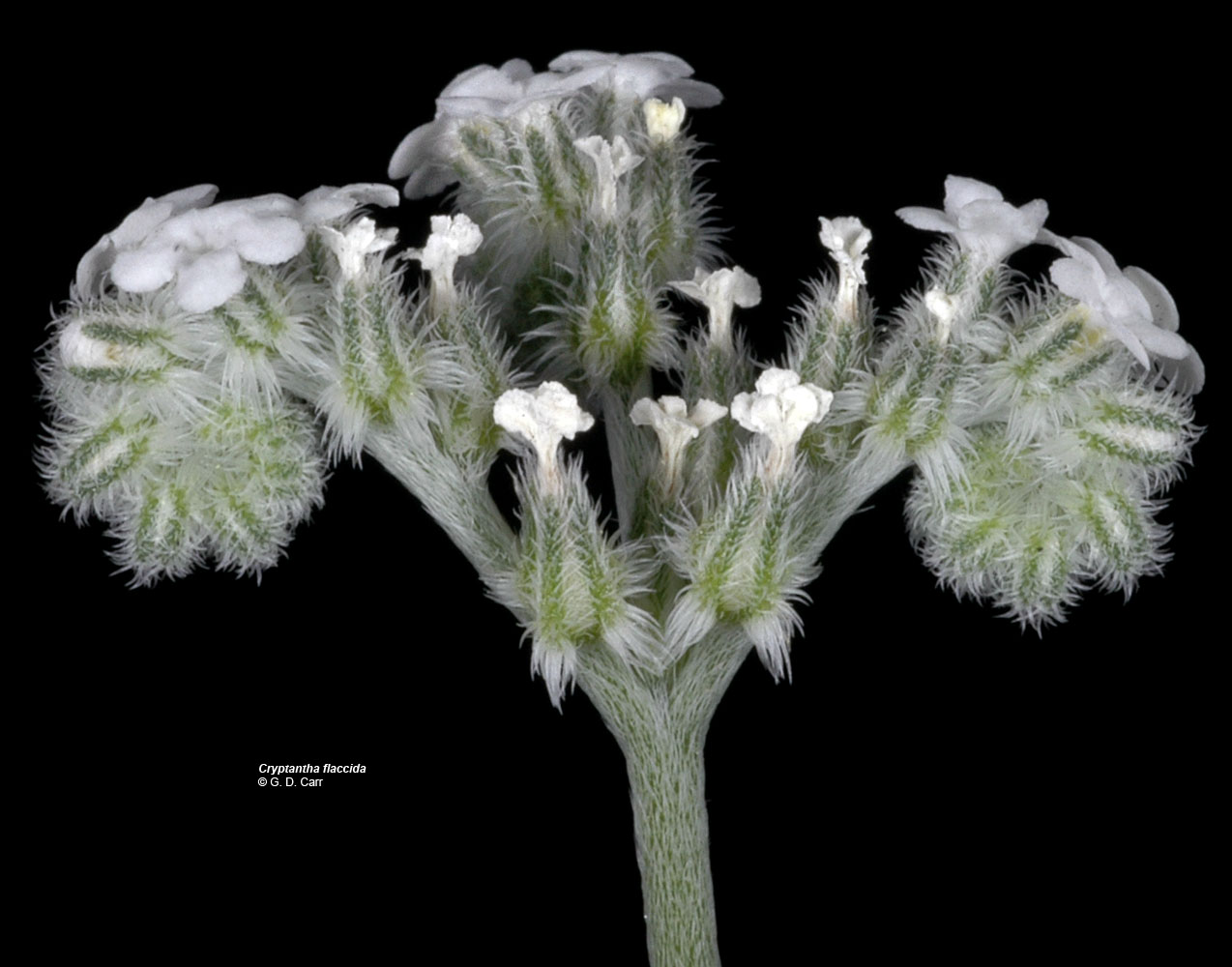
| Cryptantha flaccida (Douglas ex Lehm.) Greene | weak-stemmed cryptantha - native Boraginaceae |
Click on an image for a larger version. All images © Gerald D. Carr unless otherwise noted.
| Lower Wolf Creek Rd., 5.2 mi. SW of town of Wolf Creek, 1100 ft. elev, Josephine Co., OR, 5/11/2010 | Between Cow Cr. Rd. and Cow Creek at Island Cr. BLM site, 6.9 mi. SW of Riddle, 755 ft. elev., N42.91288, W123.48141, Douglas Co., OR, 6/6/2009 | Between Cow Cr. Rd. and Cow Creek at Island Cr. BLM site, 6.9 mi. SW of Riddle, 755 ft. elev., N42.91288, W123.48141, Douglas Co., OR, 6/6/2009 | Between Cow Cr. Rd. and Cow Creek at Island Cr. BLM site, 6.9 mi. SW of Riddle, 755 ft. elev., N42.91288, W123.48141, Douglas Co., OR, 6/6/2009 |
|
|
|
|
| Dalles Mt. Rd., ca. 0.8 mi. NE of SR14, just above 5-mile Cr. (NE of Dallesport), Klickitat Co., WASHINGTON, 4/29/2007 | Dalles Mt. Rd., ca. 0.8 mi. NE of SR14, just above 5-mile Cr. (NE of Dallesport), Klickitat Co., WASHINGTON, 4/29/2007 | Dalles Mt. Rd., ca. 0.8 mi. NE of SR14, just above 5-mile Cr. (NE of Dallesport), Klickitat Co., WASHINGTON, 4/29/2007 |
 |
 |
 |
| SR14, 3.5 mi. NW of jct with Hwy 197, SE of Lyle (N45.67307, W121.21299, Klickitat Co., WASHINGTON | SR14, 3.5 mi. NW of jct with Hwy 197, SE of Lyle (N45.67307, W121.21299, Klickitat Co., WASHINGTON | SR14, 3.5 mi. NW of jct with Hwy 197, SE of Lyle (N45.67307, W121.21299, Klickitat Co., WASHINGTON |
 |
 |
 |
| SR14, 3.5 mi. NW of jct with Hwy 197, SE of Lyle (N45.67307, W121.21299, Klickitat Co., WASHINGTON | Lind-Hatton Rd. (N side), ca. 6.4 mi. S of Lind, Adams Co., WASHINGTON, 6/15/2011, © Robert L. Carr | ||
 |
 |