

| Oregon Flora Image Project | |
| Cryptantha fendleri (A. Gray) Greene | Fendler's cryptantha - native Boraginaceae |
Click on an image for a larger version. All images © Gerald D. Carr unless otherwise noted.
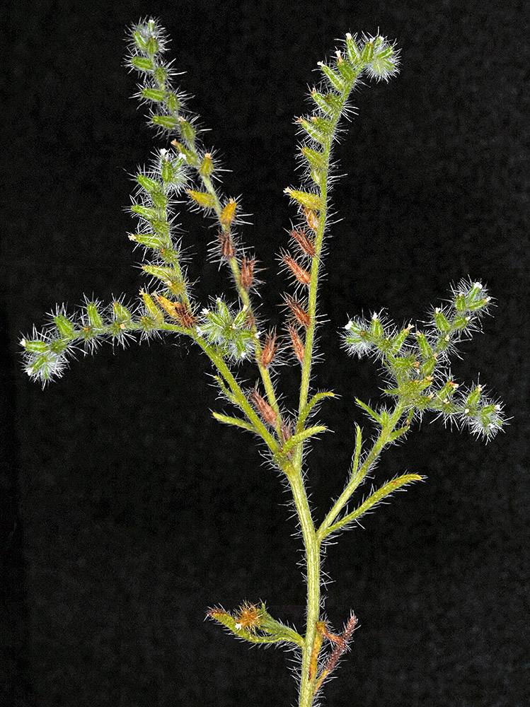
| Along powerlines 0.63 air mi. N of Wanapum Dam substation, sandy areas in exposed basalt, 985 ft. elev., N46.88928, W119.94066, Grant Co., WASHINGTON, 6/3/2017, © Robert L.Carr 2017 | Along powerlines 0.63 air mi. N of Wanapum Dam substation, sandy areas in exposed basalt, 985 ft. elev., N46.88928, W119.94066, Grant Co., WASHINGTON, 6/3/2017, © Robert L.Carr 2017 | Along powerlines 0.63 air mi. N of Wanapum Dam substation, sandy areas in exposed basalt, 985 ft. elev., N46.88928, W119.94066, Grant Co., WASHINGTON, 6/3/2017, © Robert L.Carr 2017 | Along powerlines 0.63 air mi. N of Wanapum Dam substation, sandy areas in exposed basalt, 985 ft. elev., N46.88928, W119.94066, Grant Co., WASHINGTON, 6/3/2017, © Robert L.Carr 2017 |
|
|
|
|
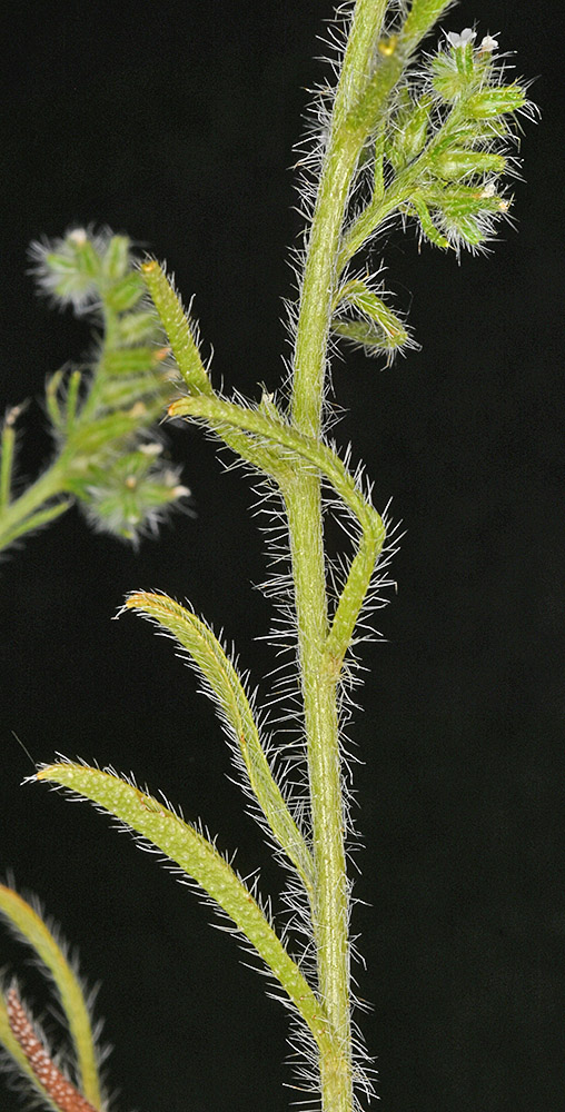
| Along powerlines 0.63 air mi. N of Wanapum Dam substation, sandy areas in exposed basalt, 985 ft. elev., N46.88928, W119.94066, Grant Co., WASHINGTON, 6/3/2017, © Robert L.Carr 2017 | Along powerlines 0.63 air mi. N of Wanapum Dam substation, sandy areas in exposed basalt, 985 ft. elev., N46.88928, W119.94066, Grant Co., WASHINGTON, 6/3/2017, © Robert L.Carr 2017 | Along powerlines 0.63 air mi. N of Wanapum Dam substation, sandy areas in exposed basalt, 985 ft. elev., N46.88928, W119.94066, Grant Co., WASHINGTON, 6/3/2017, © Robert L.Carr 2017 |
 |
 |
 |
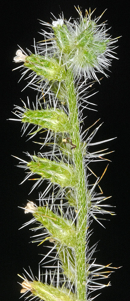
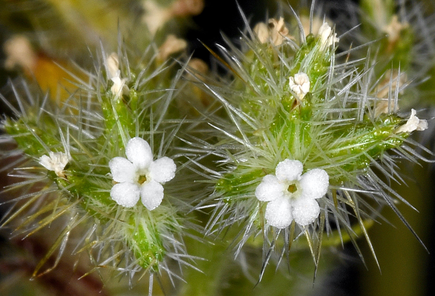
| Along powerlines 0.63 air mi. N of Wanapum Dam substation, sandy areas in exposed basalt, 985 ft. elev., N46.88928, W119.94066, Grant Co., WASHINGTON, 6/3/2017, © Robert L.Carr 2017 | Along powerlines 0.63 air mi. N of Wanapum Dam substation, sandy areas in exposed basalt, 985 ft. elev., N46.88928, W119.94066, Grant Co., WASHINGTON, 6/3/2017, © Robert L.Carr 2017 | Along powerlines 0.63 air mi. N of Wanapum Dam substation, sandy areas in exposed basalt, 985 ft. elev., N46.88928, W119.94066, Grant Co., WASHINGTON, 6/3/2017, © Robert L.Carr 2017 | Along powerlines 0.63 air mi. N of Wanapum Dam substation, sandy areas in exposed basalt, 985 ft. elev., N46.88928, W119.94066, Grant Co., WASHINGTON, 6/3/2017, © Robert L.Carr 2017 |
 |
 |
 |
 |