
| Oregon Flora Image Project | |
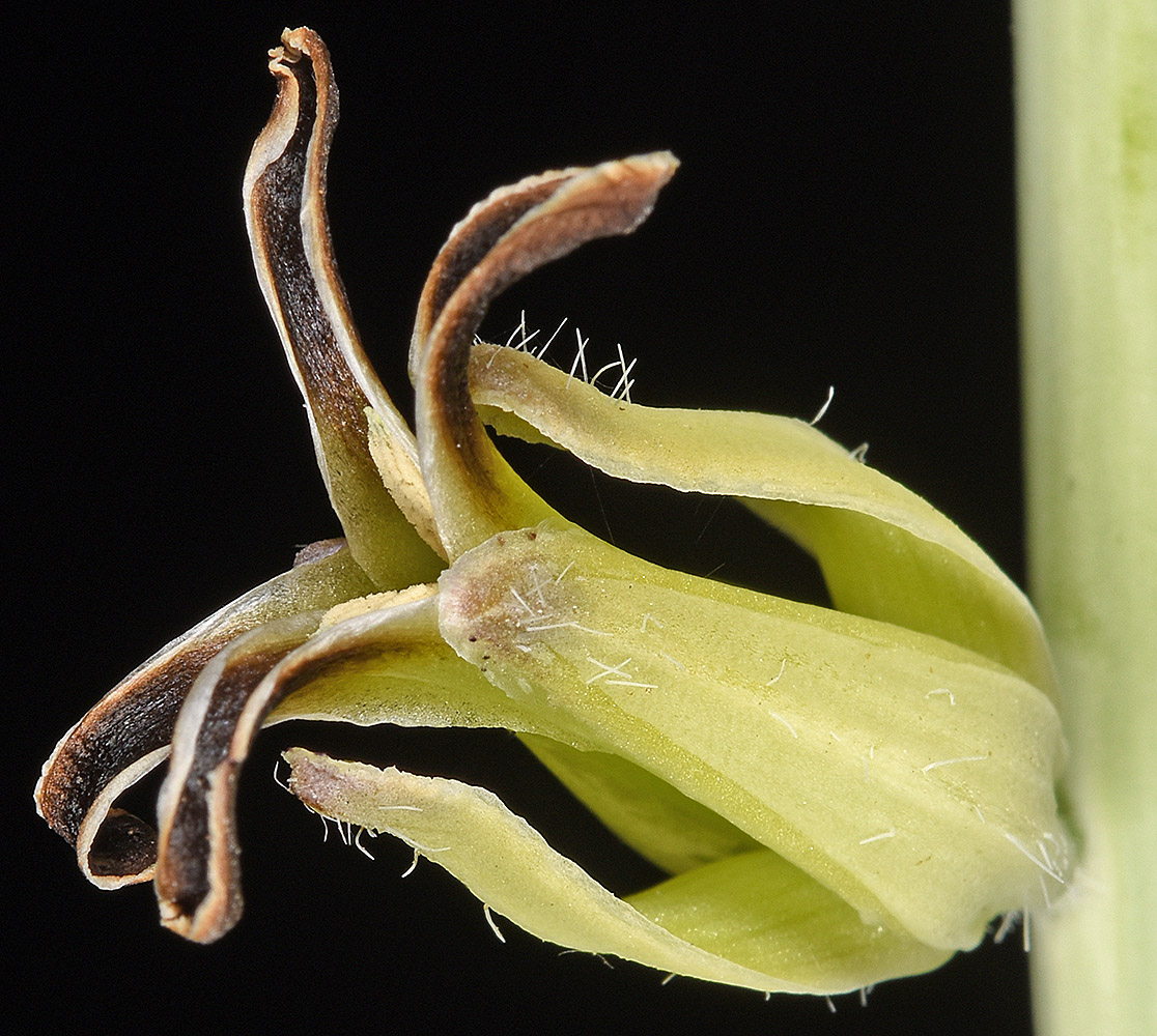
| Caulanthus crassicaulis (Torr.) S. Watson | thickstem wild cabbage - native Brassicaceae |
Click on an image for a larger version. All images © Gerald D. Carr unless otherwise noted.
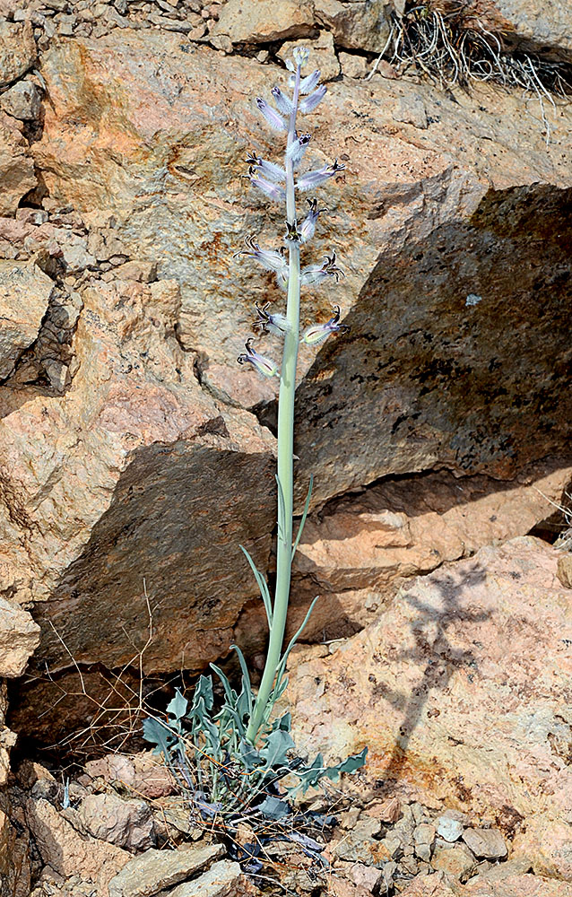
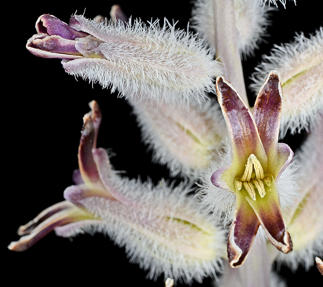
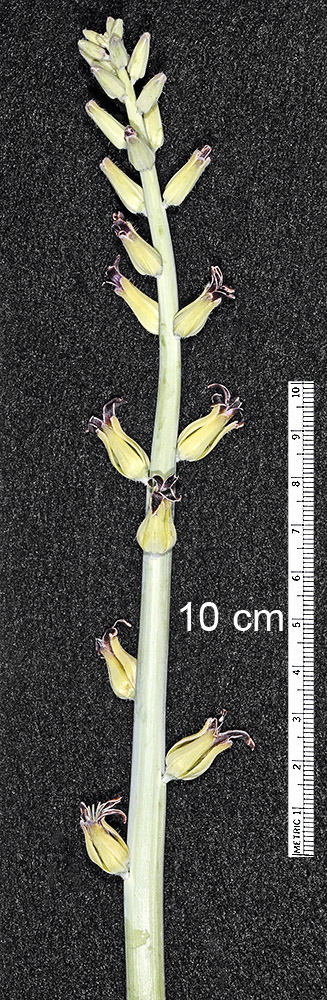
| Hwy 140 road cut, 8.5 mi. E of summit of Doherty slide, E of Adel, 6120 ft. elev., N41.99894, W119.32730, Harney Co., OR, 6/1/2014 | Hwy 140 road cut, 8.5 mi. E of summit of Doherty slide, E of Adel, 6120 ft. elev., N41.99894, W119.32730, Harney Co., OR, 6/1/2014 | Hwy 140 road cut, 8.5 mi. E of summit of Doherty slide, E of Adel, 6120 ft. elev., N41.99894, W119.32730, Harney Co., OR, 6/1/2014 | Hwy 140 road cut, 8.5 mi. E of summit of Doherty slide, E of Adel, 6120 ft. elev., N41.99894, W119.32730, Harney Co., OR, 6/1/2014 | Hwy 140 road cut, 8.5 mi. E of summit of Doherty slide, E of Adel, 6120 ft. elev., N41.99894, W119.32730, Harney Co., OR, 6/1/2014 |
|
|
|
|
|
| Hwy 140 road cut, 8.5 mi. E of summit of Doherty slide, E of Adel, 6120 ft. elev., N41.99894, W119.32730, Harney Co., OR, 6/1/2014 | Hwy 140 road cut, 8.5 mi. E of summit of Doherty slide, E of Adel, 6120 ft. elev., N41.99894, W119.32730, Harney Co., OR, 6/1/2014 | Hwy 140 road cut, 8.5 mi. E of summit of Doherty slide, E of Adel, 6120 ft. elev., N41.99894, W119.32730, Harney Co., OR, 6/1/2014 |
 |
 |
 |
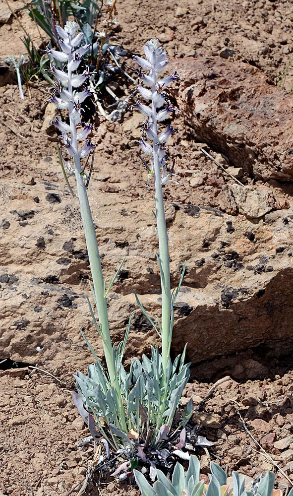
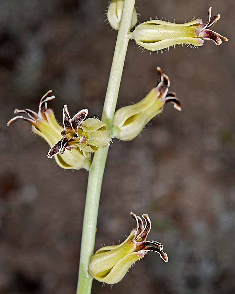
| Hwy 140 road cut, 8.5 mi. E of summit of Doherty slide, E of Adel, 6120 ft. elev., N41.99894, W119.32730, Harney Co., OR, 6/1/2014 | N-facing slope on S side of Disaster Peak Rd., 8.0 mi. W of Hwy 95 (near McDermitt, NV), 5170 ft. elev.,N42.01979, W117.86163, Malheur Co., OR, 5/31/2018 | N-facing slope on S side of Disaster Peak Rd., 8.0 mi. W of Hwy 95 (near McDermitt, NV), 5170 ft. elev.,N42.01979, W117.86163, Malheur Co., OR, 5/31/2018 |
 |
 |
 |
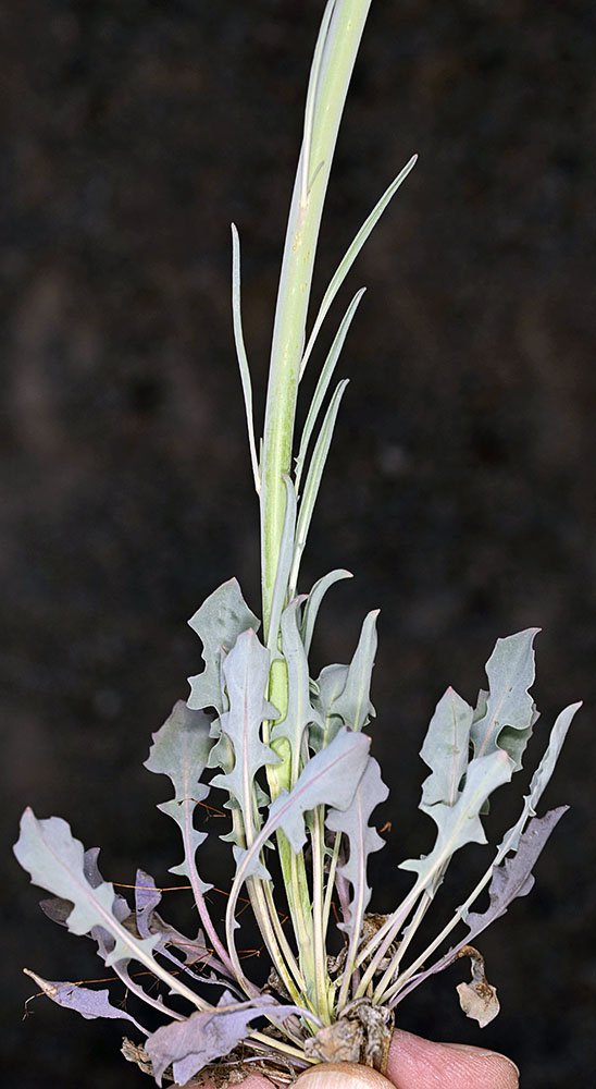
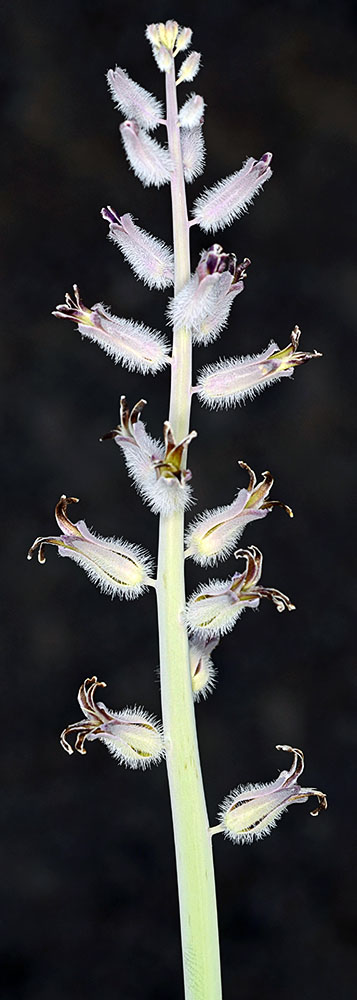
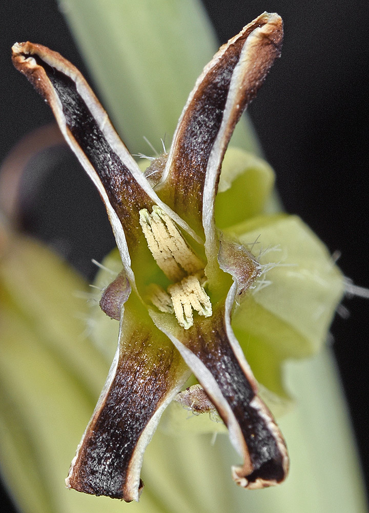
| N-facing slope on S side of Disaster Peak Rd., 8.0 mi. W of Hwy 95 (near McDermitt, NV), 5170 ft. elev.,N42.01979, W117.86163, Malheur Co., OR, 5/31/2018 | N-facing slope on S side of Disaster Peak Rd., 8.0 mi. W of Hwy 95 (near McDermitt, NV), 5170 ft. elev.,N42.01979, W117.86163, Malheur Co., OR, 5/31/2018 | N-facing slope on S side of Disaster Peak Rd., 8.0 mi. W of Hwy 95 (near McDermitt, NV), 5170 ft. elev.,N42.01979, W117.86163, Malheur Co., OR, 5/31/2018 | N-facing slope on S side of Disaster Peak Rd., 8.0 mi. W of Hwy 95 (near McDermitt, NV), 5170 ft. elev.,N42.01979, W117.86163, Malheur Co., OR, 5/31/2018 |
 |
 |
 |
 |