


| Oregon Flora Image Project | |
| Campanula prenanthoides Durand | California hairbell - native Campanulaceae |
Click on an image for a larger version. All images © Gerald D. Carr unless otherwise noted.
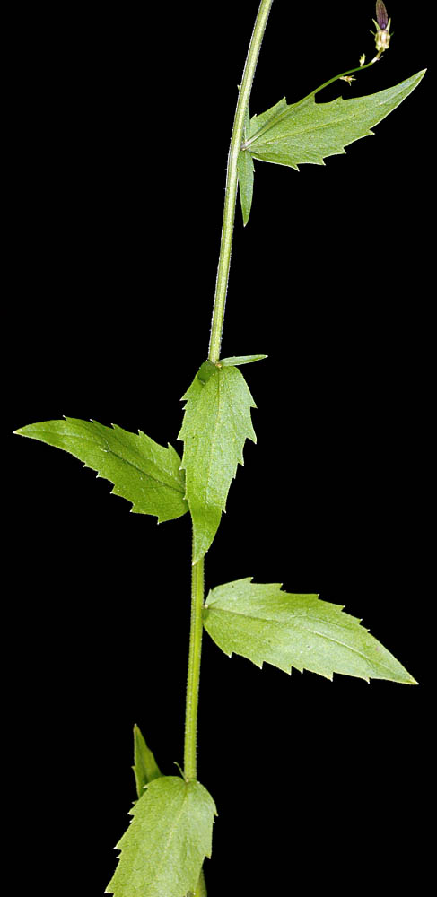
| Moon Point - Youngs Rock Trail, ca. 0.3 mi. SE of jct. to Moon Point, Warner Mt., ca. 13.8 air mi. SSE of Oakridge, 4948 ft. elev., N43.54544, W122.39252, Lane Co., OR, 8/10/2012 | Moon Point - Youngs Rock Trail, ca. 0.3 mi. SE of jct. to Moon Point, Warner Mt., ca. 13.8 air mi. SSE of Oakridge, 4948 ft. elev., N43.54544, W122.39252, Lane Co., OR, 8/10/2012 | Moon Point - Youngs Rock Trail, ca. 0.3 mi. SE of jct. to Moon Point, Warner Mt., ca. 13.8 air mi. SSE of Oakridge, 4948 ft. elev., N43.54544, W122.39252, Lane Co., OR, 8/10/2012 |
|
|
|
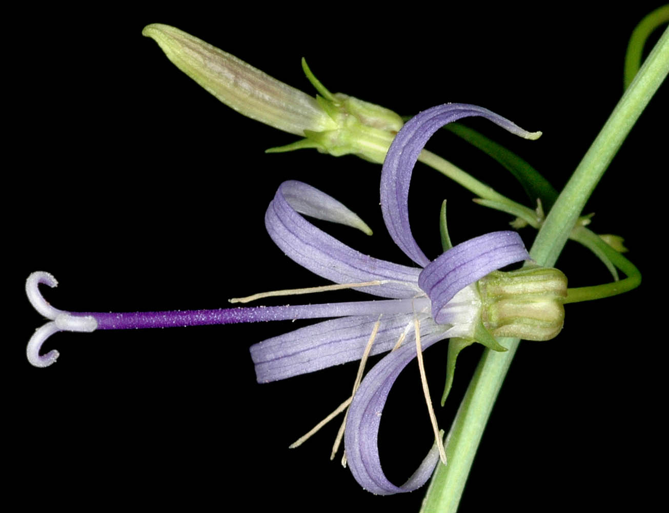
| NFD Rd. 070, 0.38 mi. S of washout, NW of Bigelow Lakes, 5525 ft. elev., N42.09650, W123.37593, Josephine Co., OR, 9/7/2010 | NFD Rd. 070, 0.38 mi. S of washout, NW of Bigelow Lakes, 5525 ft. elev., N42.09650, W123.37593, Josephine Co., OR, 9/7/2010 | Woods Creek drainage, off Woods Cr. Rd., ca. 4 mi. W of jct with Hwy 20, W of Philomath, Benton Co., OR, 7/19/2008 | Woods Creek drainage, off Woods Cr. Rd., ca. 4 mi. W of jct with Hwy 20, W of Philomath, Benton Co., OR, 7/19/2008 | Woods Creek drainage, off Woods Cr. Rd., ca. 4 mi. W of jct with Hwy 20, W of Philomath, Benton Co., OR, 7/19/2008 | Woods Creek drainage, off Woods Cr. Rd., ca. 4 mi. W of jct with Hwy 20, W of Philomath, Benton Co., OR, 7/19/2008 |
 |
 |
 |
 |
 |
 |
| Woods Creek drainage, off Woods Cr. Rd., ca. 4 mi. W of jct with Hwy 20, W of Philomath, Benton Co., OR, 7/19/2008 | Woods Creek drainage, off Woods Cr. Rd., ca. 4 mi. W of jct with Hwy 20, W of Philomath, Benton Co., OR, 7/19/2008 | ||
 |
 |
| Woods Creek drainage, off Woods Cr. Rd., ca. 4 mi. W of jct with Hwy 20, W of Philomath, Benton Co., OR, 7/19/2008 | ||
 |