| Oregon Flora Image Project | |
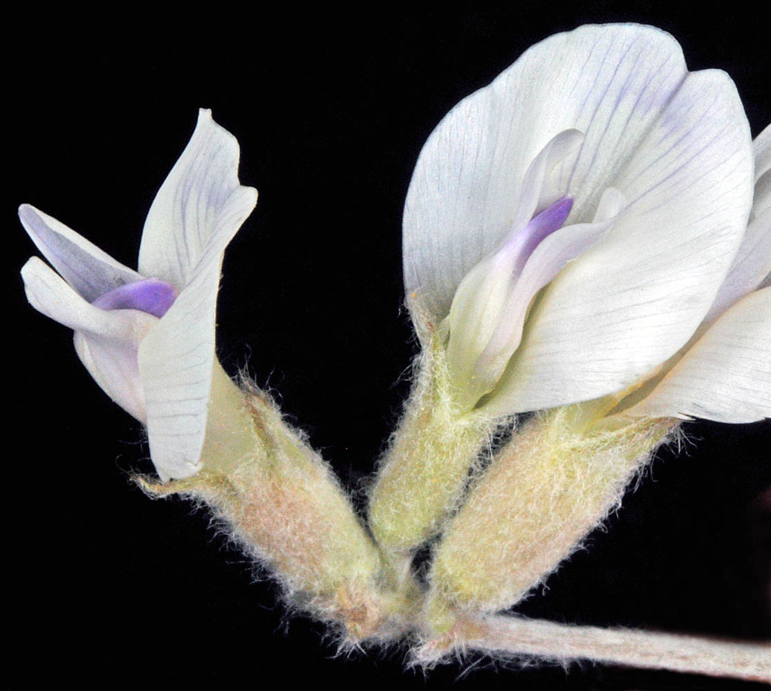
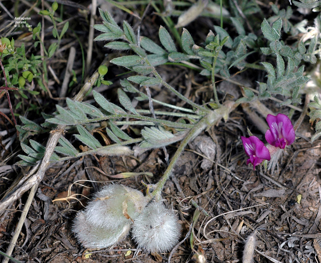
| Astragalus purshii Douglas ex Hook. | [see var.] - native Fabaceae: Faboideae |
Click on an image for a larger version. All images © Gerald D. Carr unless otherwise noted.
| var. glareosus (Dougl. ex Hook.) Barneby | gravel milkvetch |
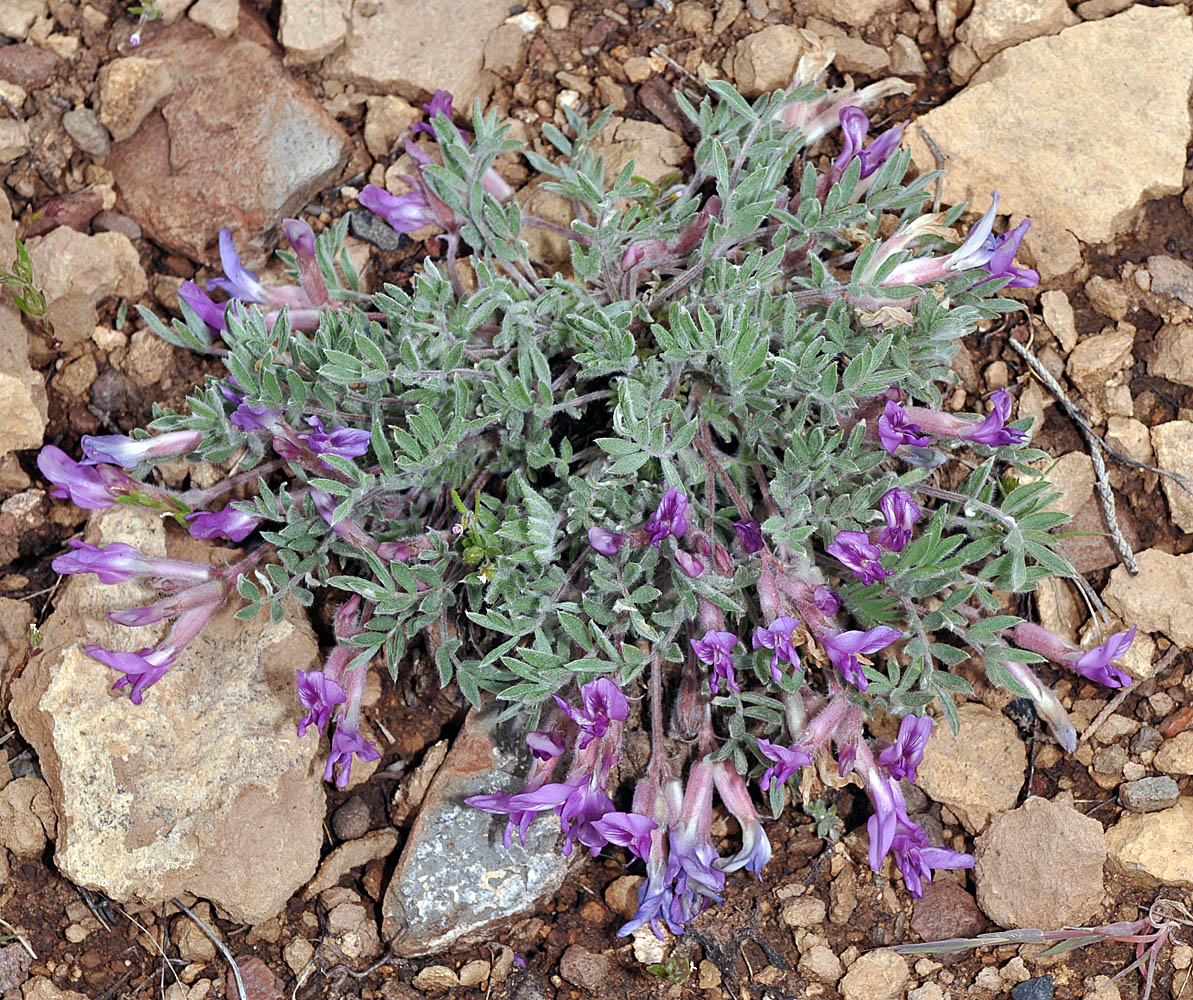
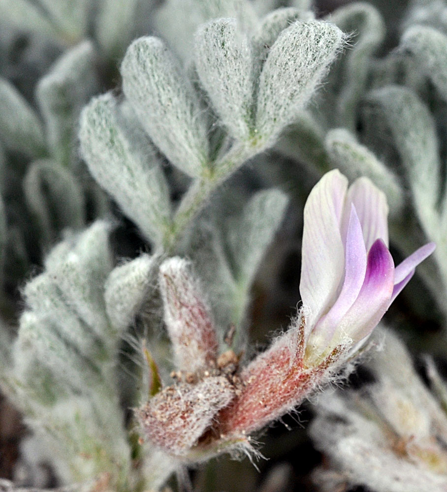
| NFD Rd. 47 (Hines-Izee Rd.), 5.1 mi. NW of Hines, 5025 ft. elev., N43.58245, W119.16081, Harney Co., OR, 5/25/2010 | NFD Rd. 47 (Hines-Izee Rd.), 5.1 mi. NW of Hines, 5025 ft. elev., N43.58245, W119.16081, Harney Co., OR, 5/25/2010 | ||
|
|
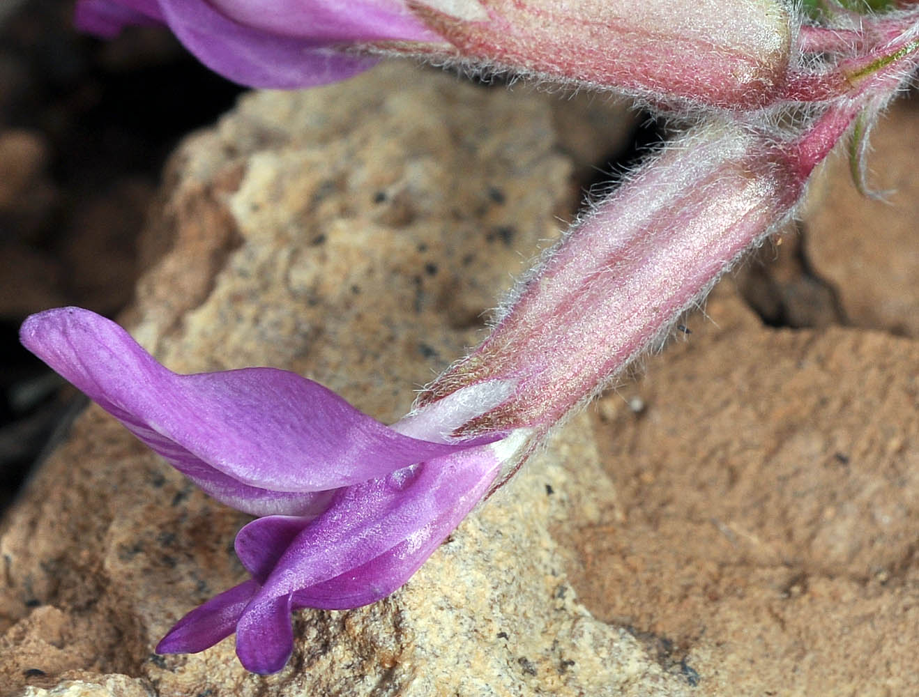
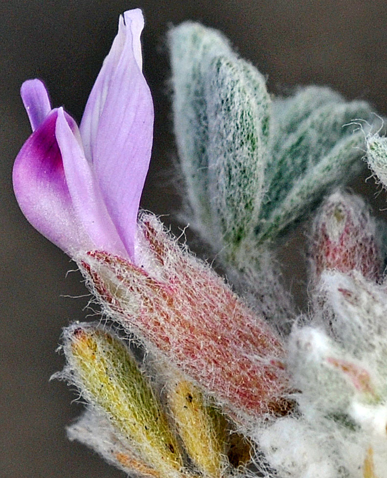
| Dalles Mt. Rd., 5.8 mi. ENE of SR14, N45.67675 W121.04877, Klickitat Co., WASHINGTON, 3/27/2008 | Dalles Mt. Rd., 5.8 mi. ENE of SR14, N45.67675 W121.04877, Klickitat Co., WASHINGTON, 3/27/2008 | ||
 |
 |
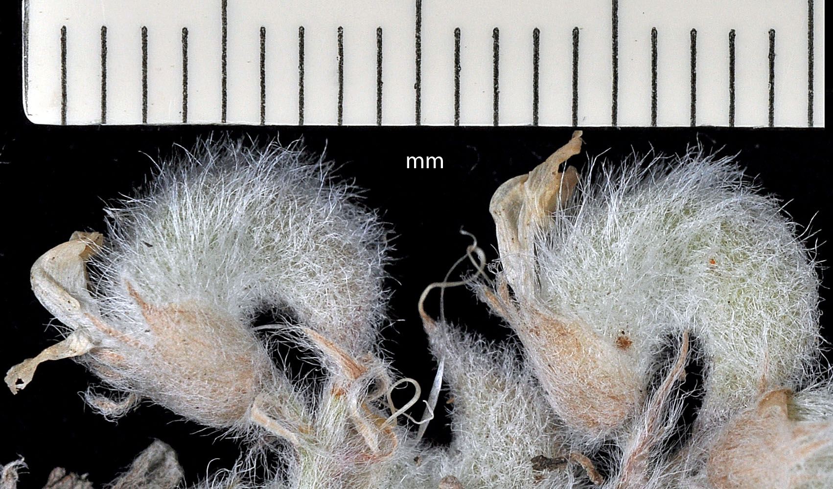
| Dalles Mt. Rd., 5.8 mi. ENE of SR14, N45.67675 W121.04877, Klickitat Co., WASHINGTON, 3/27/2008 | Dalles Mt. Rd., 5.8 mi. ENE of SR14, N45.67675 W121.04877, Klickitat Co., WASHINGTON, 3/27/2008 | ||
 |
 |
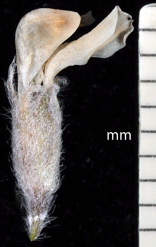
| Dalles Mt. Rd., 5.8 mi. ENE of SR14, N45.67675 W121.04877, Klickitat Co., WASHINGTON, 3/27/2008 | Dalles Mt. Rd., near jct. with SR 14, Klickitat Co., WASHINGTON, 5/4/2008 | ||
 |
 |
| var. lagopinus (Rydb.) Barneby | hare's-foot milkvetch |
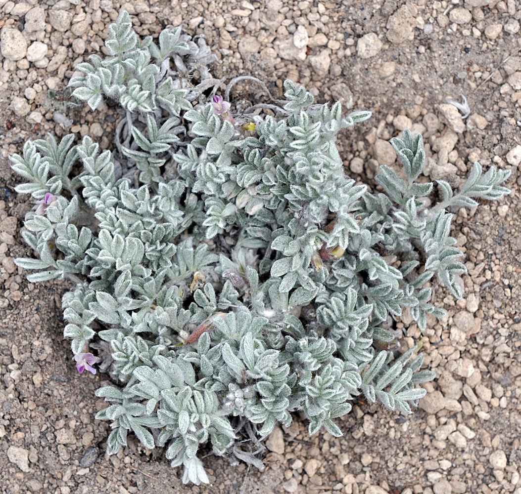
| Frederick Butte Rd., 0.8 mi. S of jct. with Hwy 20, ca. 7.9 mi. SE of Brothers, 4492 ft. elev., N43.76432, W120.47662, Deschutes Co., OR, 6/18/2012 | Frederick Butte Rd., 0.8 mi. S of jct. with Hwy 20, ca. 7.9 mi. SE of Brothers, 4492 ft. elev., N43.76432, W120.47662, Deschutes Co., OR, 6/18/2012 | Frederick Butte Rd., 0.8 mi. S of jct. with Hwy 20, ca. 7.9 mi. SE of Brothers, 4492 ft. elev., N43.76432, W120.47662, Deschutes Co., OR, 6/18/2012 |
 |
 |
 |
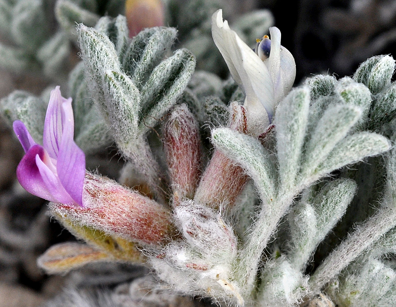
| Frederick Butte Rd., 0.8 mi. S of jct. with Hwy 20, ca. 7.9 mi. SE of Brothers, 4492 ft. elev., N43.76432, W120.47662, Deschutes Co., OR, 6/18/2012 | Frederick Butte Rd., 0.8 mi. S of jct. with Hwy 20, ca. 7.9 mi. SE of Brothers, 4492 ft. elev., N43.76432, W120.47662, Deschutes Co., OR, 6/18/2012 | ||
 |
 |
| var. purshii | Pursh's milkvetch |
| Along the S Cheney-Spokane Rd. at Scribner, 2175 ft. elev., N47.55576, W117.50128, Spokane Co., WASHINGTON, 5/10/2010 (© Robert L. Carr) | Along the S Cheney-Spokane Rd. at Scribner, 2175 ft. elev., N47.55576, W117.50128, Spokane Co., WASHINGTON, 5/10/2010 (© Robert L. Carr) | ||
 |
 |
| Along the S Cheney-Spokane Rd. at Scribner, 2175 ft. elev., N47.55576, W117.50128, Spokane Co., WASHINGTON, 5/10/2010 (© Robert L. Carr) | Along the S Cheney-Spokane Rd. at Scribner, 2175 ft. elev., N47.55576, W117.50128, Spokane Co., WASHINGTON, 5/10/2010 (© Robert L. Carr) | Along the S Cheney-Spokane Rd. at Scribner, 2175 ft. elev., N47.55576, W117.50128, Spokane Co., WASHINGTON, 5/10/2010 (© Robert L. Carr) |
 |
 |
 |
| var. tinctus M.E. Jones | dyed milkvetch |
| Sage Hen Hill Rd., 0-1.6 mi. N of Hwy 20, c. 12 mi. E of Riley, Harney Co., OR, 5/27/2006 | Sage Hen Hill Rd., 0-1.6 mi. N of Hwy 20, c. 12 mi. E of Riley, Harney Co., OR, 5/27/2006 | ||
 |
 |
| Sage Hen Hill Rd., 0-1.6 mi. N of Hwy 20, c. 12 mi. E of Riley, Harney Co., OR, 5/27/2006 | Sage Hen Hill Rd., 0-1.6 mi. N of Hwy 20, c. 12 mi. E of Riley, Harney Co., OR, 5/27/2006 | Sage Hen Hill Rd., 0-1.6 mi. N of Hwy 20, c. 12 mi. E of Riley, Harney Co., OR, 5/27/2006 |
 |
 |
 |
| Sage Hen Hill Rd., 0-1.6 mi. N of Hwy 20, c. 12 mi. E of Riley, Harney Co., OR, 5/27/2006 | Sage Hen Hill Rd., 0-1.6 mi. N of Hwy 20, c. 12 mi. E of Riley, Harney Co., OR, 5/27/2006 | ||
 |
 |