


| Oregon Flora Image Project | |
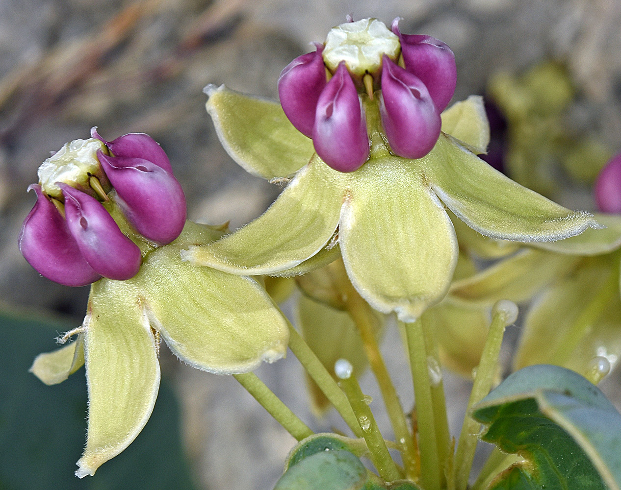
| Asclepias cryptoceras S. Wstson ssp. davisii (Woodson) Woodson | pallid milkweed - native Apocynaceae (Asclepiadaceae) |
Click on an image for a larger version. All images © Gerald D. Carr unless otherwise noted.
| Un-named rd., 1.2 mi. SSE of jct. with Hwy 95, near Crooked Creek crossing, NE of Burns Junction, 3680 ft. elev., N42.79183, W117.72602, Malheur Co., OR, 6/4/2016 | Un-named rd., 1.2 mi. SSE of jct. with Hwy 95, near Crooked Creek crossing, NE of Burns Junction, 3680 ft. elev., N42.79183, W117.72602, Malheur Co., OR, 6/4/2016 | Un-named rd., 1.2 mi. SSE of jct. with Hwy 95, near Crooked Creek crossing, NE of Burns Junction, 3680 ft. elev., N42.79183, W117.72602, Malheur Co., OR, 6/4/2016 |
|
|
|
| Un-named rd., 1.2 mi. SSE of jct. with Hwy 95, near Crooked Creek crossing, NE of Burns Junction, 3680 ft. elev., N42.79183, W117.72602, Malheur Co., OR, 6/4/2016 | Off Succor Creek Rd., 0.4 mi. N of Rockville, near W bank of Spring Creek, 3950 ft. elev, N43.29877, W117.19670, Malheur Co., OR, 5/16/2014 | Off Succor Creek Rd., 0.4 mi. N of Rockville, near W bank of Spring Creek, 3950 ft. elev, N43.29877, W117.19670, Malheur Co., OR, 5/16/2014 |
 |
 |
 |
| Off Succor Creek Rd., 0.4 mi. N of Rockville, near W bank of Spring Creek, 3950 ft. elev, N43.29877, W117.19670, Malheur Co., OR, 5/16/2014 | ||
 |